James Spann: Rain returns to Alabama Saturday
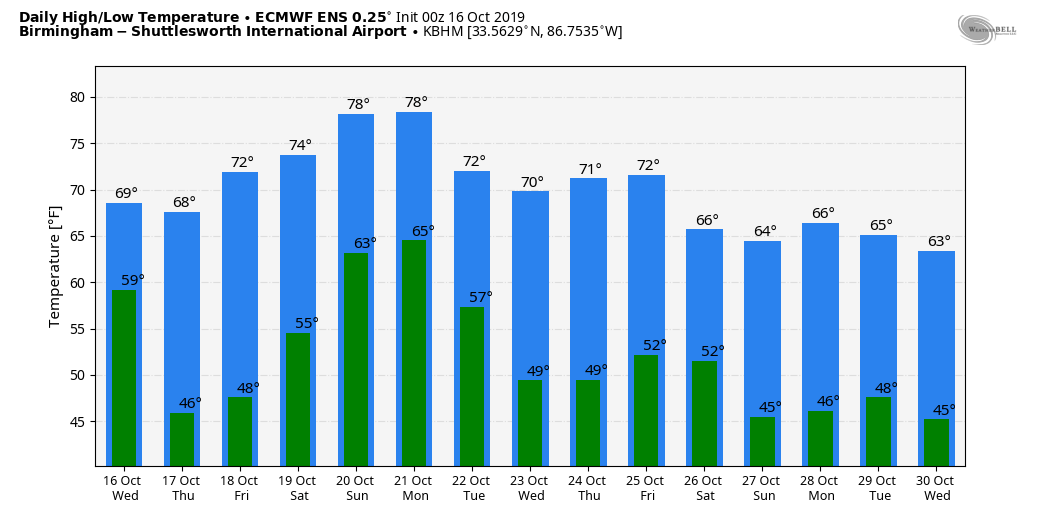
CLEARING: The sky is clearing across Alabama this afternoon as dry air blows into the state; most communities will drop into the 40- to 45-degree range early Thursday, with 30s for colder pockets. Thursday and Friday will be delightful fall days with lots of sunshine, low humidity and chilly nights. The high will be in the upper 60s Thursday, followed by low 70s Friday.
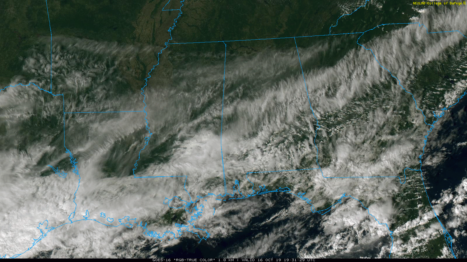
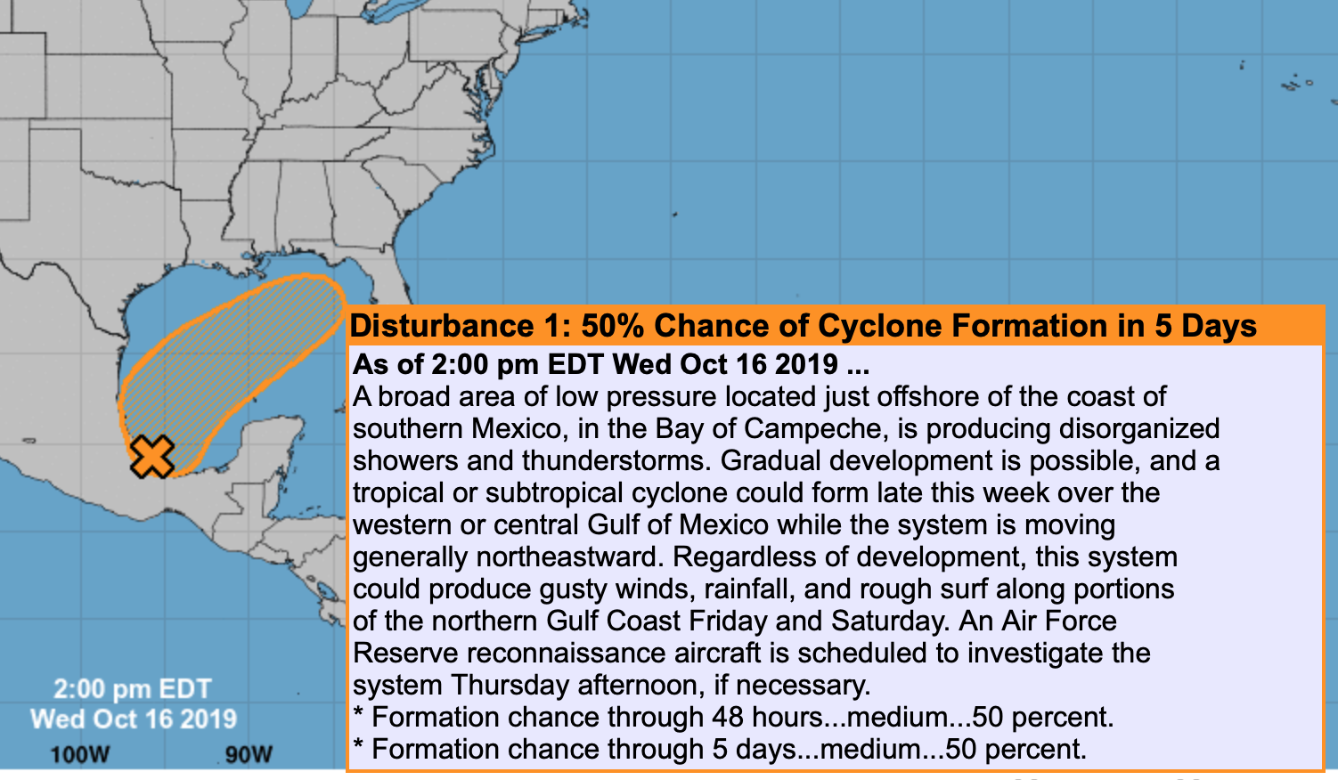
THE ALABAMA WEEKEND: The weather in Alabama Saturday will be determined by a tropical low moving inland from the Gulf. Here are the key points:
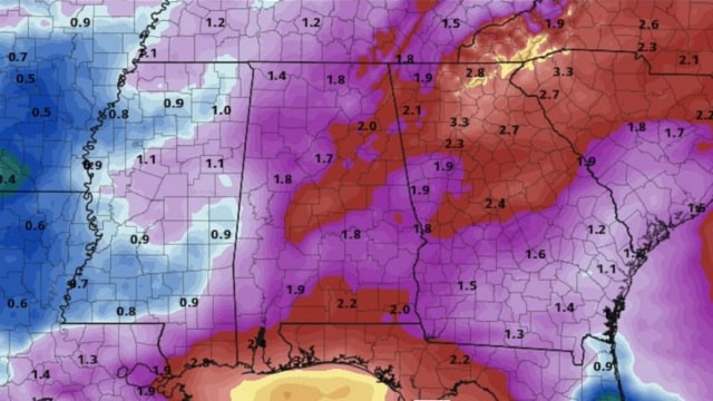
- Models shifted a little eastward this morning with the center of the low. The American global model suggests most of the rain will be over east and south Alabama late Friday night and Saturday morning before moving into Georgia. This is the best-case scenario for the football games in Tuscaloosa Saturday night and Birmingham Saturday afternoon. However, the reliable European global model is slower and more to the west, and shows rain for most of the state Saturday and Saturday night.
- Models will continue to struggle with the tropical low until it gets a well-defined center and becomes better organized, which should happen by Thursday. There is a chance it becomes Tropical Storm Nestor before it moves inland. Heavy rain is expected to be the main threat one way or another.
- We will continue to forecast a chance of rain statewide Saturday and Saturday night, but adjustments will be made to the placement, timing and intensity of the rain as the tropical system evolves. Keep an eye out for forecast changes.
- Sunday looks dry for most of the state; the high will be close to 70 Saturday and in the mid to upper 70s Sunday.
NEXT WEEK: Monday will be mild and breezy, and showers and storms are likely late in the day and Monday night as a cold front passes through the state. There will be some surface-based instability involved, and the storms could produce strong winds as they move through. Cool, dry air settles into the state for the rest of the week.
FOOTBALL WEATHER: Auburn travels to Fayetteville, Arkansas, to take on the Razorbacks Saturday (kickoff at 11 a.m. Central). The sky will be cloudy at times, and there is some risk of a passing shower or thunderstorm during the game. The kickoff temperature will be near 64, rising into the upper 60s by the second half.
Alabama will host Tennessee Saturday night at Bryant-Denny Stadium in Tuscaloosa (kickoff at 8). The sky will be cloudy, and some rain is possible during the game. Temperatures will be in the upper 60s.
UAB hosts Old Dominion Saturday afternoon at Legion Field in Birmingham (kickoff at 3). The sky will be mostly cloudy, and rain could move in during the game. The kickoff temperature will be near 70 degrees, falling back into the upper 60s by the final whistle.
Jacksonville State hosts Southeast Missouri State Saturday (3 p.m. kickoff). The sky will be mostly cloudy; rain is possible. Temperatures will fall from near 70 at kickoff into the upper 60s by the fourth quarter.
ON THIS DATE IN 1999: Hurricane Irene moved across the Florida Keys, producing heavy rainfall, strong winds and high waves. A gust of 102 mph was reported in Big Pine Key.
BEACH FORECAST: Click here to see the AlabamaWx Beach Forecast Center page.
WEATHER BRAINS: You can listen to our weekly 90-minute show any time on your favorite podcast app. This is the show all about weather featuring many familiar voices, including the meteorologists at ABC 33/40.
CONNECT: You can find me on the major social networks:
Facebook
Twitter
Instagram
Pinterest
Snapchat: spannwx
For more weather news and information from James Spann and his team, visit AlabamaWx.


