James Spann: Mostly dry weekend for Alabama, then strong to severe storms late Monday
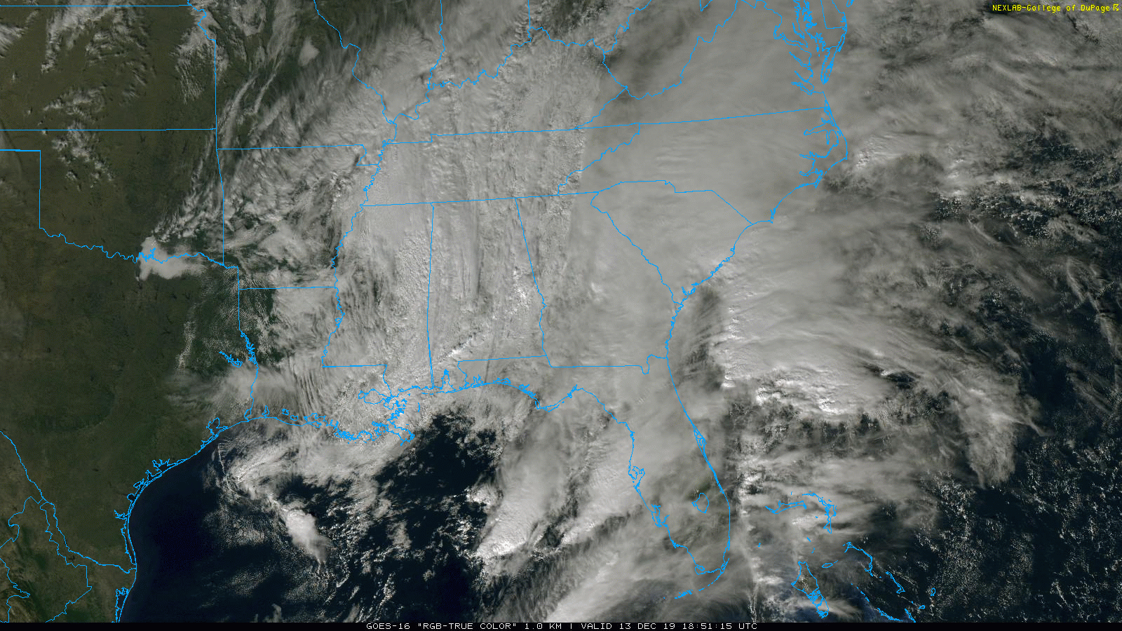
OVERCAST, COLD DAY: It has been a day of low clouds, fog, light rain and drizzle for Alabama with temperatures in the 40s over the northern half of the state. Rain will end tonight across the state as the surface low moves to the east, but the sky will remain cloudy. Temperatures drop into the upper 30s by daybreak.
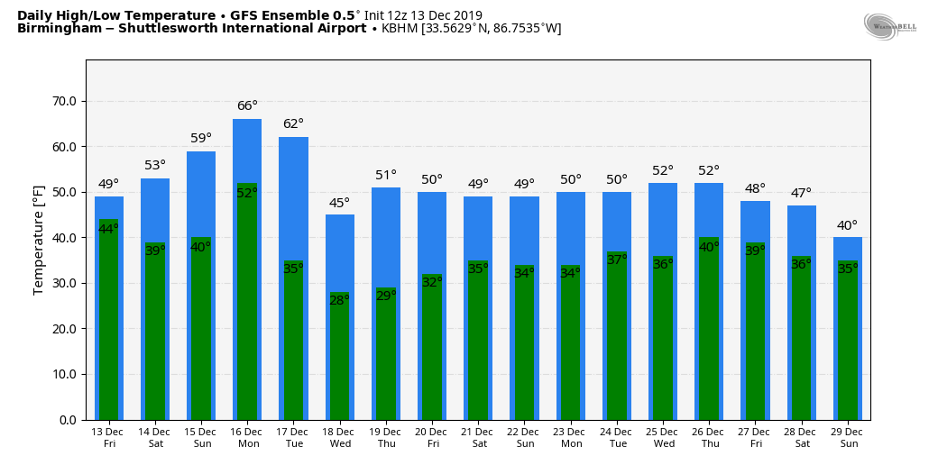
THE ALABAMA WEEKEND: Clouds will likely hang tough Saturday morning; we might even see a few showers over the northern quarter of the state as an upper trough moves overhead. But the sky becomes partly sunny in many places by afternoon as drier air moves in; the high will be in the low to mid 50s. Sunday will be dry and pleasant; the sky will be partly sunny with a high in the mid 60s.
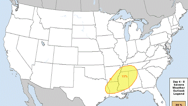
STRONG STORMS MONDAY: Monday will be a mild, breezy day with a high in the 68- to 73-degree range. Dewpoints will surge to near 60, and the air becomes unstable by afternoon. Showers and storms should become widespread by Monday afternoon into Monday night, and forecast atmospheric parameters suggest that severe storms will be possible. The Storm Prediction Center has much of the state under a severe weather risk in its outlook for Monday.
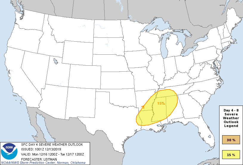
For now, it looks like the main threat will come from 3 p.m. until midnight, and all modes of severe weather will be possible. Stronger storms will be capable of producing strong winds, hail and possibly a few tornadoes. We will be able to be more specific about the threat over the weekend.
Remember, we are still in our late fall/early winter severe weather season, so having severe storms this time of the year is to be expected. Be sure you have a NOAA Weather Radio in your home and business, and wireless emergency alerts enabled on your phone so you won’t miss any warnings, if they are needed.
REST OF NEXT WEEK: Tuesday will be breezy and sharply colder; clouds will linger during the morning, but some sun could break through by afternoon. The high will be in the 45- to 50-degree range, and we drop into the 20s early Wednesday and Thursday mornings. Clouds return Thursday night, and some rain is likely by Friday, Dec. 20, as the next wave approaches from the west.
ON THIS DATE IN 1997: A freak cold snap and snowstorm that struck parts of northern Mexico left 12 people dead and the area paralyzed. It snowed in the city of Guadalajara for the first time since 1881, leaving amazed residents to gawk at the white stuff and make snowmen. The temperature plunged to 5 degrees in Chihuahua.
BEACH FORECAST: Click here to see the AlabamaWx Beach Forecast Center page.
WEATHER BRAINS: You can listen to our weekly 90-minute show any time on your favorite podcast app. This is the show all about weather featuring many familiar voices, including the meteorologists at ABC 33/40.
CONNECT: You can find me on the major social networks:
Facebook
Twitter
Instagram
Pinterest
Snapchat: spannwx
For more weather news and information from James Spann and his team, visit AlabamaWx.


