James Spann: Alabama wet at times through Wednesday
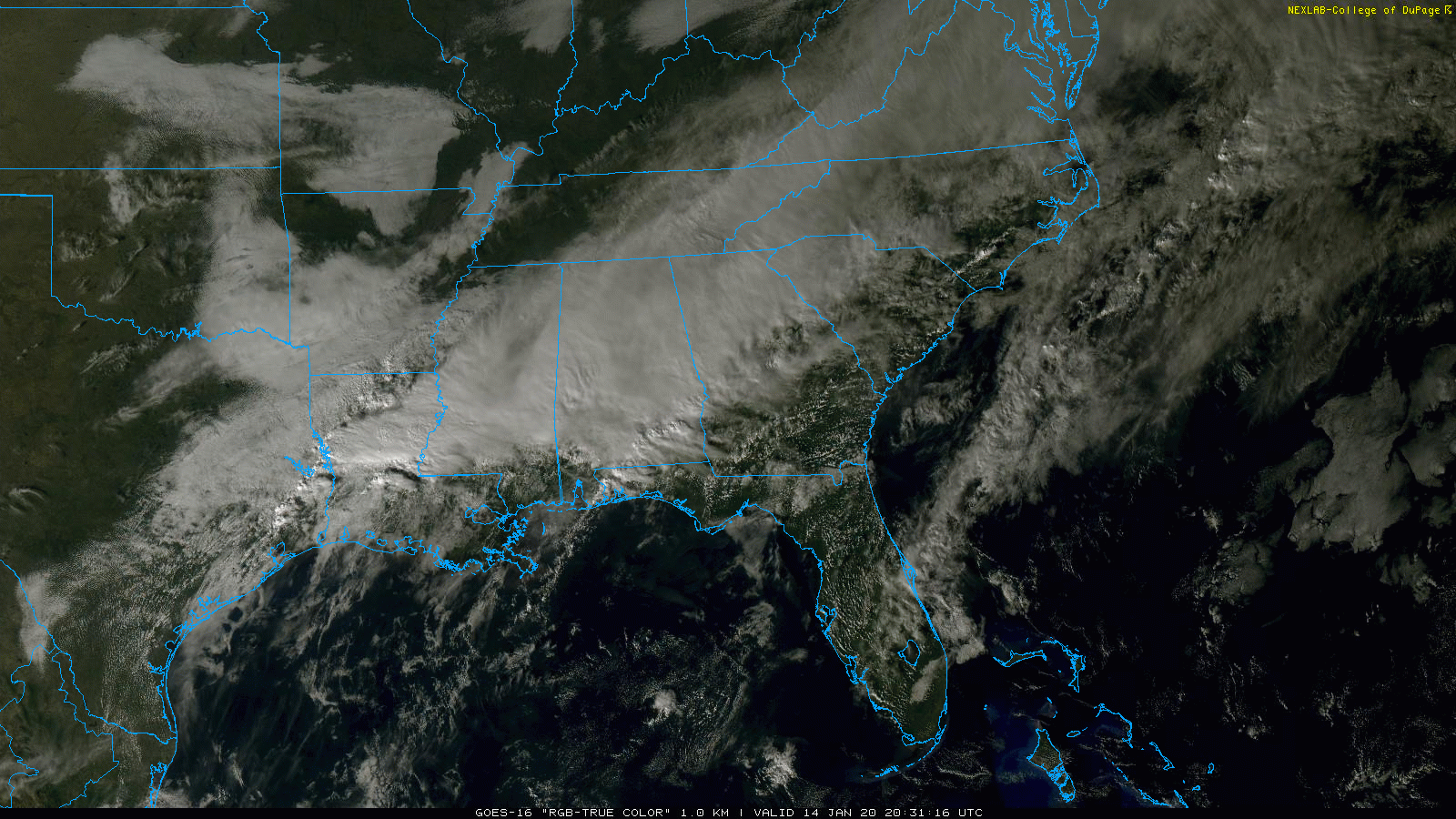
RADAR CHECK: Rain is fairly widespread across Alabama south of I-20 this afternoon. There are some heavier thunderstorms over the southeast counties of the state, where temperatures are in the 70s. A flood watch remains in effect for central Alabama.
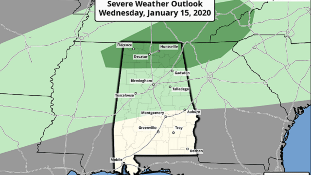
Showers and a few thunderstorms will remain possible statewide through Wednesday; a few stronger storms are possible over the Tennessee Valley of North Alabama Wednesday afternoon, where the Storm Prediction Center has a marginal risk (level 1 out of 5) of severe storms defined.

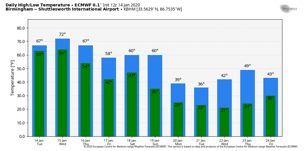
Heavier storms could produce small hail and gusty winds, but the overall threat remains low. Wednesday’s temperatures will remain very mild, with most places reaching the low 70s.
THURSDAY/FRIDAY: Cooler, drier air drops into the state Thursday. The sky becomes partly sunny, and the high will be in the 57- to 61-degree range over the northern half of the state. Any showers Thursday will be confined to the Gulf Coast region. On Friday, moist air moves northward and a few showers are possible statewide by afternoon. The high Friday will be close to 60 degrees.
THE ALABAMA WEEKEND: A cold front will bring yet another chance of showers and storms to the state Saturday. This time we don’t expect any severe weather threat because of weak instability and less-than-impressive dynamic forcing. Sunday will be dry and noticeably colder with the sky becoming mostly sunny. The high Saturday will be in the low to mid 60s, but on Sunday the high will be in the 40s over north and central Alabama with a chilly north wind.
MUCH COLDER NEXT WEEK: Models continue to trend colder next week. The high Monday will be in the upper 30s and low 40s, and many places won’t get past the mid 30s Tuesday. Morning lows will be in the 20s; some teens are very possible, if not likely, Tuesday and Wednesday morning. The week looks generally dry.
ON THIS DATE IN 1972: In Loma, Montana, the temperature soared from 54 degrees below zero to 49 degrees above zero on Jan. 14-15, 1972. The 103-degree change is the greatest ever recorded in the world for a 24-hour period.
ON THIS DATE IN 1982: One of the greatest ice storms in state history continued to keep Alabama shut down. As many as 750,000 Alabamians lost electrical service; some were in the dark for more than a week. Twenty Alabamians were dead and another 300 injured; damage totaled $78 million.
BEACH FORECAST: Click here to see the AlabamaWx Beach Forecast Center page.
WEATHER BRAINS: You can listen to our weekly 90-minute show any time on your favorite podcast app. This is the show all about weather featuring many familiar voices, including the meteorologists at ABC 33/40.
CONNECT: You can find me on the major social networks:
Facebook
Twitter
Instagram
Pinterest
Snapchat: spannwx
For more weather news and information from James Spann and his team, visit AlabamaWx.


