James Spann: Cold rain for Alabama Thursday, sunshine Friday
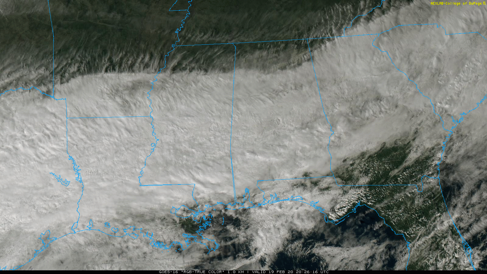
MORE RAIN AHEAD: On the maps this afternoon we have a stalled surface front over far south Alabama. Clouds cover most of the state, although the sun is breaking through in spots over the Tennessee Valley. Temperatures are mostly in the 40s and 50s, and there is patchy, light rain over parts of central and south Alabama.
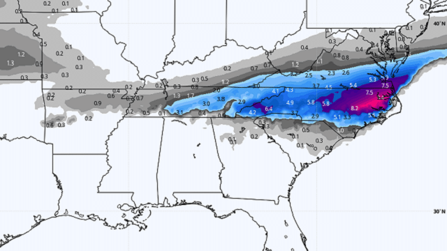
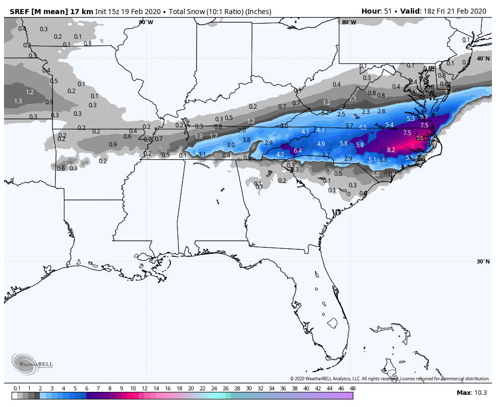
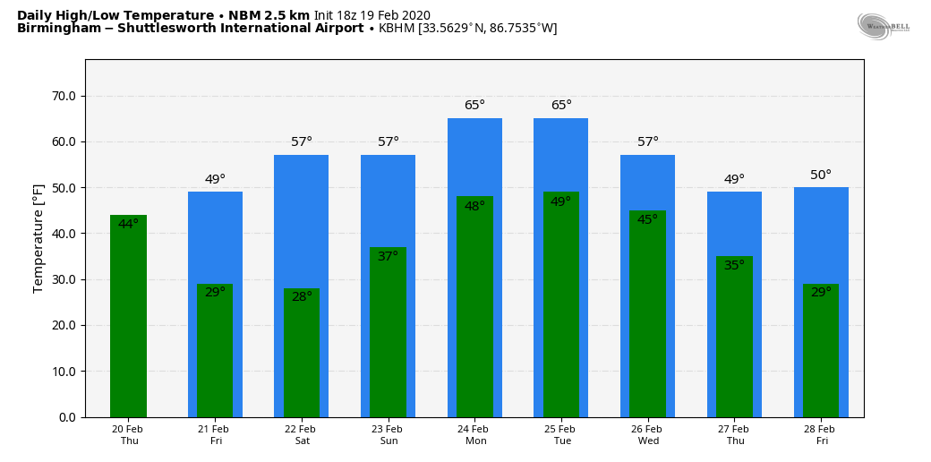
Rain will increase statewide late tonight as a wave of low pressure forms along the stalled front. Thursday will be cold and wet, with rain falling much of the day. Temperatures will hover in the 40- to 45-degree range over the northern half of the state, and some places across the Tennessee Valley might hold in the 30s all day. There’s still some risk of light snow near the Tennessee state line Thursday morning, but if that happens in Alabama we expect no impact with temperatures above freezing. Some light accumulation is possible over Tennessee on grassy areas, but the better snow opportunity comes to the east over parts of North Carolina and southern Virginia.
Rain ends late in the day Thursday; the sky clears Thursday night. Additional rain amounts of around 1 inch are expected over the next 24 hours.
FRIDAY AND THE WEEKEND: We get a nice chance to dry out Friday and Saturday. The sky will be sunny both days and mornings will be cold, with lows between 25 and 32 degrees. The high will be in the upper 40s Friday, followed by upper 50s Saturday. The day Sunday will be dry; with a mix of sun and clouds we are forecasting a high in the low 60s. Clouds thicken Sunday night, and some rain could reach the western counties of the state.
NEXT WEEK: Monday will be cloudy and mild with occasional showers and possibly a thunderstorm; the high will be in the mid 60s. On Tuesday, the most widespread rain shifts down into the southern part of the state. On Wednesday, there will be some risk of light rain statewide as much colder air returns to the state. The weather looks dry but very cool Thursday and Friday.
RAIN UPDATE: These are official totals for February so far (from NWS/FAA reporting sites)
- Tuscaloosa — 13.32 inches
- Birmingham — 11.26 inches
- Calera — 10.67 inches
- Anniston — 9.98 inches
- Muscle Shoals — 9.74 inches
- Huntsville — 8.9 inches
- Montgomery — 7.33 inches
- Mobile — 4.02 inches
ON THIS DATE IN 1884: The 1884 Enigma outbreak is thought to be among the largest and most widespread tornado outbreaks in American history, striking on Feb. 19-20, 1884. As the precise number of tornadoes as well as fatalities incurred during the outbreak are unknown, the nickname “Enigma outbreak” has come to be associated with the storm. Nonetheless, an inspection of newspaper reports and governmental studies published in the aftermath reveals tornadoes (or, more likely, long-track tornado families) striking Alabama, Georgia, Illinois, Indiana, Kentucky, Mississippi, North Carolina, South Carolina, Tennessee and Virginia, with an estimation of at least 50 tornadoes. One tornado moved from Oxmoor, in what is now the Homewood area, northeast through the Cahaba Valley. The most intense damage was in the industrial area of Leeds, where new, well-constructed homes were destroyed, some of them swept away along with their foundations. This tornado killed 13 people. Another large tornado passed north of Piedmont, near Goshen, killing 30.
BEACH FORECAST: Click here to see the AlabamaWx Beach Forecast Center page.
WEATHER BRAINS: You can listen to our weekly 90-minute show any time on your favorite podcast app. This is the show all about weather featuring many familiar voices, including the meteorologists at ABC 33/40.
CONNECT: You can find me on the major social networks:
Facebook
Twitter
Instagram
Pinterest
Snapchat: spannwx
For more weather news and information from James Spann and his team, visit AlabamaWx.