James Spann: Dry Tuesday ahead for Alabama
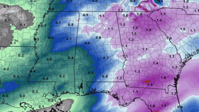
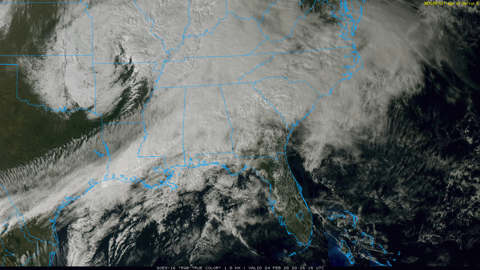
WET: Rain continues to be rather widespread across Alabama this afternoon; we’re not seeing any lightning in a stable air mass. Temperatures are in the 40s and 50s over the northern half of the state. Rain will end from west to east tonight as a slot of drier air works into the state.
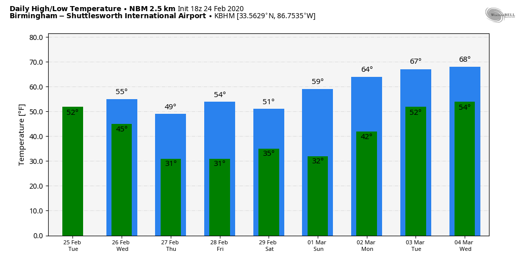
Tuesday will be dry and mild; with a mix of sun and clouds, look for a high in the mid to upper 60s. Clouds increase Tuesday night, and we will mention the chance of a few light rain showers over north Alabama Wednesday morning as a cold front passes through the state. Rain amounts should be less than one-quarter inch, and some spots won’t have enough rain to measure. Otherwise, Wednesday will be breezy and colder, with temperatures holding in the 40s most of the day. Some clearing is possible by mid to late afternoon.
THURSDAY/FRIDAY: These two days will be dry with cold mornings. We project lows in the 25- to 30-degree range over the northern half of the state. The high will be close to 50 Thursday, followed by low to mid 50s Friday. The sky will be mostly sunny both days.
THE ALABAMA WEEKEND: A disturbance rolling down the backside of an upper trough over the eastern U.S. has the potential to squeeze out a few snowflakes or rain drops over north Alabama Saturday morning. Moisture will be very limited, and for now this doesn’t look like a big precipitation event. The sky will clear Saturday afternoon with a high in the low 50s. Sunday will feature a good supply of sunshine. After a low in the upper 20s and low 30s, the high will be in the upper 50s.
NEXT WEEK: Moisture returns early in the week. A few scattered showers are possible Monday and Tuesday, but a more significant rain event is likely Tuesday night and Wednesday with a surface low passing north of the state. The week looks fairly mild, with highs mostly in the 60s.
RAIN UPDATE: Birmingham’s official rain total for February so far is 12.31 inches. That makes 2020 the third-wettest February on record, behind February 1961 (17.67 inches) and February 1903 (15.86 inches). Current rain projections for the next seven days suggest February 2020 will most likely stay in third place.
ON THIS DATE IN 1969: The famous “100-Hour Storm” began in Boston. Snow fell much of the time between early on the 25th through noon on the 28th. The 26.3 inches at Logan Airport is the second-greatest snowstorm in Boston’s history. Seventy-seven inches fell at Pinkham Notch Base Station in New Hampshire, bringing its February total to 130 inches. Its snow cover on the 27th was 164 inches. Mt. Washington, New Hampshire, received 172.8 inches of snow in the month.
BEACH FORECAST: Click here to see the AlabamaWx Beach Forecast Center page.
WEATHER BRAINS: You can listen to our weekly 90-minute show any time on your favorite podcast app. This is the show all about weather featuring many familiar voices, including the meteorologists at ABC 33/40.
CONNECT: You can find me on the major social networks:
Facebook
Twitter
Instagram
Pinterest
Snapchat: spannwx
For more weather news and information from James Spann and his team, visit AlabamaWx.com.


