James Spann: Clearing, colder in Alabama tonight
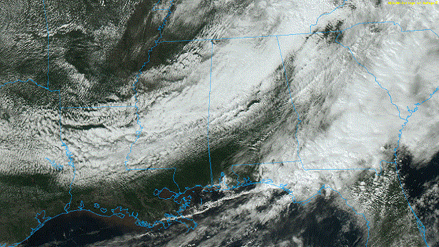
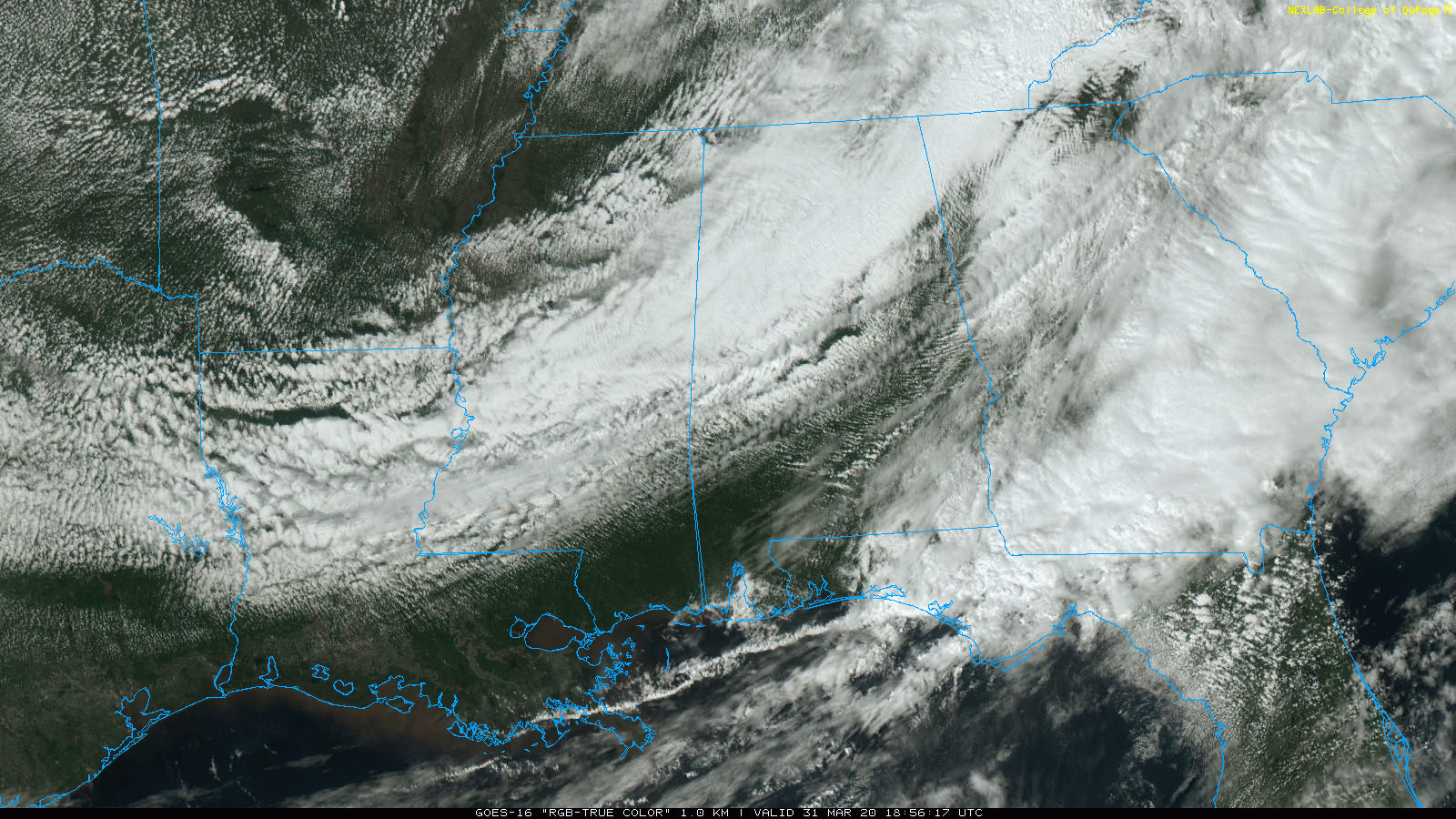
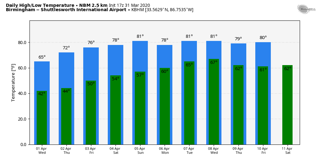
SPRING CHILL: Rain and storms have exited the state this afternoon, but clouds linger over north Alabama. Temperatures are only in the upper 40s and 50s in many areas; the average high for March 31 at Birmingham is 71. The sky will clear tonight, and we project a low between 37 and 44 degrees early Wednesday for most places. For colder valleys and protected areas, there is a chance of some scattered light frost.
REST OF THE WEEK: Dry weather is the story Wednesday through Friday. It will be sunny Wednesday and Thursday, and partly sunny Friday. The high will be in the mid 60s Wednesday, followed by low 70s Thursday and mid 70s Friday.
THE ALABAMA WEEKEND: Look for a mix of sun and clouds Saturday and Sunday with warm afternoons; highs will be in the 78- to 82-degree range. We will mention just a small risk of a shower Saturday, and there is potential for a few scattered showers Sunday. Still, a decent part of the weekend will be dry.
NEXT WEEK: A moist, unstable air mass will set up across the Deep South early in the week, and we will have a chance of showers and thunderstorms Monday and Tuesday. It remains to be seen whether there will be a severe weather threat. The latter half of the week, for now, looks dry with warm afternoons.
THIS MORNING’S STORMS: A large tornado passed just south of downtown Eufaula this morning, producing significant damage. Other tornadoes were reported in Mobile, Escambia and Pike counties. A line of heavy showers brought strong winds through metro Birmingham and parts of east Alabama as well, where some trees came down.
ON THIS DATE IN 1973: A devastating tornado took a nearly continuous 83-mile path through north central Georgia, causing more than $113 million damage, the highest total on record for a natural disaster in the state at that time. It touched down first in Jonesboro around 4:30 p.m. The tornado badly damaged homes in Conyers and Monroe, but the worst damage occurred in Athens. Two people were killed in a trailer park and at least 70 others were injured. Several businesses, including a truck stop, were destroyed.
ON THIS DATE IN 2016: Thunderstorms began forming across Mississippi by mid-afternoon, spreading east into western Alabama by early evening. A mix of supercells, storm clusters and bowing segments was observed through the duration of the event. Seven tornadoes touched down in Alabama — four EF-1s and three EF-0s.
BEACH FORECAST: Click here to see the AlabamaWx Beach Forecast Center page.
WEATHER BRAINS: You can listen to our weekly 90-minute show any time on your favorite podcast app. This is the show all about weather featuring many familiar voices, including the meteorologists at ABC 33/40.
CONNECT: You can find me on all of the major social networks:
Facebook
Twitter
Instagram
Pinterest
Snapchat: spannwx
For more weather news and information from James Spann and his team, visit AlabamaWx.com.


