James Spann: Strong to severe storms for Alabama Thursday, dry Friday
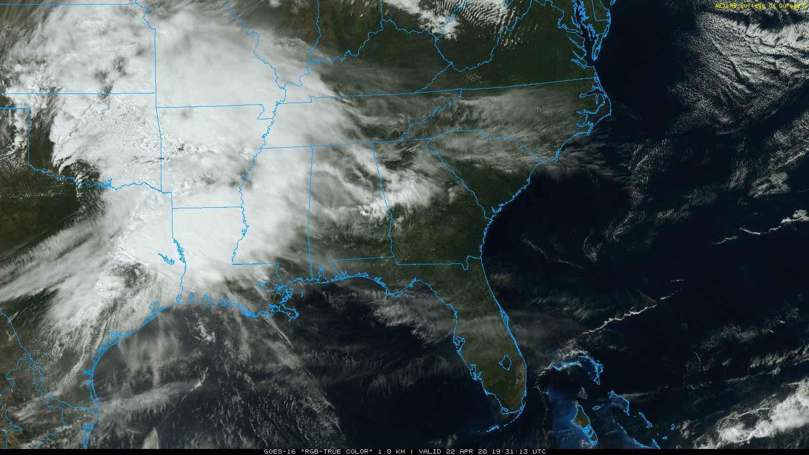
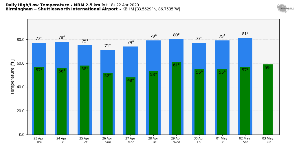
UNSETTLED WEATHER: The sky has become mostly cloudy across Alabama this afternoon and a few patches of light rain have been moving across the state. A larger amount of rain is moving into the western counties as I write this. Temperatures are generally in the 65- to 72-degree range; the average high for April 22 at Birmingham is 76.
SEVERE WEATHER POTENTIAL THURSDAY: An organized band of rain and thunderstorms will pass through early Thursday morning. The air will be cool and stable, but some hail and strong winds are possible. The rain will be heavy at times.
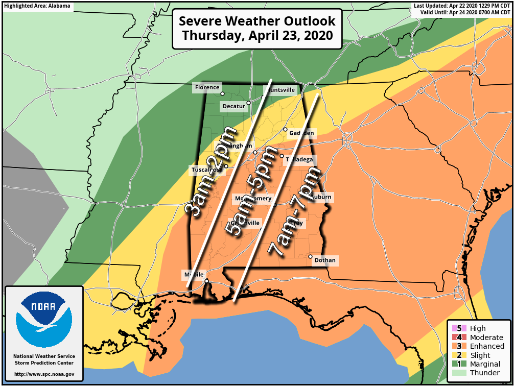
Then, later in the day, additional thunderstorms will likely develop, mainly over the eastern and southern counties of the state. The Storm Prediction Center maintains an enhanced risk (level 3 out of 5) of severe weather for areas south and east of Birmingham, with slight and marginal risks to the north and west.
The potential afternoon thunderstorm threat is conditional; the air will be rain-cooled from the morning activity, and there is a chance the unstable air will remain over the southern half of the state, much like this past Sunday. But high-resolution models show a surge of instability by afternoon into east Alabama.
TIMING: On the attached graphic, you see very large severe weather windows (12 hours); this is to cover the morning round of storms as well as the afternoon convection. There should be a lull during the mid to late morning and possibly early in the afternoon as well. But most of the storms will come between 3 a.m. and 7 p.m.
THREATS: The morning storms will be capable of producing some hail and strong winds. Afternoon storms over east and south Alabama could feature large hail, damaging wind and a few tornadoes.
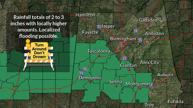
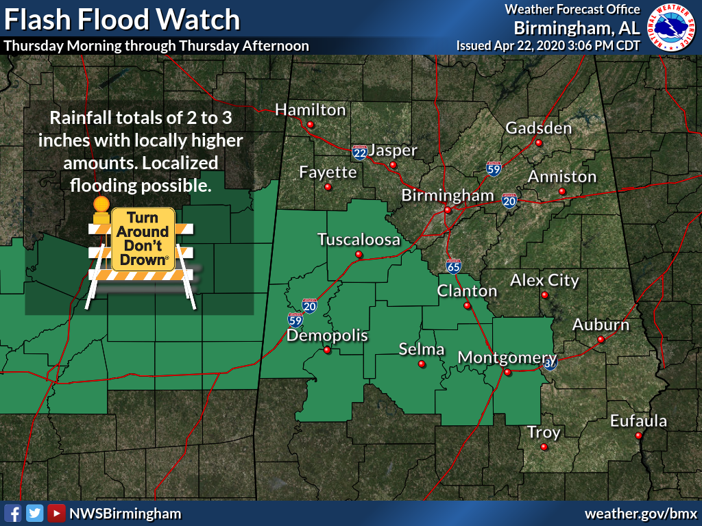
RAIN: Rain amounts of 2-3 inches are expected across central Alabama, and a flash flood watch is in effect for 14 counties.
It will be another day to be weather aware. Be sure you have a way of hearing severe weather warnings and pay attention to severe thunderstorm warnings. Know your safe place and how to get there quickly.
FRIDAY AND THE WEEKEND: Dry air will cover Alabama Friday; the day will be mostly sunny with a high around 80 degrees. Then, another fast-moving weather system will bring a band of showers and thunderstorms to the northern third of the state after midnight Friday night into early Saturday morning. For now, it looks like moisture return will be limited and the severe weather threat will be low. We expect gradual clearing by Saturday afternoon. Sunday, for a change, looks like beautiful day with ample sunshine and a high around 70 degrees.
NEXT WEEK: For now we don’t see any signs of severe thunderstorms during the week. A cold front could bring a few showers Wednesday, but it doesn’t look like a big rain event.
ON THIS DATE IN 2003: Tropical Storm Ana became the first Atlantic tropical storm since records began in 1871 to form during April. Maximum sustained winds reached 55 mph. Starting as a nontropical area of low pressure on April 18 about 210 miles south-southwest of Bermuda, it was classified as a subtropical storm early on April 20 and gained full tropical characteristics near 0000 Coordinated Universal Time on April 21, developing an “eye” feature.
WEATHER BRAINS: You can listen to our weekly 90-minute show anytime on your favorite podcast app. This is the show all about weather featuring many familiar voices, including the meteorologists at ABC 33/40.
CONNECT: You can find me on the major social networks:
Facebook
Twitter
Instagram
Pinterest
Snapchat: spannwx
For more weather news and information from James Spann and his team, visit AlabamaWx.