James Spann: Wet weather for Alabama at times through Friday
RADAR CHECK: Showers and thunderstorms have been steadily increasing over the northern half of Alabama this afternoon in the moist, unstable air. Away from the showers temperatures are near 90, but many places are in the 80s. We will maintain the chance of showers through the night tonight as a broad upper trough forms over the region.
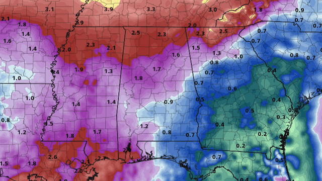
REST OF THE WEEK: With a broad trough and very high precipitable water values, look for numerous showers and thunderstorms daily through the rest of the week. While most of the tropical showers will come during the afternoons and evenings, we could very well see some late-night and morning rain as well. Heavier storms will be very efficient rain producers in this kind of environment.
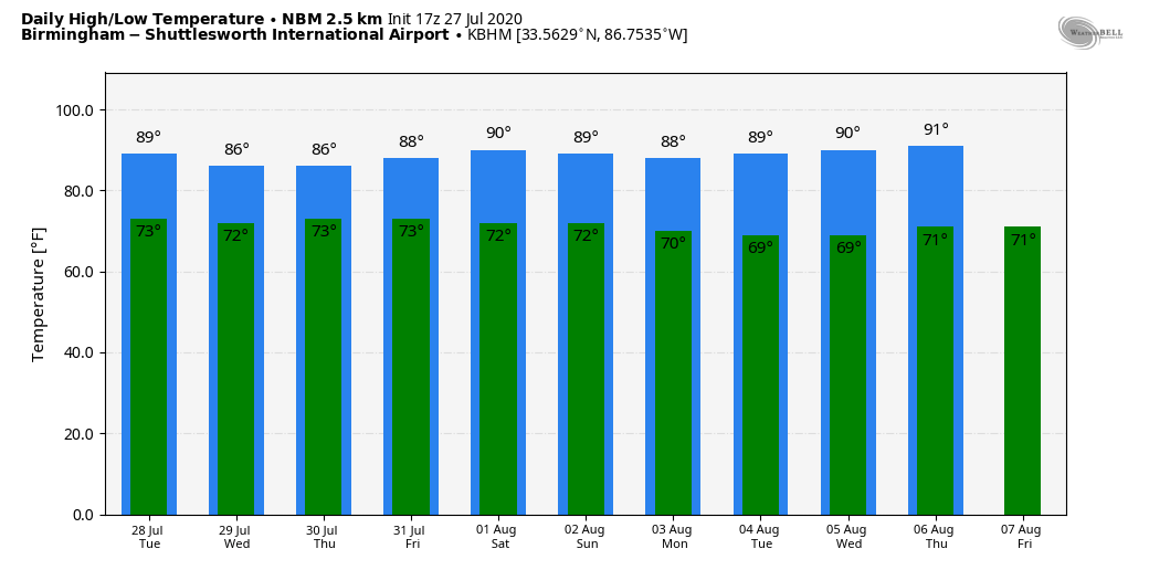
Daytime temperatures will be below average due to clouds and showers, with highs mostly in the mid to upper 80s through Friday. The average high for Birmingham is 91 degrees at the end of July.
THE WEEKEND AND NEXT WEEK: For the weekend, expect a mix of sun and clouds with scattered, mostly afternoon and evening showers and thunderstorms, just what you expect at the beginning of August. Highs both days will be around 90 degrees. And we see very little change through much of next week. Days will be partly sunny with the usual risk of scattered afternoon storms. Highs will be mostly in the 88- to 92-degree range.
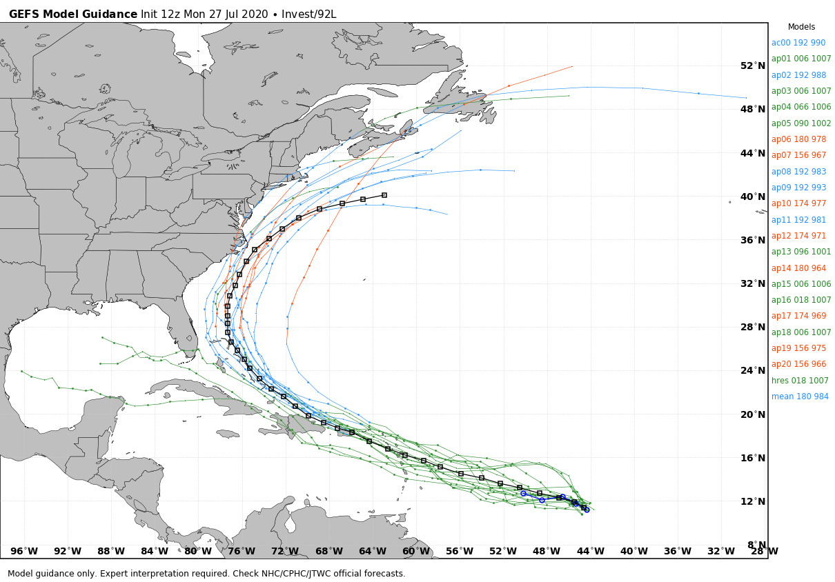
TROPICS: The National Hurricane Center still gives Invest 92L in the Atlantic, about 1,000 miles east of the Windward Islands, a 70% to 80% chance of developing into a tropical depression or storm during midweek. There are still more questions than answers about the system at this point; intensity guidance has come down, with many models suggesting the system won’t reach hurricane strength this week. Model consensus takes the system just north of Puerto Rico, followed by a curve to the north around the Bahamas and just off the East Coast of the U.S. in seven to 10 days. But it is way too early to know the track or intensity of the system. Just something to watch for now.
The rest of the Atlantic basin is quiet.
ON THIS DATE IN 1943: A surprise Category 2 hurricane moved ashore near Galveston, Texas. Because of World War II all news underwent censorship, including any weather reports, making this a surprise storm. The hurricane killed 19 people and caused millions of dollars in damages. Lt. Col. Joe Duckworth and Lt. Ralph O’Hair flew an AT-6 Texan into the eye of the hurricane, the first flight into the eye of a storm.
BEACH FORECAST: Click here to see the AlabamaWx Beach Forecast Center page.
WEATHER BRAINS: You can listen to our weekly 90-minute show anytime on your favorite podcast app. This is the show all about weather featuring many familiar voices, including the meteorologists at ABC 33/40.
CONNECT: You can find me on the major social networks:
Facebook
Twitter
Instagram
Pinterest
Snapchat: spannwx
For more weather news and information from James Spann and his team, visit AlabamaWx.