James Spann: Strong storms possible for Alabama again Saturday; drier Sunday
ACTIVE WEATHER DAY: A line of showers and thunderstorms developed quickly across north Alabama around 1, and the storms grew to severe limits in spots. A number of severe thunderstorm warnings have been required today; the main threat with the storms passing through is from strong straight-line winds. Some tree and power line damage has been reported in scattered locations over the northern half of the state.
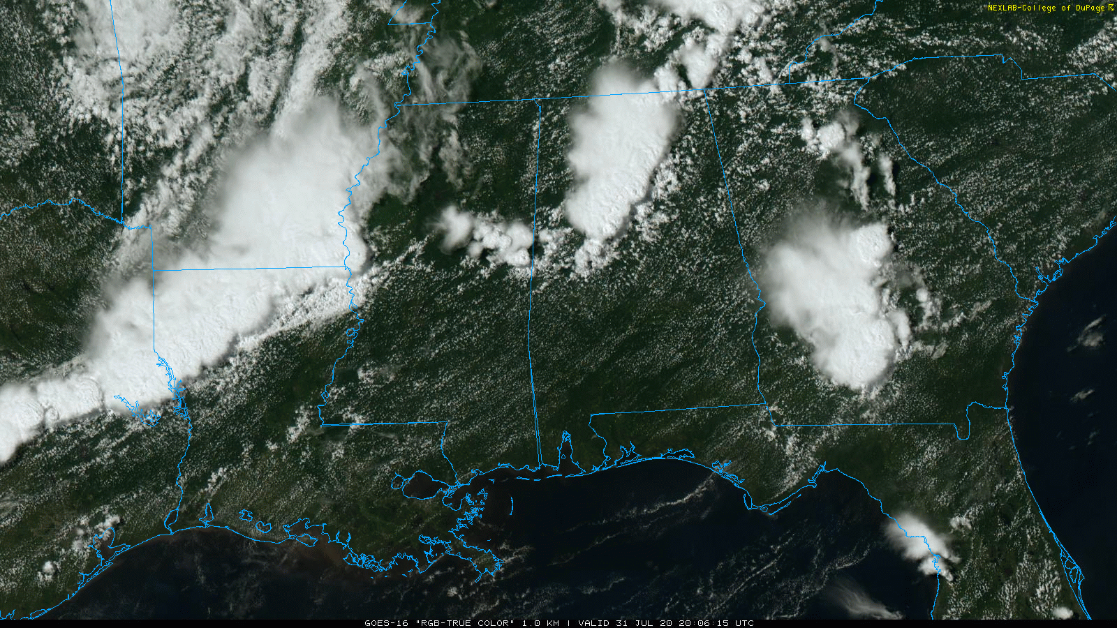
Storms will diminish this evening as they move east into Georgia.
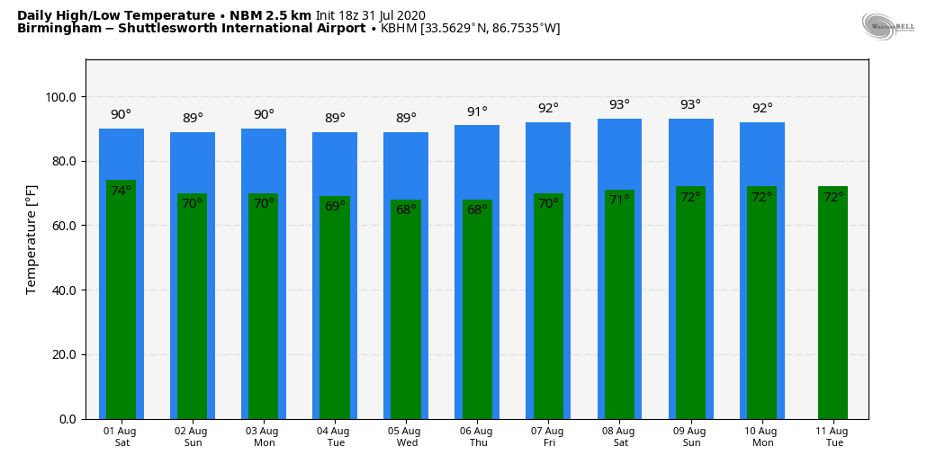
THE ALABAMA WEEKEND: Saturday will be another active weather day; showers and storms will likely form by afternoon and, like today, they could be strong over the northern third of the state. On the positive side, the Storm Prediction Center has dropped the marginal risk of severe weather for north Alabama Saturday. Most of the storms will come from noon to midnight, although a few isolated morning showers can’t be ruled out. On Sunday, the weather trends drier with only isolated showers. Highs over the weekend will be in the 88- to 92-degree range.
NEXT WEEK: Monday looks fairly dry, with only an outside risk of a shower; then we will have the usual risk of random, scattered, mostly afternoon and evening showers and thunderstorms Tuesday through Friday. Highs during the week will be at or just over 90 degrees.
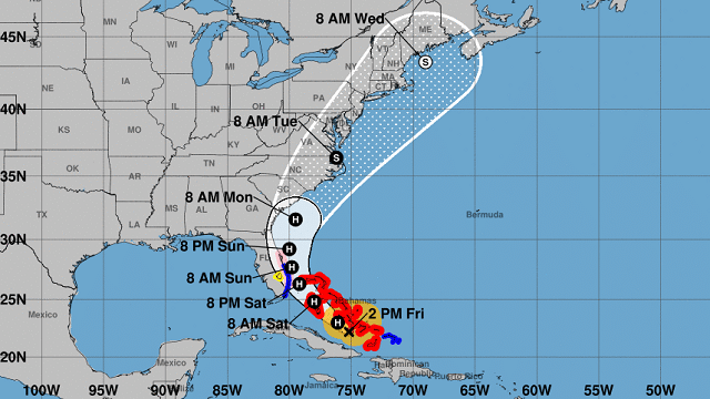
HURRICANE ISAIAS: Winds are now 75 mph and the hurricane is struggling with shear keeping it from growing stronger. The National Hurricane Center continues to forecast a track just east of the Florida Atlantic coast over the weekend, followed by a turn to the northeast, near the U.S. east coast.
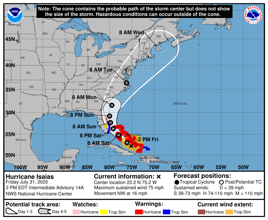
Tropical storm conditions are expected with hurricane conditions possible along portions of the Florida east coast beginning Saturday, and a Tropical Storm Warning and Hurricane Watch are in effect. Storm surge watches or warnings could be needed for part of this area this evening.
There is a risk of impacts from winds, heavy rainfall and storm surge beginning late this weekend along the northeastern Florida coast and spreading northward along the remainder of the U.S. east coast through early next week. Interests along the entire U.S. east coast should monitor the progress of Isaias and updates to the forecast.
Isaias will not affect Alabama or the central Gulf Coast (places like Gulf Shores, Pensacola, Destin and Panama City Beach).
TROPICAL DEPRESSION 10: A new tropical depression has formed in the far eastern Atlantic close to the coast of Africa; this one will drift northward, and for now it looks like it will stay far away from the U.S. and the Lesser Antilles.
ON THIS DATE IN 1997: South Pole, Antarctica, recorded its coldest July ever. The average temperature of minus 86.8 degrees broke the previous record of minus 83.6 degrees set in July 1965.
BEACH FORECAST: Click here to see the AlabamaWx Beach Forecast Center page.
WEATHER BRAINS: You can listen to our weekly 90-minute show anytime on your favorite podcast app. This is the show all about weather featuring many familiar voices, including the meteorologists at ABC 33/40.
CONNECT: You can find me on the major social networks:
Facebook
Twitter
Instagram
Pinterest
Snapchat: spannwx
For more weather news and information from James Spann and his team, visit AlabamaWx.


