James Spann: Occasional showers, storms for Alabama through Friday
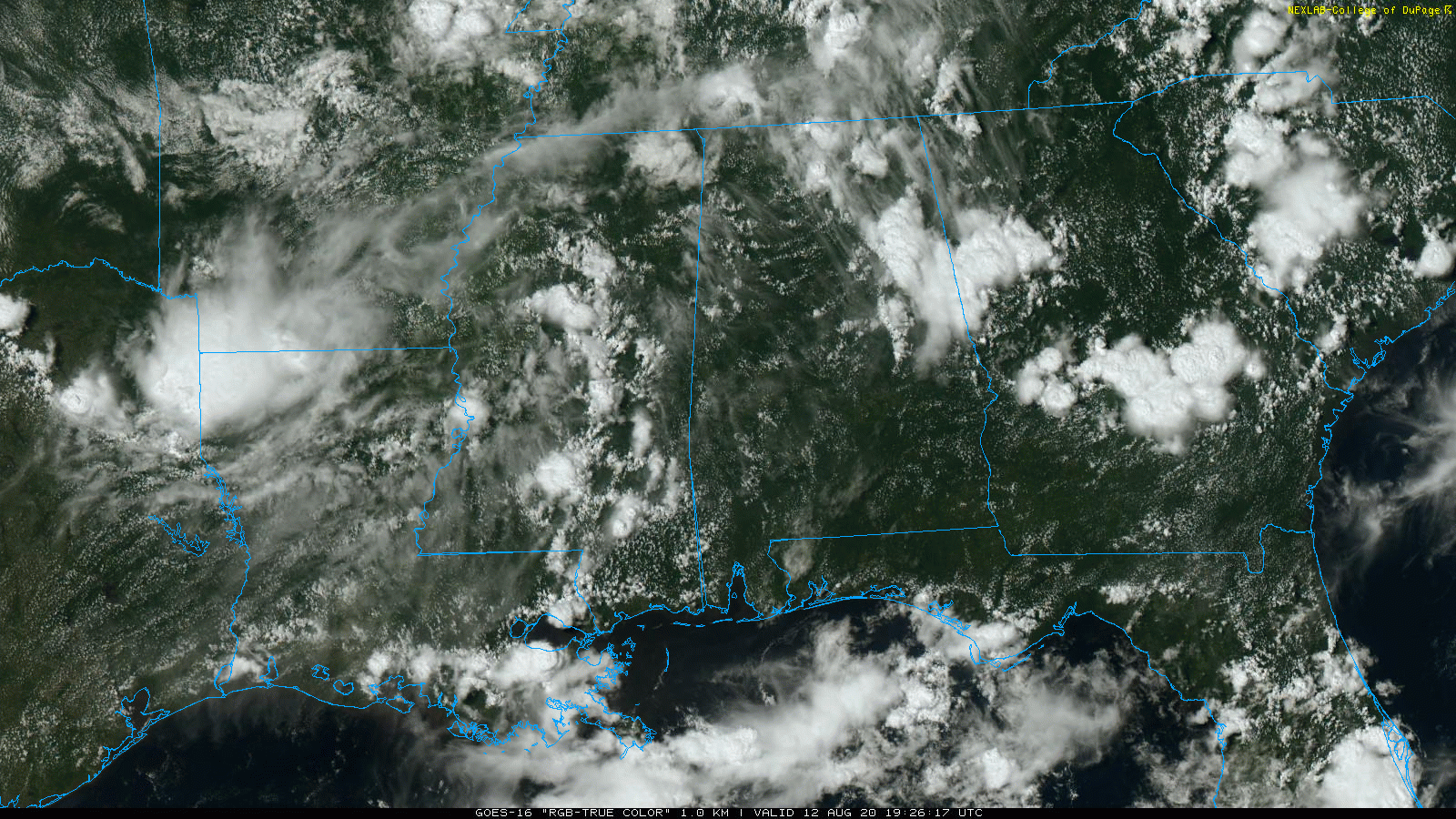
RADAR CHECK: Showers and thunderstorms are most active over the eastern half of Alabama this afternoon; some communities are seeing heavy rain, frequent lightning and gusty winds with the heavier storms. Additional showers and storms will likely develop in the unstable air over the rest of the state in coming hours, and some could linger well into the night. Temperatures are in the 70s where rain is falling; over in west Alabama we are seeing mostly low 90s.
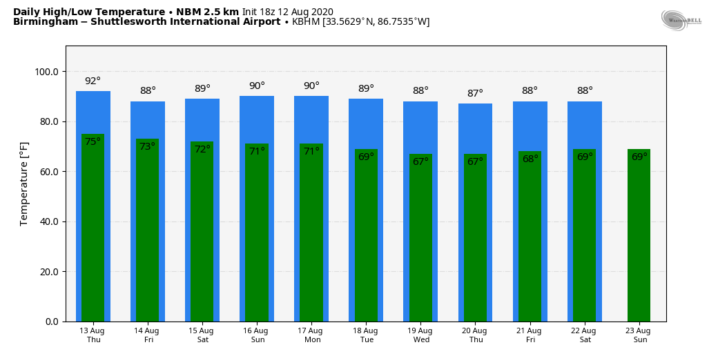
THURSDAY/FRIDAY: With an upper trough nearby, we expect the sky to be cloudy at times, with scattered to numerous showers and thunderstorms both days. No washout, but occasional heavy downpours are likely. Heat levels will be lower because of clouds and showers; we expect highs mostly in the 87- to 90-degree range.
THE ALABAMA WEEKEND: Showers become fewer in number Saturday as the air should be drier, and we are expecting only isolated showers Sunday. The sky will be partly to mostly sunny both days with highs not far from 90 degrees.
NEXT WEEK: A high-amplitude upper-air pattern will form over the nation, with a hot upper ridge over the western states, and a “cool” upper trough over the eastern half. This should bring below-average temperatures to Alabama and much of the Deep South; on most days highs will be in the 80s and lows in the 60s. Much of the week will be rain-free, with just a few isolated showers around.
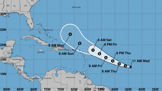
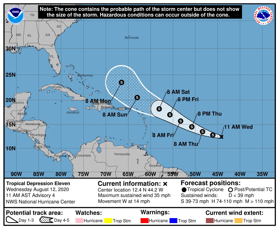
TROPICS: Tropical Depression 11, which is about halfway between the coast of Africa and the Lesser Antilles, is still expected to become Tropical Storm Josephine tonight. It will gain latitude and should pass north of the Leeward Islands Saturday. The system will be dealing with a good bit of shear, and it is very possible that it will dissipate north of Puerto Rico over the weekend. If it does survive, it will recurve over the open Atlantic well east of the U.S. The rest of the Atlantic basin, including the Gulf of Mexico, is quiet.
ON THIS DATE IN 1955: Hurricane Connie made landfall on the North Carolina coast at Category 2 strength. Ahead of the storm, the United States Weather Bureau issued widespread hurricane warnings, spurring evacuations, flight cancellations and beach closures. Connie produced strong winds, high tides and heavy rainfall as it moved ashore, causing heavy crop damage and 27 deaths in North Carolina. Four people were killed in Washington, D.C., in a traffic accident caused by slick roads. In Chesapeake Bay, Connie capsized a boat, killing 14 people and prompting a change in Coast Guard regulations. There were six deaths each in Pennsylvania and New Jersey, and 14 deaths in New York, where record rainfall flooded houses and subways. At least 295,000 people nationwide lost electric power during the storm. Damage in the United States totaled around $86 million in 1955 U.S. dollars.
BEACH FORECAST: Click here to see the AlabamaWx Beach Forecast Center page.
WEATHER BRAINS: You can listen to our weekly 90-minute show anytime on your favorite podcast app. This is the show all about weather featuring many familiar voices, including the meteorologists at ABC 33/40.
CONNECT: You can find me on the major social networks:
Facebook
Twitter
Instagram
Pinterest
Snapchat: spannwx
For more weather news and information from James Spann and his team, visit AlabamaWx.