James Spann: Alabama stays mostly dry through Tuesday
ON THE MAPS: A surface front is near I-59 this afternoon; north of the front, humidity is lower and the sky is sunny. South of the front, we have a field of cumulus cloud,s and a few isolated showers and thunderstorms are in progress. Temperatures are mostly in the 87- to 92-degree range.
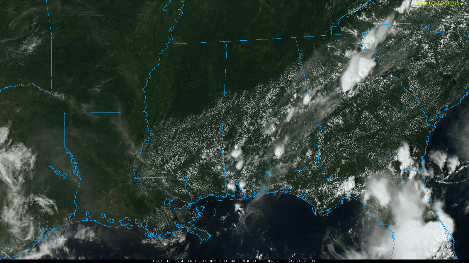
The isolated showers will end after sunset as the air cools and becomes more stable.
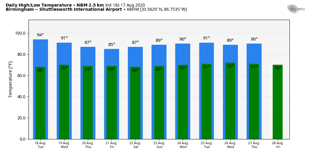
REST OF THE WEEK: Tuesday will be mostly rain-free over the northern half of the state, but a few isolated showers are possible over the southern counties. Showers remain fairly widely spaced Wednesday, but we are looking for an increase in the number of scattered afternoon and evening showers and storms Thursday and Friday as moisture levels rise. The high will be close to 90 Tuesday and Wednesday; we are forecasting mid to upper 80s Thursday and Friday.
THE ALABAMA WEEKEND: Look for a mix of sun and clouds Saturday and Sunday with scattered showers and thunderstorms both days, mostly between noon and 10 p.m. Highs over the weekend will be in the 86- to 90-degree range, a bit below average for August in Alabama.
NEXT WEEK: Forecast confidence isn’t especially high with potential for a tropical system in the Gulf of Mexico early in the week; for now we will keep up the summer persistence forecast, but be aware the forecast could change significantly.
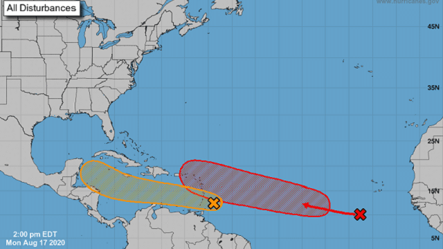
TROPICS: The National Hurricane Center is monitoring two tropical waves in the main development region of the Atlantic basin. Both have a medium to high chance of becoming a tropical storm in the next five days.
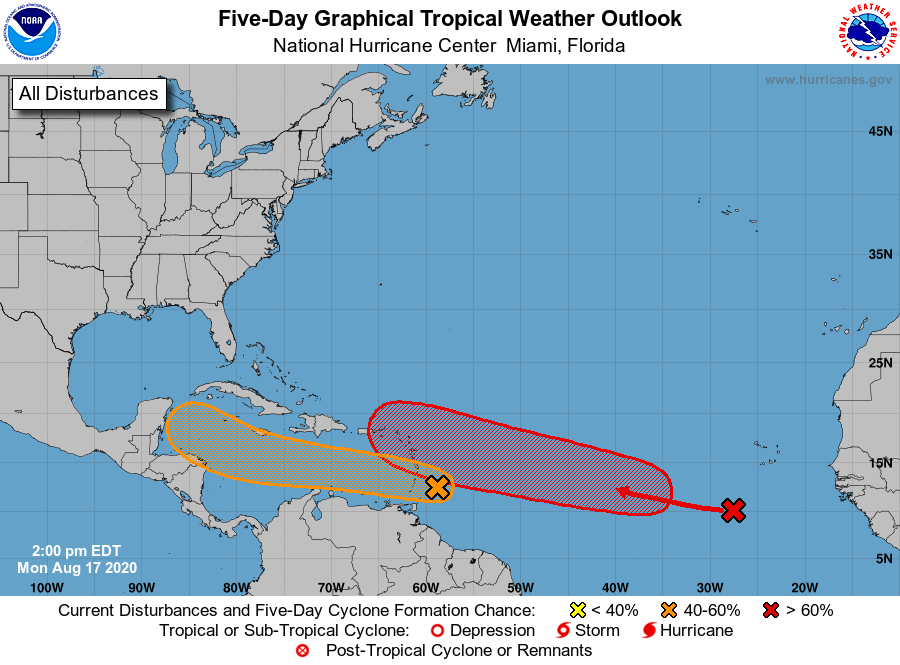
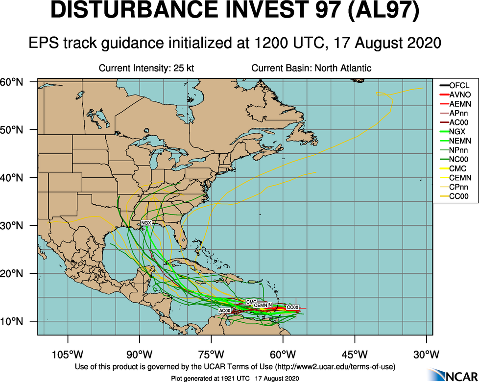
INVEST 97L: The lead wave is approaching the Windward Islands and is producing a large area of disorganized shower and thunderstorm activity. This disturbance is moving westward at about 20 mph. It is expected to continue to move quickly westward over the eastern and central Caribbean Sea during the next couple of days, which is likely to limit significant development. After that time, however, the system is expected to move more slowly westward across the western Caribbean, where upper-level winds could become more conducive for the development of a tropical depression during the latter part of this week. Regardless of development, locally heavy rainfall and gusty winds are expected over portions of the Windward and southern Leeward Islands through Tuesday morning.
There is a pretty good chance 97L winds up in the Gulf of Mexico in a week or so, but there is no way of knowing now the ultimate intensity or destination. Just something to watch; no need to cancel any beach trips.
INVEST 98L: The easternmost wave is forecast to interact with another disturbance several hundred miles southwest of the Cabo Verde Islands within the next day or two. This interaction is expected to lead to the formation of a broad area of low pressure, and conditions are forecast to be conducive for the development of a tropical depression during the middle-to-latter part of this week while the system moves westward to west-northwestward at 15 to 20 mph across the central and western portions of the tropical Atlantic. Again, it’s too early to know whether this system will affect the U.S.
The Gulf of Mexico will remain quiet for the rest of this week.
ON THIS DATE IN 1969: Hurricane Camille made landfall along the Mississippi Gulf Coast near Waveland. Camille is one of only four Category 5 hurricanes ever to make landfall in the continental United States – the others being the 1935 Labor Day Hurricane, which hit the Florida Keys; Hurricane Andrew in 1992, which hit south Florida; and Hurricane Michael in 2018, which hit the Florida panhandle. (It is worth mentioning that the 1928 San Felipe Hurricane made landfall as a Category 5 hurricane on Puerto Rico.)
Camille ranks as the second most intense hurricane to strike the continental U.S. with 900-millibar pressure and landfall intensity of 150 knots. Camille ranks just below the 1935 Labor Day Hurricane, with 892 millibars and 160 knots, while slightly stronger than Hurricane Andrew, with 922 millibars and 145 knots, and Hurricane Michael, with 919 millibars and 140 knots. The actual maximum sustained winds of Hurricane Camille are not known, as the hurricane destroyed all the wind-recording instruments in the landfall area. Re-analysis data found peak winds of 150 knots (roughly 175 mph) along the coast. A devastating storm tide of 24.6 feet occurred in Pass Christian, Mississippi. The death toll was 256.
BEACH FORECAST: Click here to see the AlabamaWx Beach Forecast Center page.
WEATHER BRAINS: You can listen to our weekly 90-minute show anytime on your favorite podcast app. This is the show all about weather featuring many familiar voices, including the meteorologists at ABC 33/40.
CONNECT: You can find me on the major social networks:
Facebook
Twitter
Instagram
Pinterest
Snapchat: spannwx
For more weather news and information from James Spann and his team, visit AlabamaWx.


