James Spann: Showers, storms become more numerous in Alabama Thursday
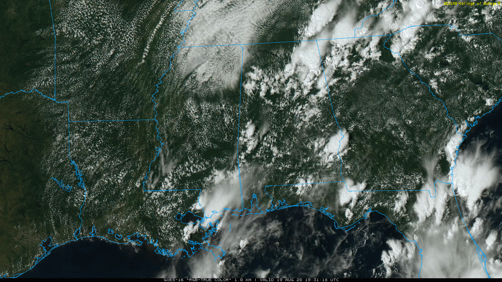
RADAR CHECK: Scattered showers and thunderstorms have returned to Alabama this afternoon. The more numerous ones so far have been over the northeast part of the state, where some places have experienced heavy rain and small hail. Storms are moving slowly northeast and will diminish late tonight. Where rain is falling, temperatures are in the 70s; elsewhere, readings are mostly between 88 and 92.
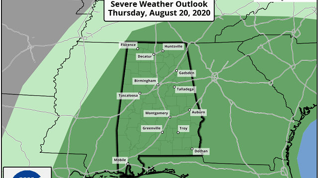
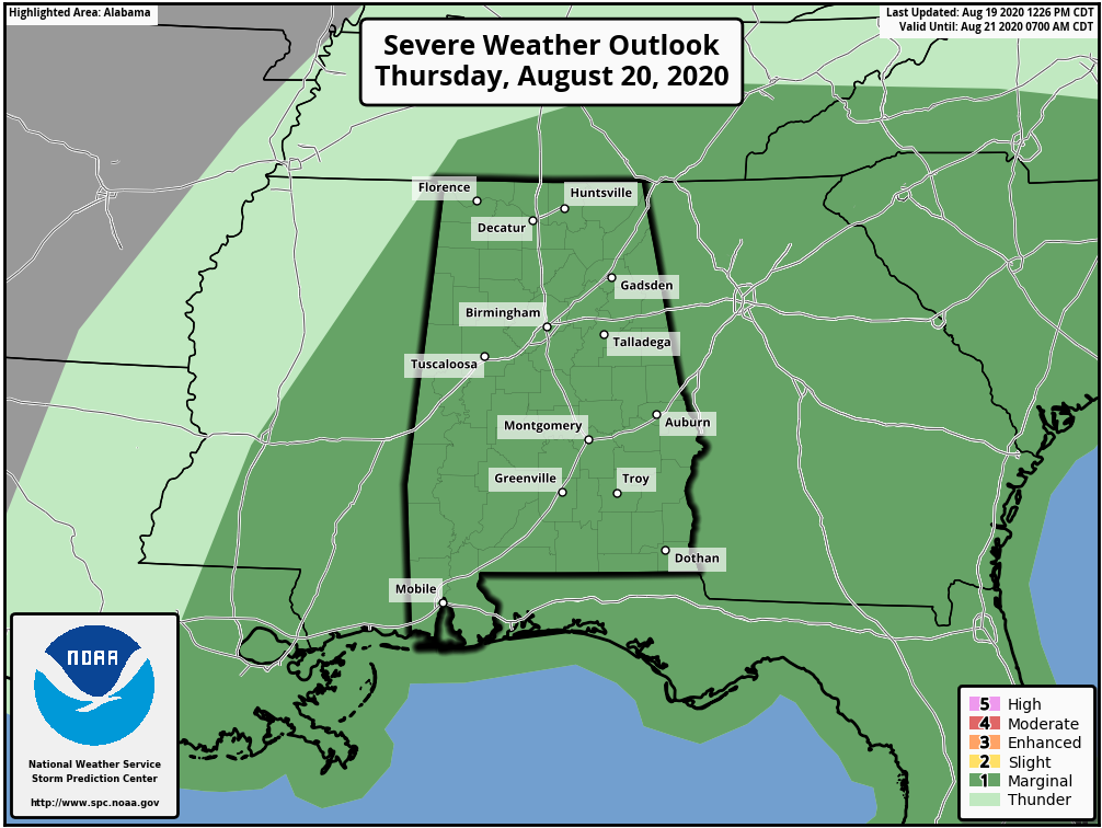
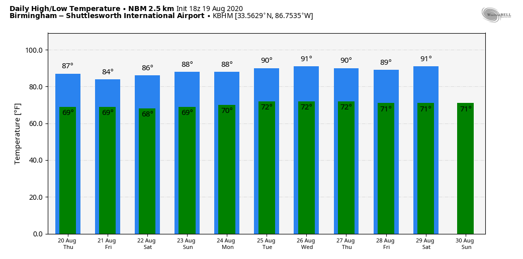
THURSDAY/FRIDAY: The weather will be unsettled across Alabama and the Deep South, with scattered to numerous showers and thunderstorms both days. In fact, the Storm Prediction Center has all 67 Alabama counties in a marginal risk Thursday due to the potential for strong winds with the heavier storms.
The sky will be occasionally cloudy and we expect highs only in the mid 80s both days. We should be in the low 90s this time of the year based on seasonal averages. Most of the rain will come from about 1 until 9 p.m., but we can’t rule out a few late-night or morning showers or storms.
THE ALABAMA WEEKEND: Models have trended a bit wetter for the weekend; we will have at least scattered showers and thunderstorms both Saturday and Sunday as a moist, unstable air mass remains in place. Otherwise, look for a mix of sun and clouds both days with highs between 85 and 90 degrees.
NEXT WEEK: The weather will be greatly dependent on any potential tropical system in the Gulf of Mexico, if one develops. For now we will maintain a summer persistence forecast with partly sunny days and the usual risk of scattered, mostly afternoon and evening showers and thunderstorms.
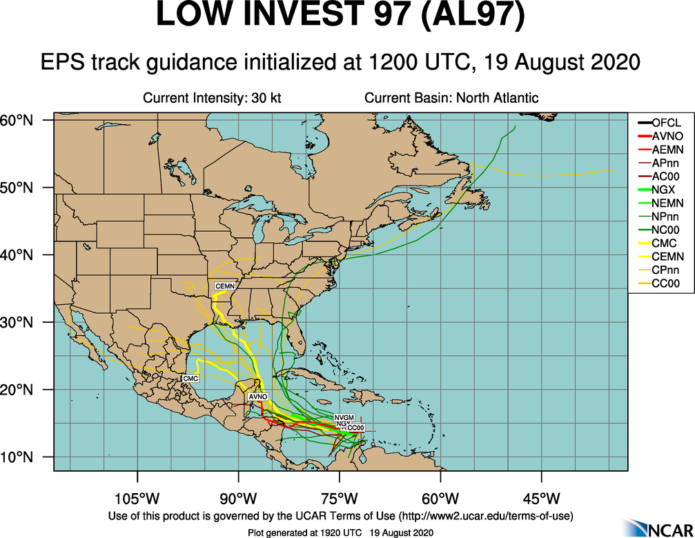
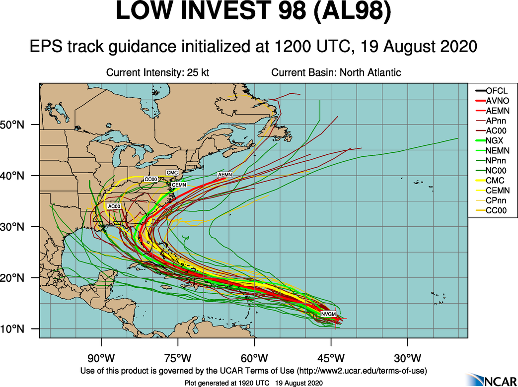
TROPICS: We are watching three tropical waves this afternoon. One is about to emerge off the coast of Africa (this will be designated Invest 99L soon), one wave in the Central Atlantic (Invest 98L) and one in the Caribbean (Invest 97L).
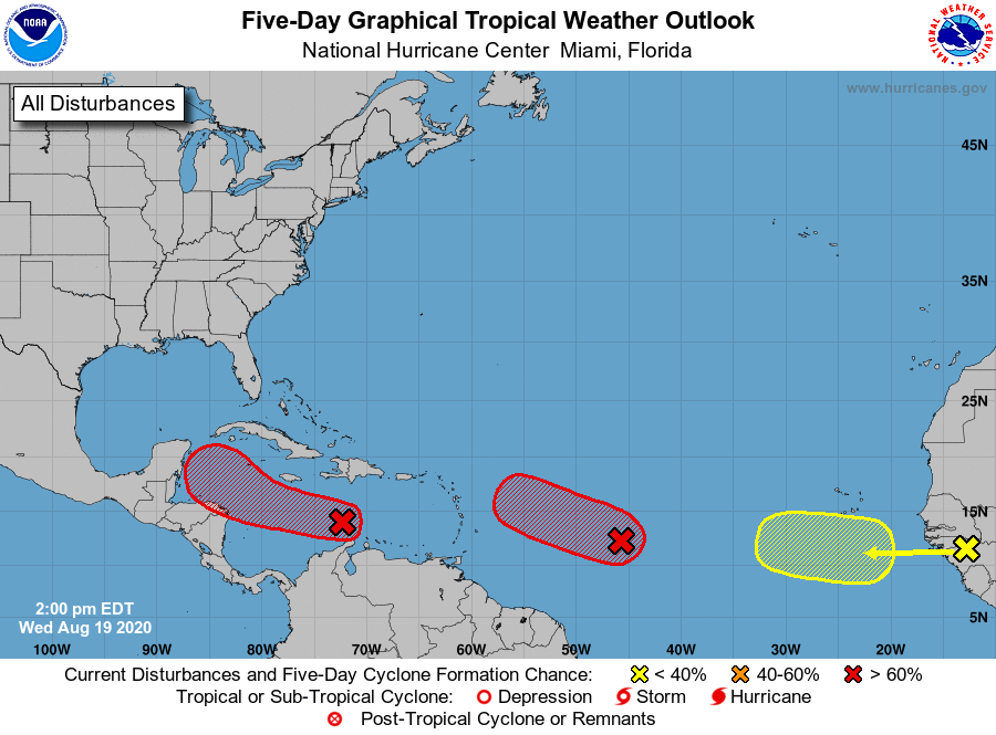
INVEST 97L: Showers and thunderstorms have become more concentrated today in association with a tropical wave over the central Caribbean Sea. Some gradual development of this system is possible over next day or so while it moves westward at about 15 to 20 mph. After that time, the wave is forecast to move more slowly west-northwestward, and a tropical depression is likely to form later this week when the system reaches the northwestern Caribbean Sea. There is a good chance this one gets into the Gulf of Mexico in four to five days, but there is no skill in knowing what, if any, part of the U.S. Gulf Coast will be affected. There’s no need to cancel a beach trip next week; just keep an eye on forecast updates. This could wind up anywhere from Mexico to Florida.
INVEST 98L: An elongated area of low pressure about 1,000 miles east of the Windward Islands continues to produce a concentrated area of showers and thunderstorms. Although recent satellite-derived wind data indicates that the low is not well-defined, environmental conditions are conducive for further development, and a tropical depression is expected to form during the next day or two while the system moves generally west-northwestward at 15 to 20 mph across the central and western portions of the tropical Atlantic. Interests in the Lesser Antilles should monitor the progress of this system. There is a chance this system could affect parts of the southeastern U.S. next week, but there is no way of knowing the ultimate track or destination now. It is simply beyond the science.
A large area of showers and thunderstorms over Guinea and Sierra-Leone, Africa, is associated with a vigorous tropical wave. Environmental conditions are expected to be conducive for some development of this system while the wave enters the extreme eastern Atlantic on Friday. By early next week, however, conditions are forecast to become less favorable for tropical cyclone formation while it moves west-northwestward at 15 to 20 mph toward the central tropical Atlantic.
ON THIS DATE IN 1991: Hurricane Bob made landfall twice in Rhode Island as a Category 2 hurricane, first on Block Island and then in Newport. Upon doing so, it became the only hurricane to make landfall in the contiguous United States during the 1991 season. Bob was one of the costliest hurricanes in New England history; it left extensive damage throughout New England in its wake, totaling approximately $1.5 billion (in 1991 dollars). This made it one of the costliest United States hurricanes at the time. In addition, 18 fatalities were reported in association with Bob. The loss of life and most of the damage occurred as a result of high winds and rough seas. There were six confirmed tornadoes during its passage.
BEACH FORECAST: Click here to see the AlabamaWx Beach Forecast Center page.
WEATHER BRAINS: You can listen to our weekly 90-minute show anytime on your favorite podcast app. This is the show all about weather featuring many familiar voices, including the meteorologists at ABC 33/40.
CONNECT: You can find me on the major social networks:
Facebook
Twitter
Instagram
Pinterest
Snapchat: spannwx
For more weather news and information from James Spann and his team, visit AlabamaWx.


