James Spann: A few isolated tornadoes possible Friday over north Alabama
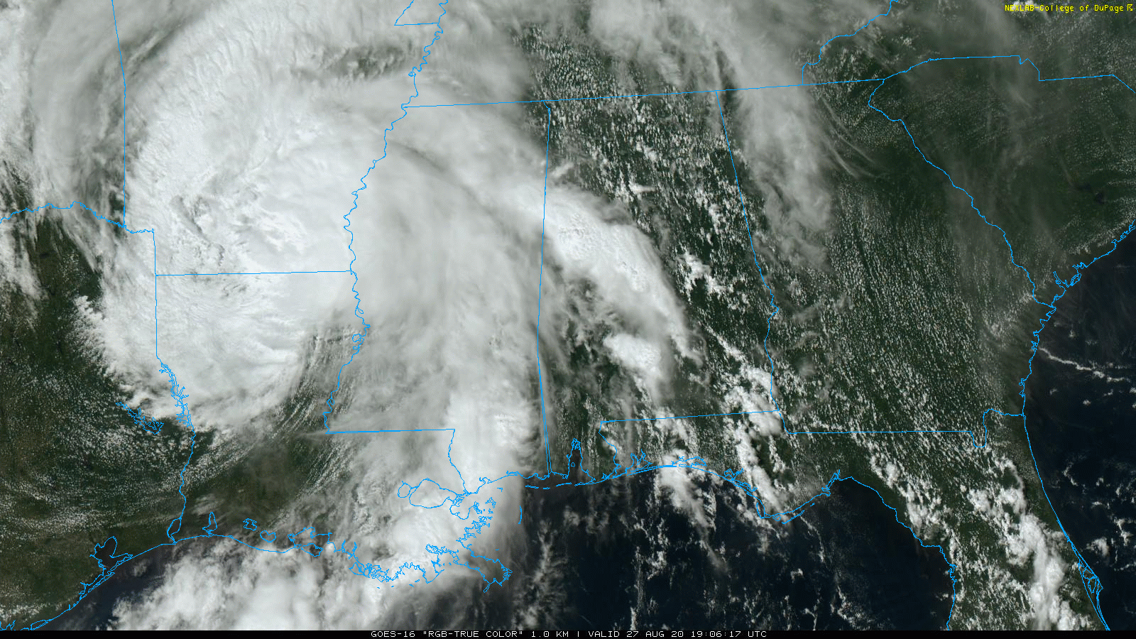
RADAR CHECK: A fast-moving band of thunderstorms has been moving through west Alabama this afternoon, producing gusty winds and some small hail; this is one of the outer feeder bands associated with Tropical Storm Laura, which is now over Arkansas. Other scattered showers and thunderstorms are over east Alabama; otherwise, the sky is partly sunny with temperatures mostly in the upper 80s and low 90s.
We will maintain the chance of a few scattered showers and storms through tonight.
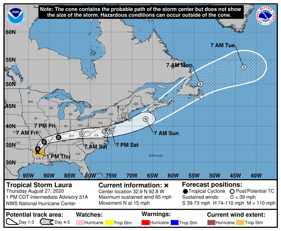
FRIDAY: The remnant circulation of Laura will turn eastward, moving through southern Kentucky during the day. This will put north Alabama in a position with fairly high storm relative helicity values and will set the stage for some potential for isolated tornadoes. The Storm Prediction Center has defined a slight risk (level 2 of 5) as far south as Scottsobro, Oneonta, Dora and Reform. A marginal risk (level 1 of 5) is up as far south as Jacksonville, Calera and Demopolis.
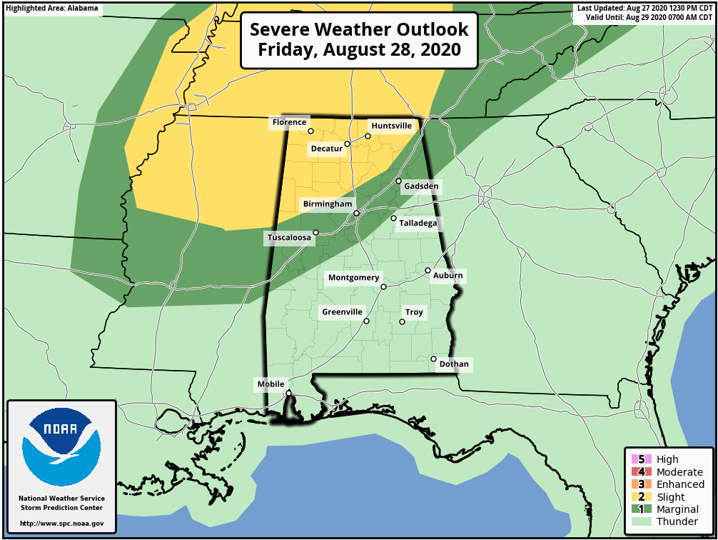
Keep in mind any tornadoes that develop Friday most likely will be short-lived, and sometimes they can touch down with little or no warning. The storms will be low-topped, and sometimes they are literally under the radar beam. Just be weather aware and pay attention to warnings if they are issued. Otherwise, Friday will be mostly cloudy with a good chance of occasional showers and thunderstorms. The high will be in the low to mid 80s.
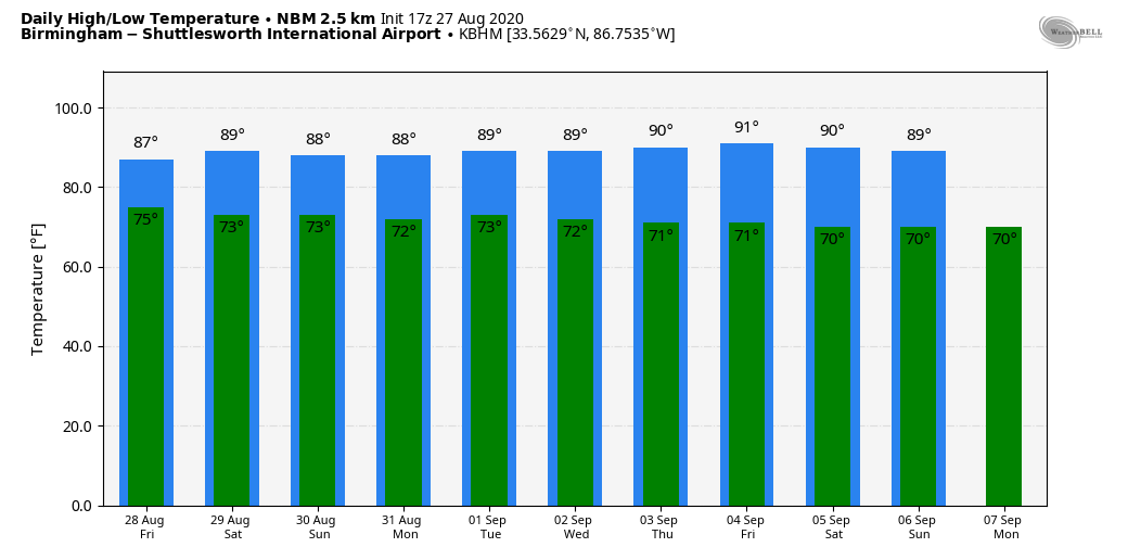
THE ALABAMA WEEKEND: We are seeing evidence of drier air trying to slip into the northern quarter of the state Saturday, but for most of Alabama expect scattered to numerous showers and thunderstorms with a high between 87 and 90 degrees. Sunday will feature more clouds than sun, with a few passing showers and thunderstorms likely and a high in the mid to upper 80s. The weekend won’t be a washout, but be ready for rain at times and possibly some thunder.
NEXT WEEK: Tropical moisture will remain. Each day we will have scattered showers and thunderstorms, most active during the afternoon and evening. Highs will remain mostly in the upper 80s, right at seasonal averages for early September in Alabama.
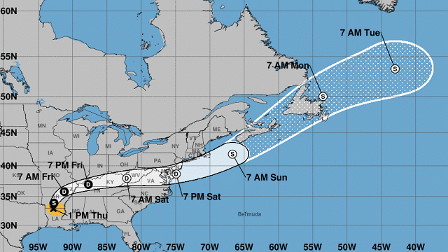
LAURA NOW A TROPICAL STORM: Laura is packing sustained winds of 65 mph over southern Arkansas and will continue to weaken tonight. The system will turn eastward Friday, moving through southern Kentucky. It will move out into the Atlantic as a post-tropical system Saturday night.
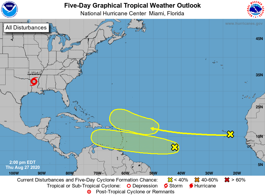
The National Hurricane Center is monitoring two tropical waves in the Atlantic; one is in the far eastern Atlantic and the other about halfway between the coast of Africa and the Lesser Antilles. Both, for now, have a low chance of development over the next five days. The Gulf of Mexico is quiet.
ON THIS DATE IN 2005: Hurricane Katrina reached Category 3 intensity in the Gulf of Mexico about 335 miles south-southeast of the mouth of the Mississippi River with maximum sustained winds of 115 mph.
BEACH FORECAST: Click here to see the AlabamaWx Beach Forecast Center page.
WEATHER BRAINS: You can listen to our weekly 90-minute show anytime on your favorite podcast app. This is the show all about weather featuring many familiar voices, including the meteorologists at ABC 33/40.
CONNECT: You can find me on the major social networks:
Facebook
Twitter
Instagram
Pinterest
Snapchat: spannwx
For more weather news and information from James Spann and his team, visit AlabamaWx.


