James Spann: Widespread rain continues in Alabama south and east of Birmingham
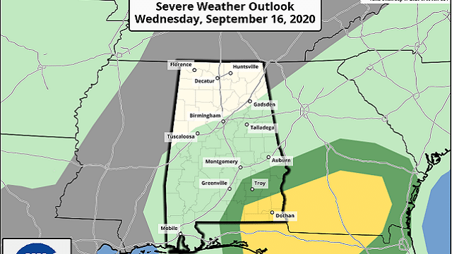
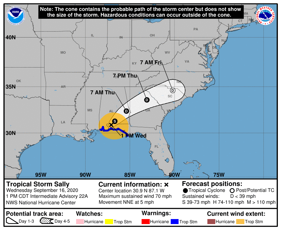
RADAR CHECK: The northern edge of the rain shield associated with Tropical Storm Sally is along a line from Linden to Centreville to Birmingham to Piedmont. The heaviest rain is over the southeast part of the state, where flash flood warnings have been required. There is still a low-end tornado threat over the southeast corner of the state through tonight.
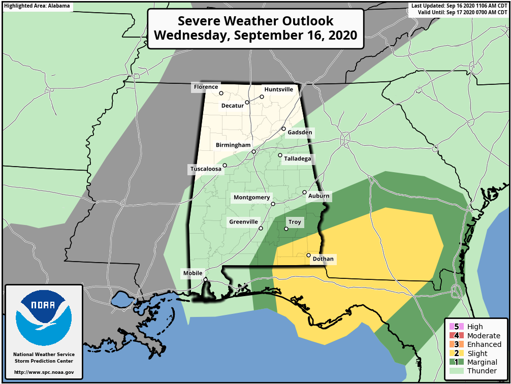
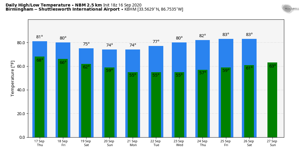
The big rain mass will move out of the state late tonight, and Thursday will be a mostly cloudy day with just some lingering patches of light rain or showers. The high will be in the upper 70s.
FRIDAY AND THE WEEKEND: Friday looks dry with a partly sunny sky; the high will be in the low 80s. We continue to have “model madness” concerning the weekend forecast. The American global model, the GFS, brings a tropical wave up into the region with some risk of rain for the southern half of the state. However, the European global model keeps that wave in the southwest Gulf of Mexico and has rain-free weather conditions for the state. We will continue to side with the more optimistic Euro and keep our weekend forecast dry for now with pleasant afternoons and fair, cool nights. Highs will be in the upper 70s; there’s a good chance we see upper 50s early Sunday morning. It will feel like fall.
NEXT WEEK: The weather looks pretty quiet through the week at this point with temperatures remaining below average for mid to late September.
TROPICS: Sally will weaken into a tropical depression tonight and the remnant circulation will move through Georgia and the Carolinas Thursday and Friday.
In the eastern Atlantic, Paulette has become post-tropical and Vicky is expected to dissipate soon. Teddy, on the other hand, is expected to become a major hurricane tonight and will be close to Bermuda by Monday of next week (although weakening by then). Then, it turns out to sea and is no threat to the U.S.
A wave in the eastern Atlantic (Invest 98L) is expected to become a tropical storm within the next five days; there’s a fair chance this gains latitude just before the Lesser Antilles and recurves, but it’s way too early to know for sure. The National Hurricane Center is also watching a disturbance in the southwest Gulf of Mexico (Invest 90L) with a high chance of becoming a tropical storm within the next five days.
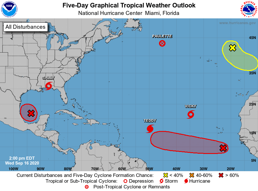
For now models are showing weak steering currents around 98L in the southwest Gulf and leave the system meandering around the same region for the next several days. It remains to be seen whether this will ultimately affect the U.S. — just something to watch for now.
ON THIS DATE IN 2004: At 51 minutes after midnight, the northern eyewall of Hurricane Ivan moved onto land near Gulf Shores as an upper Category 3 hurricane. The official time of landfall was 2:02 a.m. With 130 mph surface winds and a storm surge of 10-15 feet, the magnitude and extent of the damage and destruction along the Alabama coast exceeded that of both Hurricane Frederic (September 1979) and Hurricane Opal (October 1995). Additionally, Hurricane Ivan was very close to the magnitude of damage and destruction caused by the Hurricane of 1926, which ravaged the aforementioned counties east of Mobile Bay.
Ivan caused widespread tree and power line damage statewide along with widespread power outages. There was also considerable flooding.
BEACH FORECAST: Click here to see the AlabamaWx Beach Forecast Center page.
WEATHER BRAINS: You can listen to our weekly 90-minute show anytime on your favorite podcast app. This is the show all about weather featuring many familiar voices, including the meteorologists at ABC 33/40.
CONNECT: You can find me on the major social networks:
Facebook
Twitter
Instagram
Pinterest
Snapchat: spannwx
For more weather news and information from James Spann and his team, visit AlabamaWx.