James Spann: Dry weather for Alabama through the weekend, with mild afternoons
James Spann has the Alabama forecast and an early look at the Eta factor from Alabama NewsCenter on Vimeo.
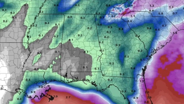
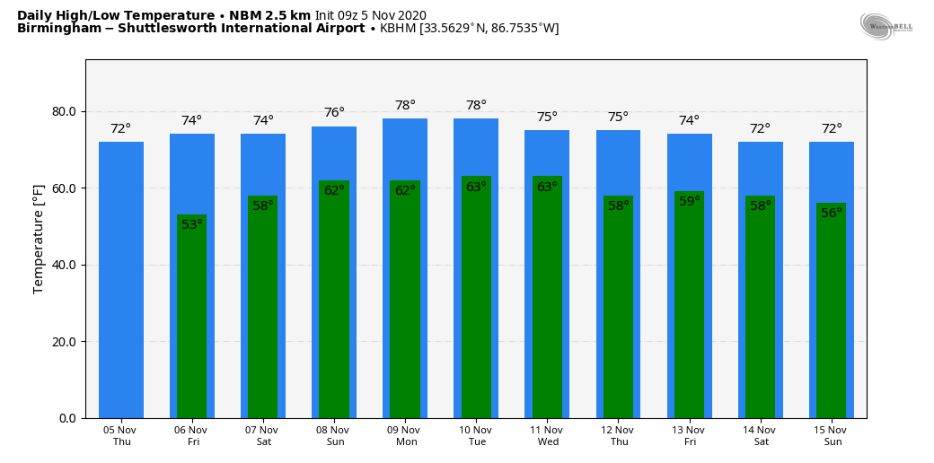
DRY THROUGH SUNDAY: A quiet weather pattern will persist across Alabama through the weekend. Expect a good supply of sunshine today and Friday, followed by a partly sunny sky Saturday and Sunday. Highs will be in the 70s, with lows in the 50s early Friday and low 60s over the weekend. A few isolated showers could show up near the Gulf Coast Saturday, but most of the state will remain dry.
NEXT WEEK: Dry, mild weather continues Monday and Tuesday; a few isolated showers could show up over the latter half of the week, but for now we are not expecting anything widespread. A decent rain event could unfold over the following weekend (Nov. 14-15) as Eta moves in from the Gulf, but considerable uncertainty remains in that scenario.
TROPICS: Eta is a tropical depression inland over Honduras this morning. It is expected to move back into the Caribbean on Friday, becoming better organized and strengthening again. The latest National Hurricane Center forecast moves the system over Cuba Sunday and to a point near Key West early next week.
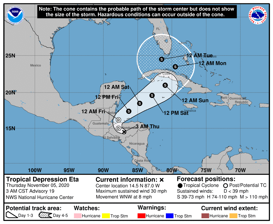
There is low confidence in the forecast, especially at three to five days; until the system gets back over the water and becomes better organized, models will have a hard time initializing the system. But there is certainly a decent chance Eta will be in the Gulf of Mexico by the middle of next week.
The rest of the Atlantic basin is quiet; the hurricane season will end at the end of this month.
RAIN UPDATE: Here are rain totals for the year so far, and the departure from average:
- Birmingham — 67.02 inches (22.06 inches above average)
- Muscle Shoals — 65.83 (22.44 above average)
- Huntsville — 63.95 (19.73 above average)
- Tuscaloosa — 60.02 (16.62 above average)
- Montgomery — 59.58 (15.48 above average)
- Anniston — 54.72 (13.23 above average)
- Mobile — 51.89 (4.73 below average)
ON THIS DATE IN 1894: A significant snowstorm affected New England on Nov. 5-6. It formed off the New Jersey coast and passed east of Connecticut with rapidly increasing heavy rain and snow, along with high winds. This caused significant damage to trees and brought down telegraph poles by the hundreds. The telegraph and telephone service in all southern New England was crippled, and fallen poles and trees delayed railroad trains.
BEACH FORECAST: Click here to see the AlabamaWx Beach Forecast Center page.
WEATHER BRAINS: You can listen to our weekly 90-minute show anytime on your favorite podcast app. This is the show all about weather featuring many familiar voices, including the meteorologists at ABC 33/40.
CONNECT: You can find me on the major social networks:
Facebook
Twitter
Instagram
Pinterest
Snapchat: spannwx
For more weather news and information from James Spann and his team, visit AlabamaWx.