James Spann: Rain returns to Alabama Thursday
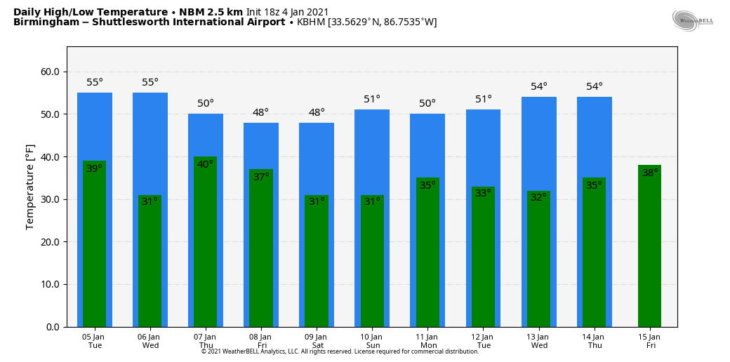
PLEASANT WINTER DAY: The sky is mostly sunny across Alabama this afternoon with temperatures between 57 and 61 degrees, slightly above average for early January. Tonight will be mostly fair with a low between 37 and 42 degrees.
The weather will stay dry Tuesday and Wednesday; expect a partly to mostly sunny sky both days with highs in the mid 50s. Clouds increase Wednesday night.
RAIN RETURNS: Thursday will be cloudy with periods of rain; amounts of around one-half inch are likely. The air will be cool and stable (we could hold in the 40s all day), with no risk of severe storms and probably no thunder. The rain tapers off Thursday night, but as a deep cold-core upper low passes overhead we might have a snowflake or two somewhere over north Alabama due to dynamic cooling. But for now we expect no accumulation or impact; it will be mostly a rain event.
Friday, look for gradual clearing with a high between 48 and 53 degrees.
THE ALABAMA WEEKEND: Saturday will be a sunny day to start the weekend; after a low around 30 degrees, the high will be close to 50. On Sunday, clouds increase with a high again right at 50 degrees.
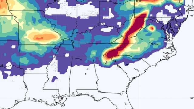
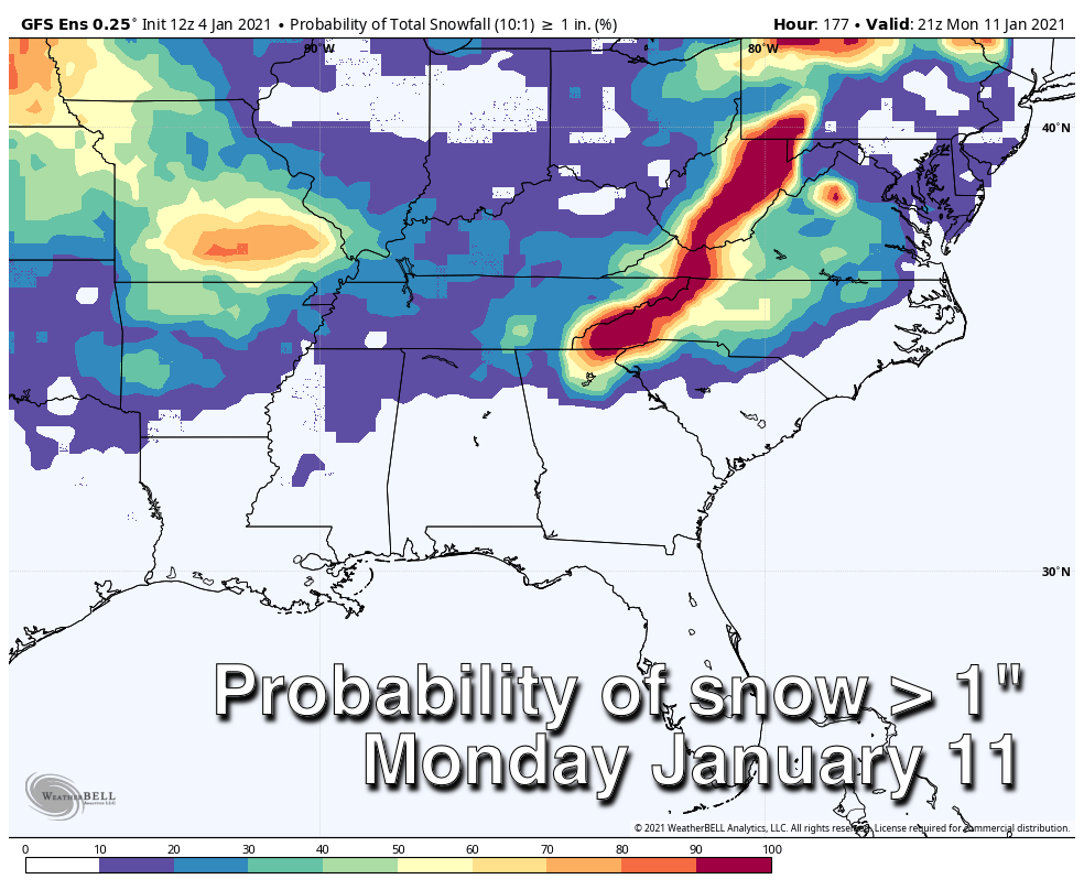
SUNDAY NIGHT AND MONDAY: You will be hearing lots of buzz about the weather Sunday night into Monday morning across the Deep South as the new 12Z model set today has come in colder, suggesting potential for snow over the northern third of Mississippi and Alabama. However, using ensemble model output and probabilistic outlooks, snow fans don’t need to get too excited just yet. Both the American Global Forecast System and the European ECMWF ensembles are showing only a 10-20% chance of 1 inch or more of snow with this event for now.
It is too early to know whether there will be any significant winter weather with this system; just something to watch. A cold rain is likely for most of the state with amounts around one-half inch. We will have much better clarity, of course, as we get closer.
REST OF NEXT WEEK: The weather looks dry and cool Tuesday and Wednesday; more rain arrives with the next wave by Thursday and Friday.
ON THIS DATE IN 1917: A tornado with estimated F-3 damage cut a 15-mile path and struck a school at Vireton in Pittsburg County, Oklahoma, killing 16 people. It ranks as the fourth-worst school tornado disaster in U.S. history. Ahead of that storm system, very warm air surged into the Southeast. Birmingham’s high on Jan. 4, 1917, was 75 degrees, a record for the date that still stands.
BEACH FORECAST: Click here to see the AlabamaWx Beach Forecast Center page.
WEATHER BRAINS: You can listen to our weekly 90-minute show any time on your favorite podcast app. This is the show all about weather featuring many familiar voices, including the meteorologists at ABC 33/40.
CONNECT: You can find me on the major social networks:
For more weather news and information from James Spann and his team, visit AlabamaWx.com.


