James Spann: Rain returns to Alabama Saturday night into Sunday morning
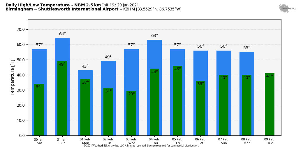
PLEASANT WINTER DAY: With a mostly sunny sky, temperatures are generally in the low to mid 50s this afternoon over the northern half of the state, with low 60s for south Alabama. Tonight will be mostly fair with a low between 26 and 34 degrees.
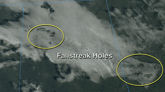
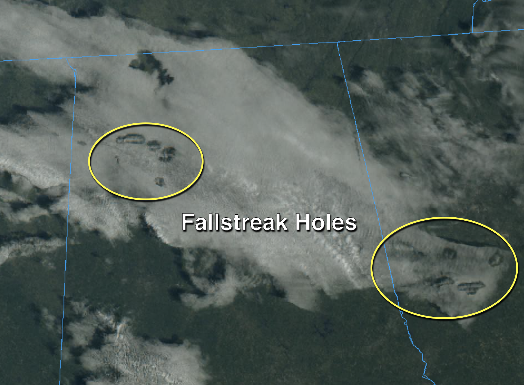
Some enjoyed seeing fallstreak holes over Alabama this morning. They are also known as a “hole punch cloud,” an elliptical gap that can appear in altocumulus or cirrocumulus clouds when the supercooled water droplets abruptly freeze. These ice crystals then fall and leave a hole behind. The process is often initiated by a passing aircraft.
THE ALABAMA WEEKEND: After a sunny start, clouds increase during the day across Alabama Saturday, and rain will push into the state Saturday night. The main window for rain will come from about midnight through noon Sunday; amounts of one-half inch or less are expected. There is no surface-based instability, so no risk of severe storms and probably very little thunder. The high will be between 56 and 61 degrees Saturday, and mid 60s are likely Sunday.
NEXT WEEK: Much colder air drops into the state Monday; some communities across the Tennessee Valley of far north Alabama could hold in the 30s all day; the high will be in the 40s elsewhere with a mix of sun and clouds and a chilly north wind. We are dry Tuesday and Wednesday with a warming trend; the high will be around 50 Tuesday, followed by upper 50s Wednesday. Rain returns Thursday night and Friday; for now it doesn’t look like a severe weather setup, with no instability.
ON THIS DATE IN 1921: A small but intense windstorm resulted in the “Great Olympic Blowdown” in the Pacific Northwest. Hurricane-force winds, funneled along the mountains, downed vast expanses of Douglas fir trees, and the storm destroyed 8 billion board feet of timber. Winds at North Head, Washington, gusted to 113 mph. On Jan. 31, 1921, the International News Services reported from Aberdeen, Washington, “It is reported that thousands of dollars in damage was done to buildings and storms in Aberdeen and Hoquiam. The wind velocity was estimated at from 125 to 150 miles an hour. Four steel smokestacks reaching almost 200 feet into the air were the first to collapse before the terrific onslaught of the gale. The giant chimneys crashed down on dwellings, crushing them like houses of cardboard.”
ON THIS DATE IN 1966: This was a bitter cold day across Alabama in which 7.2 inches of snow fell in Huntsville. The morning temperature at Huntsville was 3 degrees below zero. Birmingham’s low was 2 degrees above zero. Mobile’s low that morning was 19. Temperatures the following morning would be even colder.
BEACH FORECAST: Click here to see the AlabamaWx Beach Forecast Center page.
WEATHER BRAINS: You can listen to our weekly 90-minute show anytime on your favorite podcast app. This is the show all about weather featuring many familiar voices, including the meteorologists at ABC 33/40.
CONNECT: You can find me on the major social networks:
For more weather news and information from James Spann and his team, visit AlabamaWx.


