James Spann: Alabama stays dry through Wednesday with warm afternoons
James Spann forecasts some of Alabama’s warmest days so far this year from Alabama NewsCenter on Vimeo.
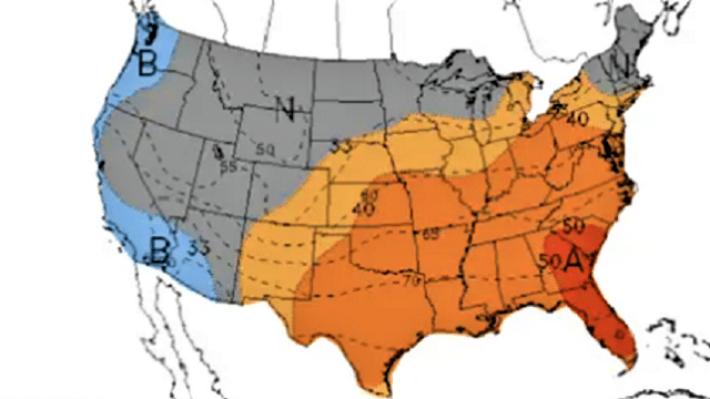
WARMING TREND: An upper ridge will keep Alabama dry through Wednesday, and the warming trend continues. We project a high around 80 degrees today, followed by mid 80s Tuesday and Wednesday. Clouds will increase Thursday, and our next chance of rain will come late Thursday afternoon, Thursday night and into Friday morning as a cold front passes through the state. At this time we aren’t expecting any severe weather with the main dynamic forcing passing to the north and limited instability.
Rain amounts for most of the state will be around 1 inch, and the rain will end from northwest to southeast during the day Friday. Friday will be cooler following the frontal passage, with highs back in the low 70s.
THE ALABAMA WEEKEND: A very dry air mass will be in place and the weather will be beautiful, with sunny days and fair nights. The high will be in the mid 70s Saturday, followed by low 80s Sunday.
NEXT WEEK: Moisture will increase a bit by Monday with some risk of widely scattered showers, but the best chance of rain next week will come in the Wednesday/Thursday time frame with another cold front. 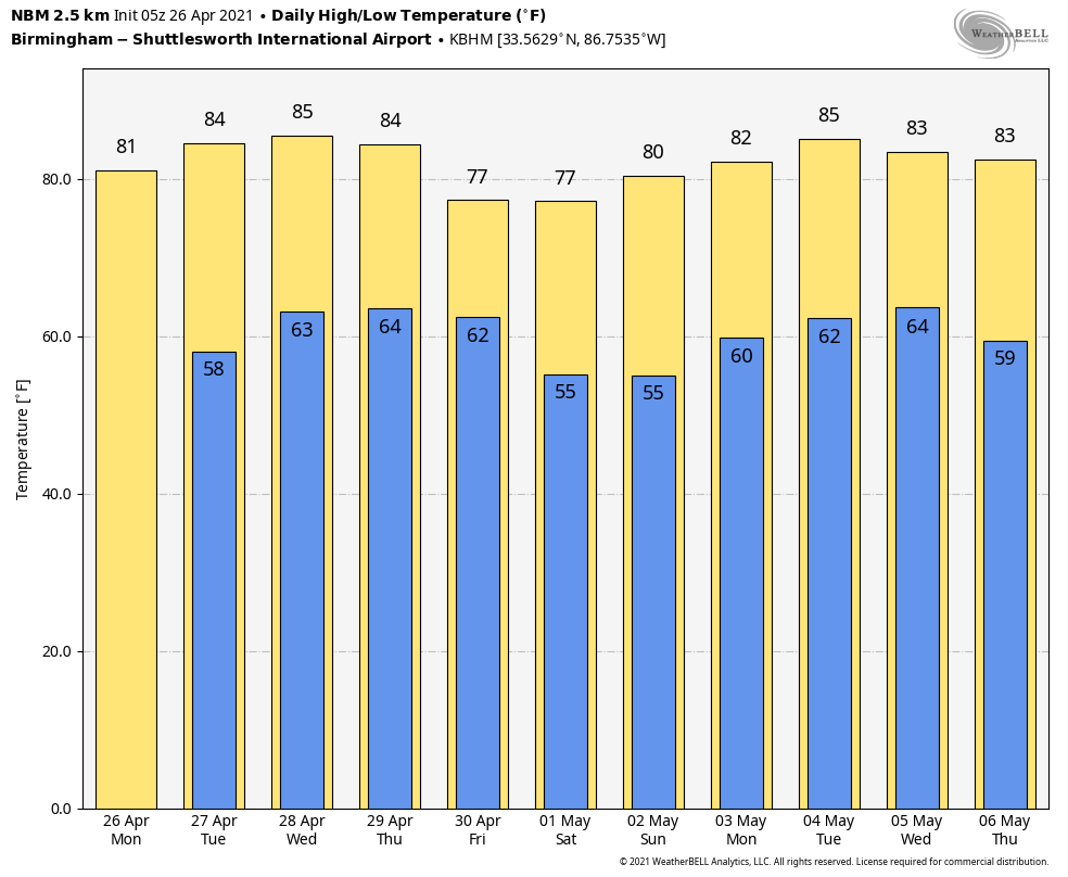
RAIN UPDATE: Here are rain totals since Jan. 1, and the departure from average:
- Mobile — 23.4 inches (2.46 inches above average)
- Muscle Shoals — 22.83 inches (5.18 inches above average)
- Huntsville — 21.88 inches (3.37 inches above average)
- Birmingham — 21.12 inches (2.86 inches above average)
- Tuscaloosa — 19.82 inches (1.07 inches above average)
- Montgomery — 17.98 inches (1.37 inches below average)
- Anniston — 10.88 inches (7.11 inches below average)
ON THIS DATE 10 YEARS AGO: The second day of the 2011 Super Outbreak was underway. From April 25 to April 28, 2011, more than 175 tornadoes struck Alabama, Mississippi and Tennessee, the most severely damaged states. Other destructive tornadoes occurred in Arkansas, Georgia, Kentucky, Louisiana, New York and Virginia, with storms also affecting other states in the southern and eastern United States.
Alabama’s encounter with tornadoes during this event would be one day later, on April 27. I wrote this on the afternoon blog discussion April 26: “All of the synoptic elements for a major outbreak are in place. A deep (sub-1,000 mb) low west of Memphis, steep lapse rates, strong veering of the wind with altitude in respect to projected storm motion, strong wind fields at the surface and aloft, dry air in the mid levels, and a very deep, long-wave upper trough that is somewhat negatively tilted, enhancing diffluence aloft over Alabama.”
BEACH FORECAST: Click here to see the AlabamaWx Beach Forecast Center page.
WEATHER BRAINS: You can listen to our weekly 90-minute show any time on your favorite podcast app. This is the show all about weather featuring many familiar voices, including the meteorologists at ABC 33/40.
CONNECT: You can find me on the major social networks:
For more weather news and information from James Spann and his team, visit AlabamaWx.


