James Spann: Warmer days ahead for Alabama, showers Thursday night
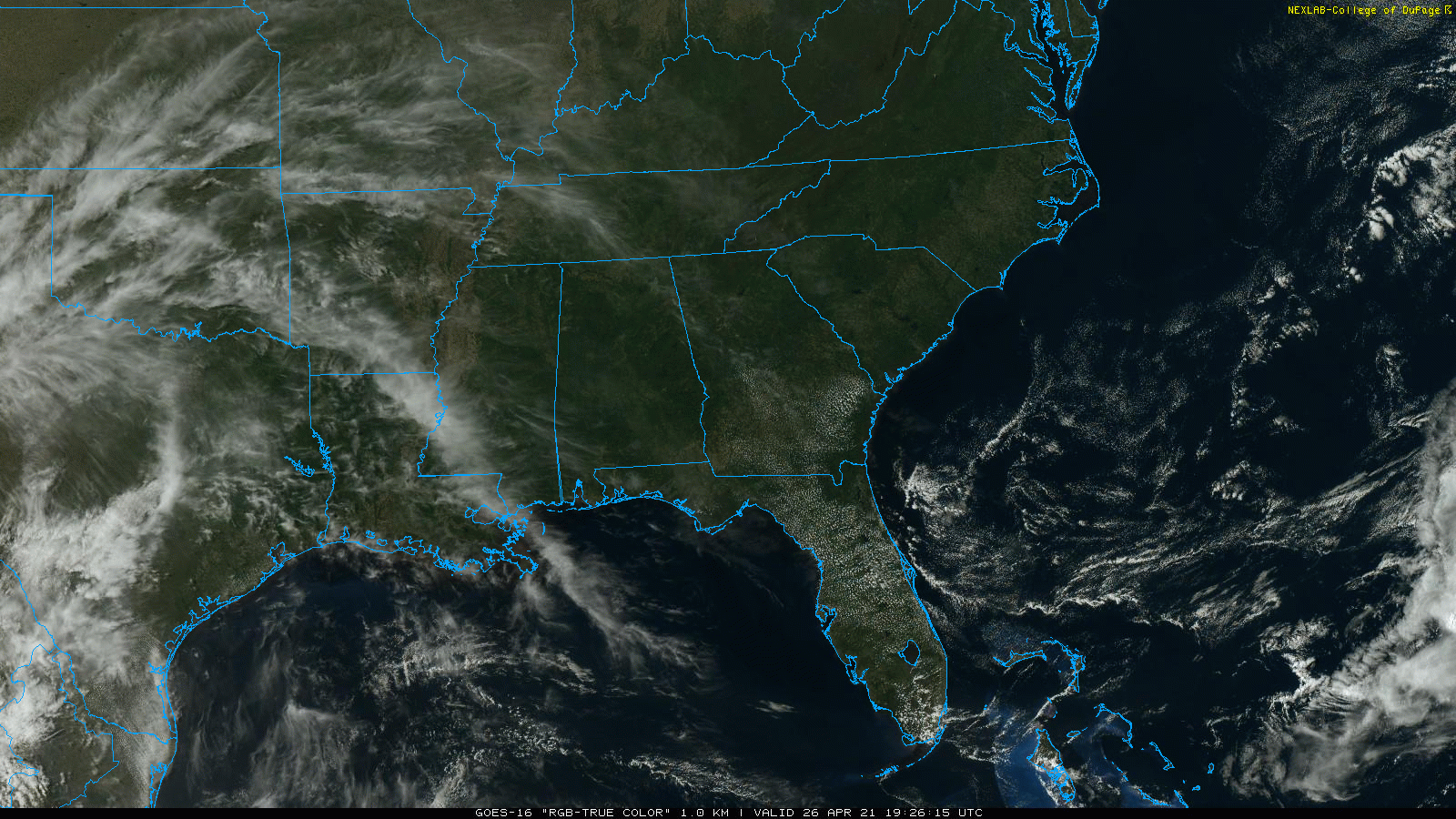
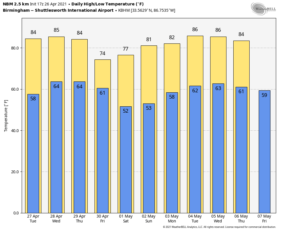
SPECTACULAR SPRING DAY: With sunshine in full supply, temperatures are between 77 and 81 degrees across most of Alabama this afternoon. Tonight will be clear with lows in the upper 50s and low 60s.
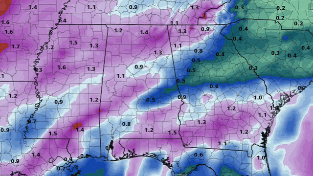
 The weather will be dry and warm Tuesday and Wednesday. Look for a partly to mostly sunny sky both days with highs between 82 and 85 degrees. Clouds will increase Thursday ahead of a cold front, and we will bring in a chance of showers and thunderstorms late in the day and into Thursday night. For now the severe weather potential looks low, with the main dynamic forcing passing well to the north and limited instability. Rain should end over the northern half of the state by midday Friday, with showers possibly lingering over south Alabama through Friday night.
Rain amounts will be between one-half and 1 inch. Friday will be cooler, with a high between 67 and 71 degrees. Friday night will be fairly chilly for late April; temperatures drop into the 37- to 44-degree range by daybreak Saturday.
THE ALABAMA WEEKEND: Look for sunshine in full supply both days thanks to a very dry air mass. The high will be in the low 70s Saturday and close to 80 degrees Sunday afternoon.
NEXT WEEK: The weather looks warm and dry Monday and Tuesday. We are seeing evidence for a chance of showers late Wednesday, Wednesday night or Thursday morning, but for now it doesn’t look like a major rain event.
ON THIS DATE 10 YEARS AGO: The second day of the 2011 Super Outbreak was underway. From April 25 to April 28, 2011, more than 175 tornadoes struck Alabama, Mississippi and Tennessee, the most severely damaged states. Other destructive tornadoes occurred in Arkansas, Georgia, Kentucky, Louisiana, New York and Virginia, with storms also affecting other states in the southern and eastern United States.
Alabama’s encounter with tornadoes during this event would be one day later, on April 27. I wrote this on the afternoon blog discussion April 26: “All of the synoptic elements for a major outbreak are in place. A deep (sub-1,000 mb) low west of Memphis, steep lapse rates, strong veering of the wind with altitude in respect to projected storm motion, strong wind fields at the surface and aloft, dry air in the mid levels, and a very deep, long-wave upper trough that is somewhat negatively tilted, enhancing diffluence aloft over Alabama.”
BEACH FORECAST: Click here to see the AlabamaWx Beach Forecast Center page.
WEATHER BRAINS: You can listen to our weekly 90-minute show any time on your favorite podcast app. This is the show all about weather featuring many familiar voices, including the meteorologists at ABC 33/40.
CONNECT: You can find me on the major social networks:
For more weather news and information from James Spann and his team, visit AlabamaWx.


