James Spann: Showers, a few strong storms for Alabama tonight; dry Friday
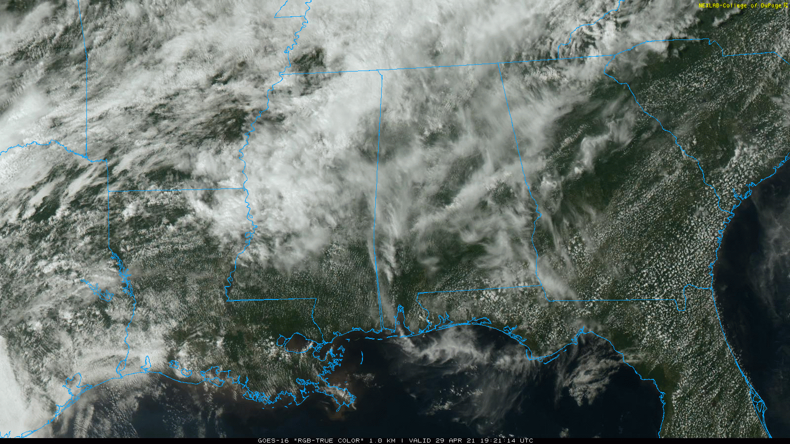
RADAR CHECK: Most of Alabama is rain-free this afternoon; a batch of rain and a few thunderstorms moved across the Tennessee Valley over far north Alabama earlier in the day. The sky is mostly cloudy with temperatures generally in the upper 70s and low 80s.
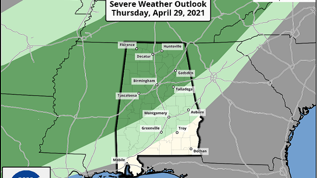
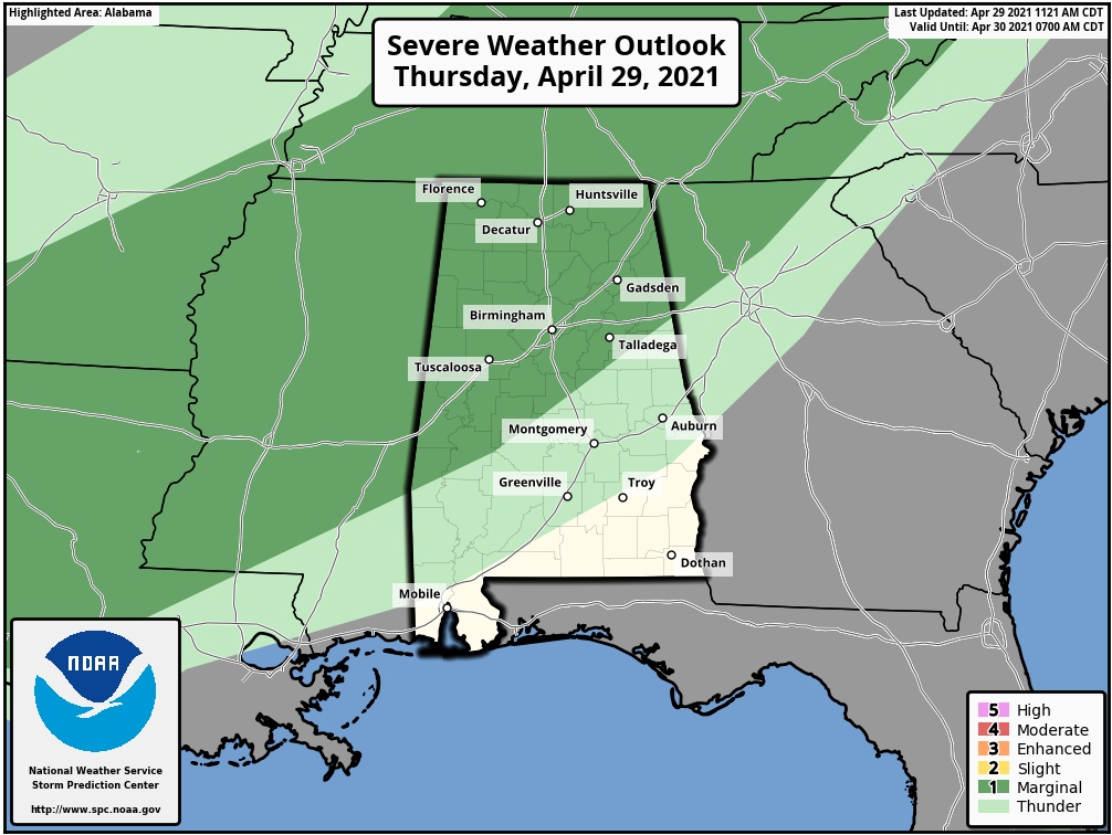
A cold front will push a band of showers and thunderstorms into north Alabama this evening. A few of the storms could be strong with gusty winds and small hail, but the overall threat is low. The Storm Prediction Center maintains a marginal risk (level 1 out of 5) of severe thunderstorms for Alabama north of a line from Linden to Clanton to Heflin.
The main window for the heavier storms will come from about 6 p.m. until midnight. Showers will weaken as they drift into the southern half of the state after midnight.
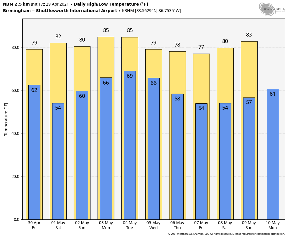
FRIDAY AND THE WEEKEND: Friday will be dry for most of the state with a good supply of sunshine. The exception is the southwest corner, where a few scattered showers are possible. The high will be in the upper 70s. Saturday promises to be very nice, with ample sunshine and a high around 80 degrees.
Moist air returns Sunday and we will bring in a chance of showers and thunderstorms by afternoon. We are forecasting a high between 75 and 80 degrees.
NEXT WEEK: The weather looks unsettled Monday through Thursday; we will have some risk of showers and storms daily. Higher rain chances will come during the afternoon and evening hours, and a few strong, possibly severe thunderstorms could develop along the way. It’s too early to define any specific window for the heavier storms. Drier air will arrive Friday. Rain amounts during the week will be 2-3 inches.
ON THIS DATE IN 1910: The temperature at Kansas City, Missouri, soared to 95 degrees to establish a record for April. Four days earlier the afternoon high in Kansas City was 44 degrees following a record cold morning low of 34 degrees.
ON THIS DATE IN 1991: Southeast Bangladesh was devastated by a tropical cyclone with sustained winds of approximately 155 mph late in the night. A 20-foot storm surge inundated the offshore islands south of Chittagong and pushed water from the Bay of Bengal inland for miles. Best estimates put the loss of life from this cyclone between 135,000 and 145,000 people.
BEACH FORECAST: Click here to see the AlabamaWx Beach Forecast Center page.
WEATHER BRAINS: You can listen to our weekly 90-minute show any time on your favorite podcast app. This is the show all about weather featuring many familiar voices, including the meteorologists at ABC 33/40.
CONNECT: You can find me on the major social networks:
For more weather news and information from James Spann and his team, visit AlabamaWx.


