James Spann: Most of Alabama dry through Friday, with pleasant nights
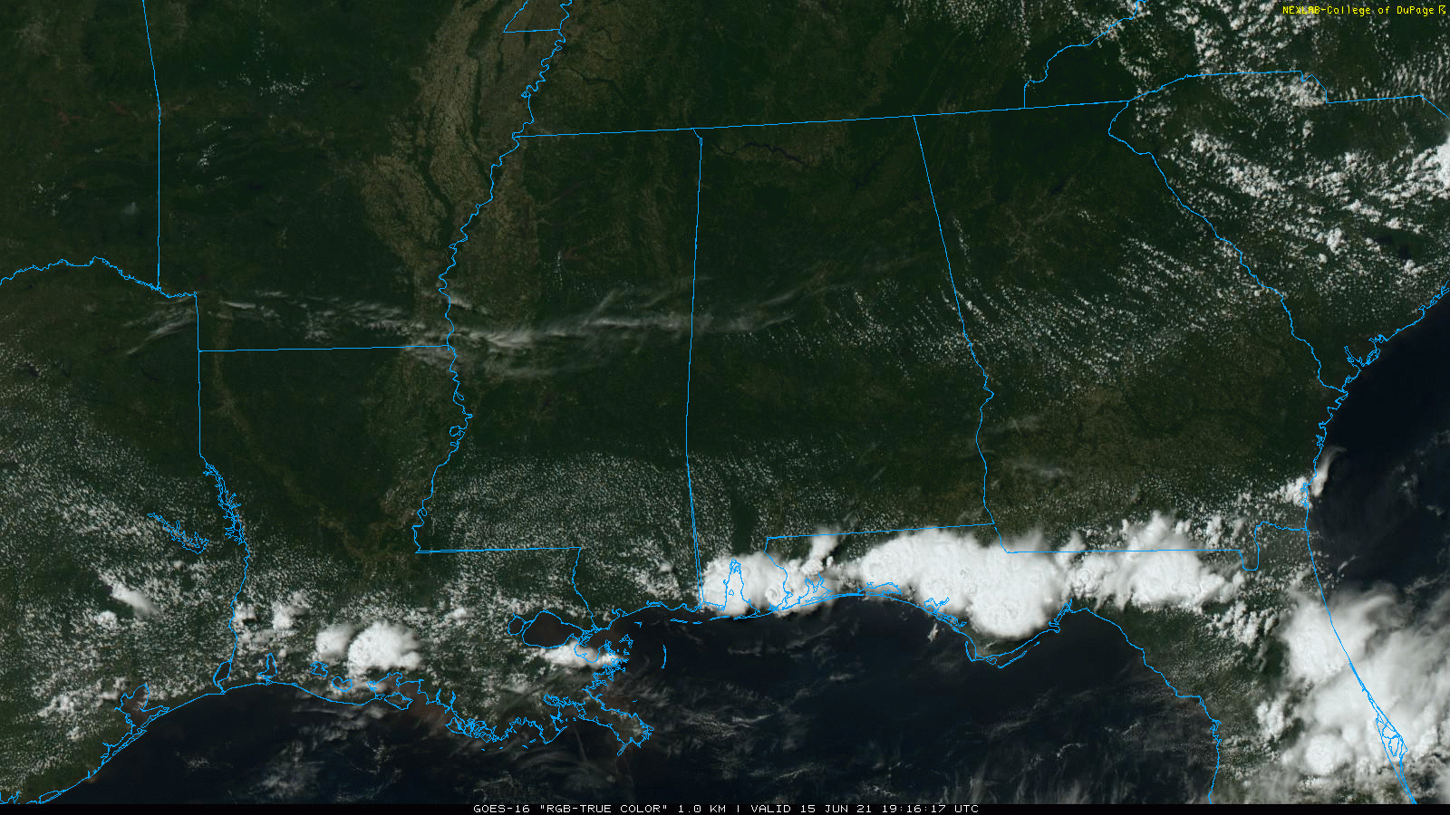
RADAR CHECK: Most of Alabama is dry this afternoon; we do note a band of strong to severe thunderstorms along the Gulf Coast from Dauphin Island to Panama City Beach. These storms are moving southward and should be off the coast soon. Tonight will be mostly fair and very pleasant, with lows mostly between 60 and 65 degrees, but cooler spots over the northern half of the state will dip into the 50s.
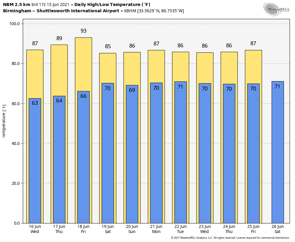
The weather will stay dry Wednesday through Friday for most of the state with mostly sunny days and fair nights; highs will be between 85 and 89 degrees for most communities. A few showers could reach southwest Alabama Friday ahead of a tropical low in the western Gulf of Mexico.
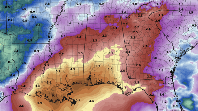
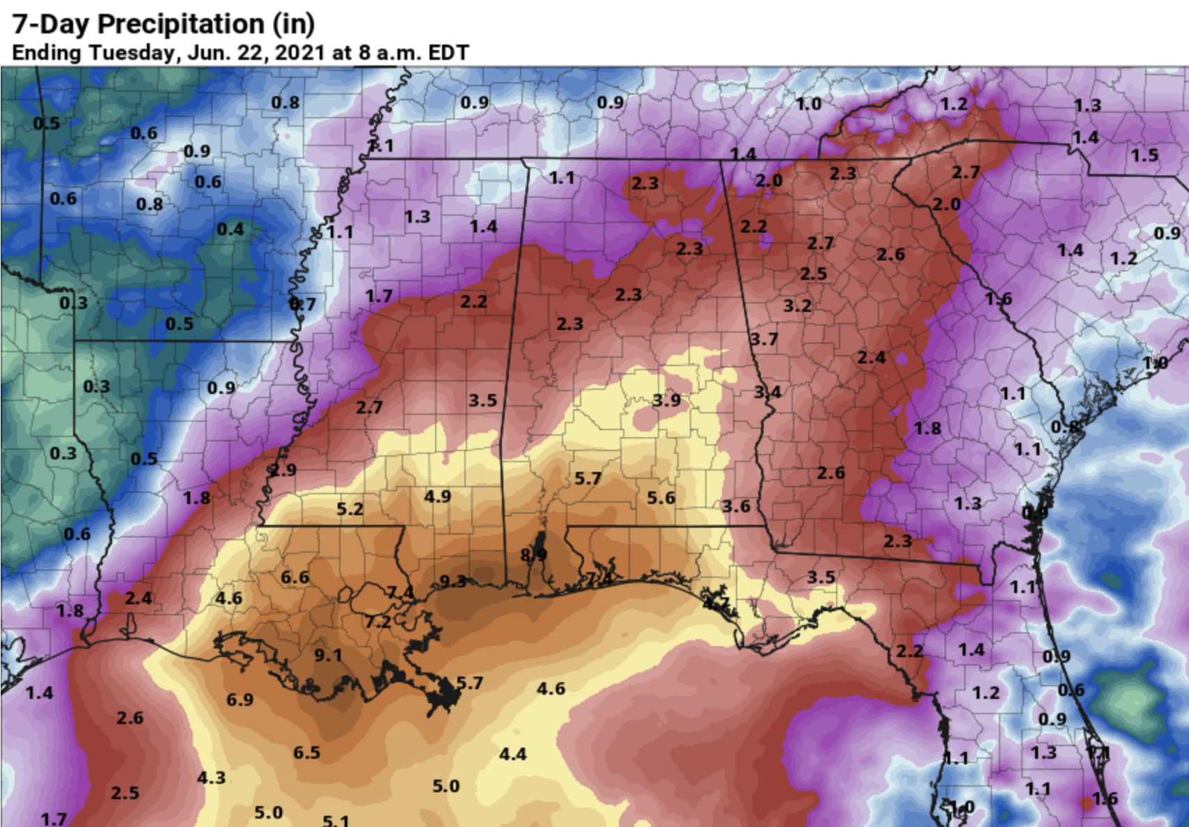
THE ALABAMA WEEKEND: Wet weather returns as the tropical low moves toward the western Louisiana coast. Some rain is possible during the day Saturday; rain should be fairly widespread statewide Saturday night into Sunday. Amounts could be heavy at times, especially over the southern half of the state. Highs over the weekend will be between 78 and 83 degrees.
NEXT WEEK: Scattered to numerous showers and storms remain likely Monday and Tuesday, becoming more scattered Wednesday through Friday. The week will be warm and humid, with highs in the mid to upper 80s most days, right at seasonal averages for mid-June in Alabama.
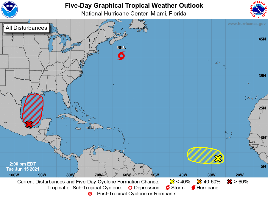
TROPICS: A tropical depression is expected to form in the southwest Gulf of Mexico during the next 72 hours. This broad low will move in the general direction of the Louisiana coast by Friday, and will bring potential for heavy rain and dangerous rip currents to the Gulf Coast from Galveston to the Florida Panhandle by Friday night and the weekend. Parts of the Gulf Coast could receive 4-8 inches of rain Friday through Monday.
Elsewhere, Tropical Storm Bill, well east of the upper U.S. Atlantic coast, will become post-tropical as it gains latitude tonight. In the eastern Atlantic, shower activity is limited in association with a tropical wave a few hundred miles south-southwest of the Cabo Verde Islands. Development, if any, should be slow to occur during the next couple of days while the wave moves westward. Thereafter, a combination of dry air aloft and strong upper-level winds should end the chances of formation when the wave reaches the central tropical Atlantic.
ON THIS DATE IN 1991: The second-largest volcanic eruption of the 20th century began as Mount Pinatubo injected 15 to 30 million tons of sulfur dioxide 100,000 feet into the atmosphere. As a result of the eruptions, 343 people were killed in the Philippines and 200,000 were left homeless. Material from the explosion would spread around the globe, leading to climate changes worldwide as the sun’s energy was blocked out and global temperatures cooled by as much as one degree Fahrenheit. Globally, 1992 was one of the coldest years since the 1970s.
BEACH FORECAST: Click here to see the AlabamaWx Beach Forecast Center page.
WEATHER BRAINS: You can listen to our weekly 90-minute show any time on your favorite podcast app. This is the show all about weather featuring many familiar voices, including the meteorologists at ABC 33/40.
CONNECT: You can find me on the major social networks:
For more weather news and information from James Spann and his team, visit AlabamaWx.


