James Spann: Tropical moisture arrives Tuesday for north Alabama
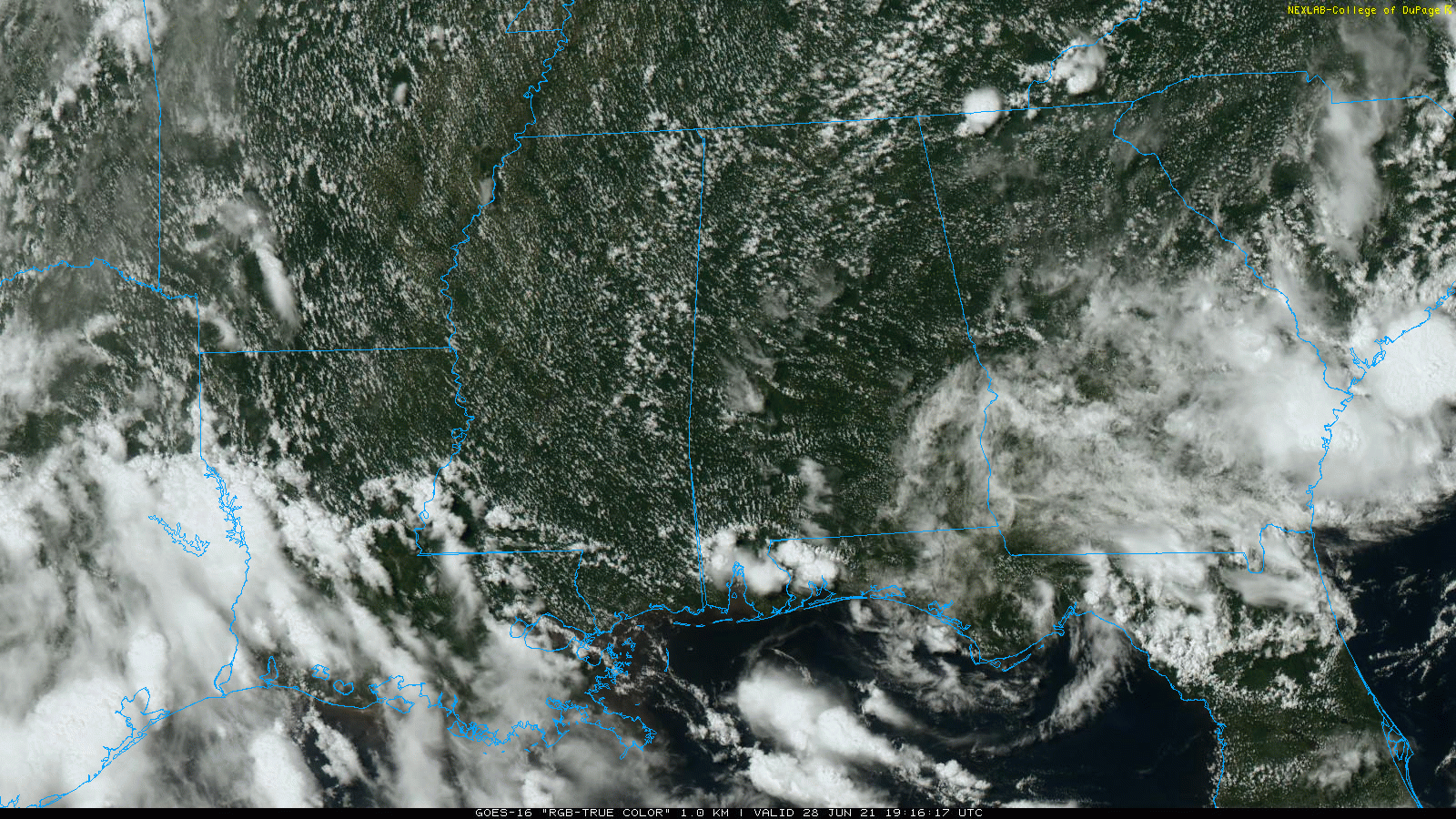
RADAR CHECK: As expected, showers are few and far between across Alabama this afternoon. The sky is partly to mostly sunny with temperatures mostly in the upper 80s. The small, isolated showers will dissipate after sunset.
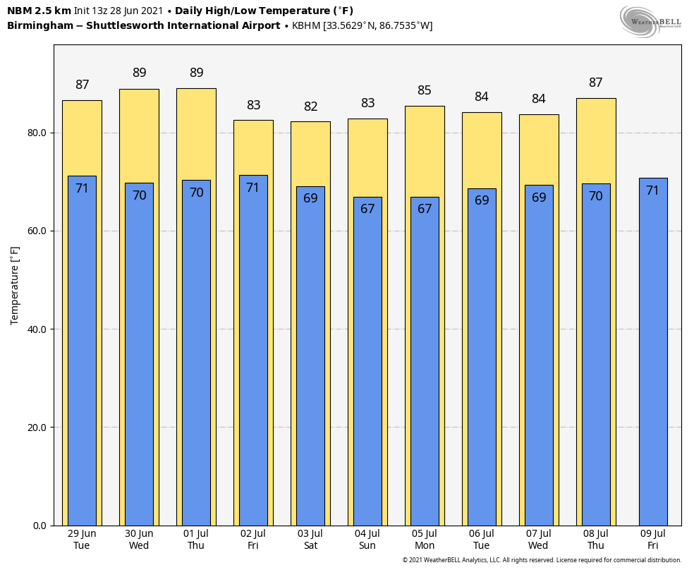
TUESDAY: Tropical moisture will increase over the northern half of the state from what is now Tropical Storm Danny, moving onto the South Carolina coast. Coverage of showers and storms will be higher, especially over the northeast quarter of Alabama. Still, it won’t rain everywhere, and much of west and south Alabama will see only isolated showers. We don’t expect any flooding, and winds will remain light across the state despite the tropical trough passing just north of here. The high will be in the mid 80s for most places.
WEDNESDAY/THURSDAY: These two days should feature rather typical summer weather — partly sunny days with a few random, scattered afternoon and evening pop-up showers and thunderstorms. Highs will be between 84 and 88 degrees. The chance of any one spot getting wet will be 25-35%.
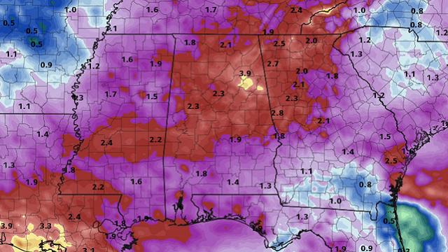
FRIDAY AND THE HOLIDAY WEEKEND: Global models continue to show a surface front stalling out just north of the state on these three days. With high precipitable water values in place, we are looking at occasional showers and storms Friday and over the weekend with only a limited amount of sun. Of course, there will be some good breaks in the rain, but the overall pattern looks pretty unsettled. Highs will be between 79 and 83 degrees, and rain amounts over the weekend will average 2 inches for most communities. The greatest coverage of rain over the holiday weekend will be over the northern two-thirds of Alabama.
NEXT WEEK: We’re seeing some evidence drier air will creep into north Alabama Monday; then the front washes out and the week looks fairly routine for early July, but with temperatures below average. Expect some risk of scattered, mostly afternoon and evening showers and thunderstorms each day with a mix of sun and clouds; highs will be in the 80s.
TD 4 BECOMES TROPICAL STORM DANNY: Doppler radar data from Charleston, South Carolina, along with preliminary data from an Air Force Reserve reconnaissance aircraft, indicate that the depression has strengthened and is now Tropical Storm Danny. The maximum sustained winds are estimated to be 40 mph with higher gusts. A Weatherflow station at Folly Beach, South Carolina, recently reported a wind gust of 41 mph.
The remnant circulation will move to a point near Chattanooga Tuesday night; the main impact inland will be enhanced rain chances.
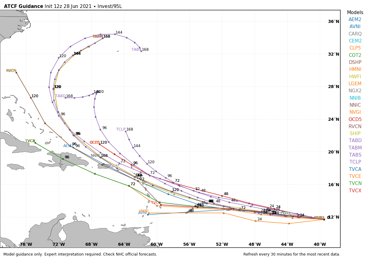
Out in the central Atlantic, a tropical wave is producing disorganized showers and a few thunderstorms. Some slow development of this disturbance is possible after the middle of the week while the system moves westward to west-northwestward at 15 to 20 mph, likely reaching the Lesser Antilles by Wednesday night. The chance of development over the next five days is now 40%.
The Gulf of Mexico remains quiet this week.
ON THIS DATE IN 1924: An estimated F4 tornado struck the towns of Sandusky and Lorain, Ohio, killing 85 people and injuring more than 300. This tornado is the deadliest ever in Ohio history.
ON THIS DATE IN 1975: Lightning struck Lee Trevino and two other golfers at the Western Open golf tournament in Oak Brook, Illinois.
BEACH FORECAST: Click here to see the AlabamaWx Beach Forecast Center page.
WEATHER BRAINS: You can listen to our weekly 90-minute show any time on your favorite podcast app. This is the show all about weather featuring many familiar voices, including the meteorologists at ABC 33/40.
CONNECT: You can find me on the major social networks:
For more weather news and information from James Spann and his team, visit AlabamaWx.


