James Spann: Wet Friday ahead for Alabama, then a beautiful weekend

RADAR CHECK: In the warm, humid air mass across Alabama we have developing showers and thunderstorms in scattered spots this afternoon. Some of the heaviest rain at mid-afternoon was over the northwest part of the state; showers will continue to develop tonight as a cold front approaches from the north. Temperatures remain below average today, mostly in the mid 80s.
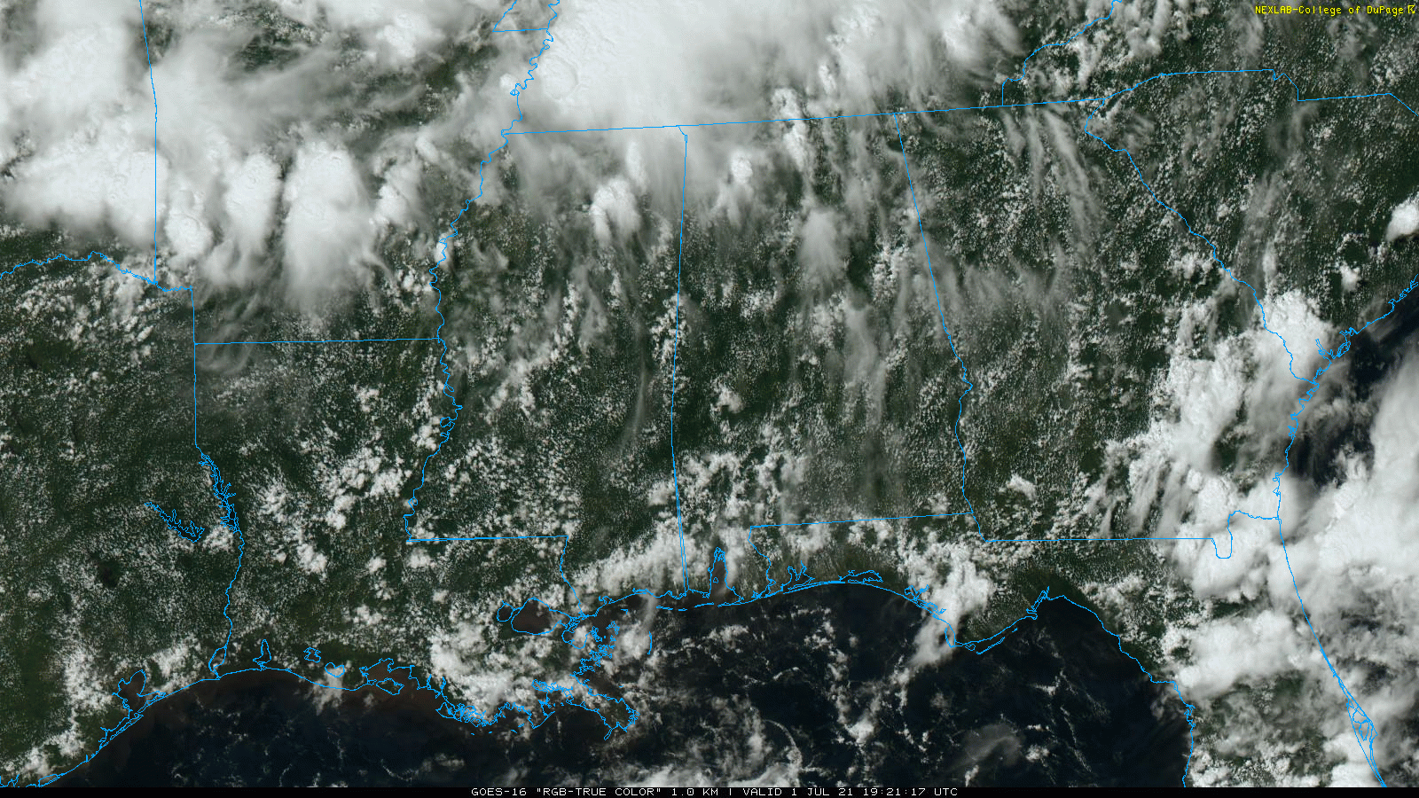
Friday will be relatively wet as a rare July cold front approaches from the north. Expect a mostly cloudy sky with occasional showers and thunderstorms; temperatures most likely won’t get out of the 70s with only a very limited amount of sunshine. Rain amounts will be around 1 inch between now and Friday night.
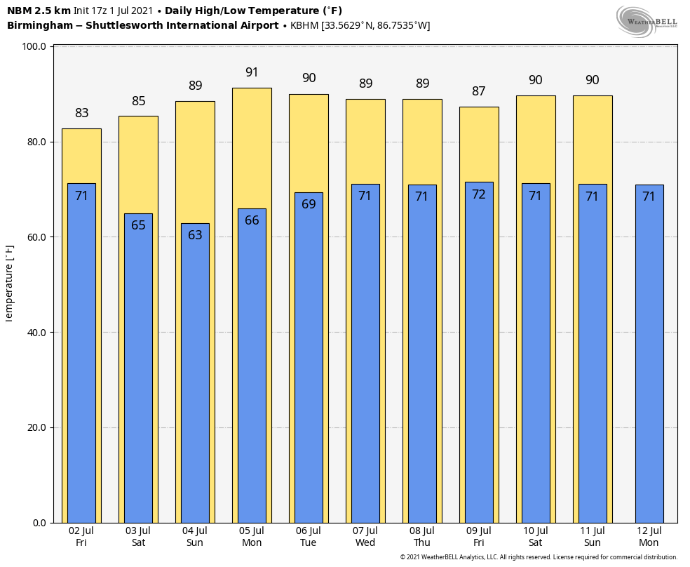
FOURTH OF JULY WEEKEND: Dry air begins to roll into north and central Alabama late Friday night, and that will set the stage for a very pleasant holiday weekend. For the northern two-thirds of the state, we expect mostly sunny days, cooler nights and lower humidity levels Saturday through Monday. Highs will be in the 80s; cooler spots could reach the 50s early Sunday morning, amazingly comfortable for early July in Alabama.
We should mention that a few scattered showers and storms are possible over the three-day weekend across extreme south Alabama and along the Gulf Coast, but even there it won’t be a washout, and the sun will be out at times.
REST OF NEXT WEEK: Moisture begins to return during midweek, and we will mention a chance of scattered showers and storms statewide Tuesday through Friday with a mix of sun and clouds and rising humidity. We will keep an eye on Tropical Storm Elsa; for the moment it looks like the main impact from that system will stay east of Alabama, but there is still considerable uncertainty. Highs during the week will be mostly between 86 and 90.
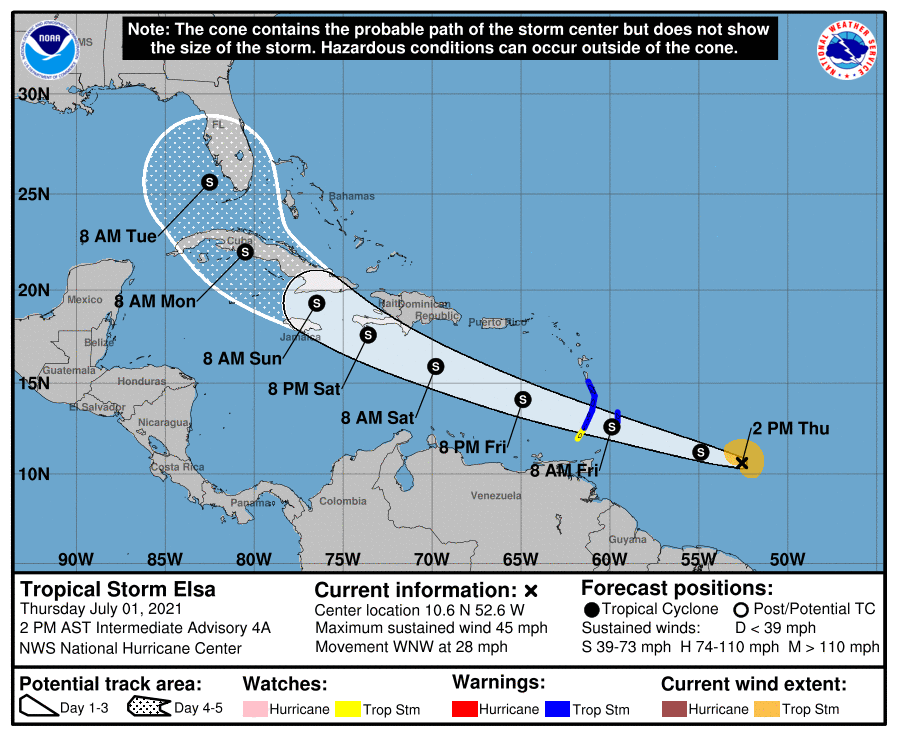
TROPICAL STORM ELSA: Elsa this afternoon is about 600 miles east/southeast of the Windward Islands in the Atlantic, with estimated winds of 45 mph. There’s no major change in the track forecast from the National Hurricane Center; Elsa moves through the Caribbean Friday and Saturday, and reaches the far southeast Gulf of Mexico Monday. The position Monday night is forecast to be just west of Fort Myers, Florida.
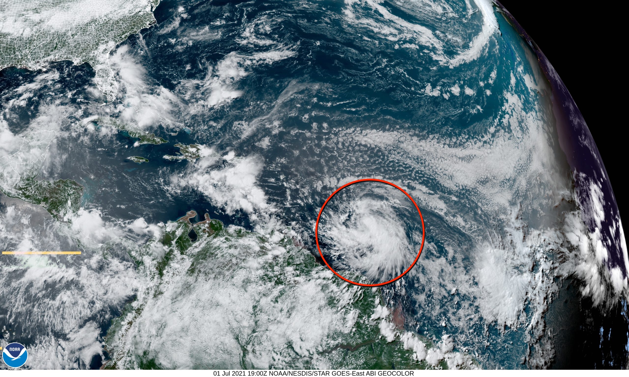
It is important to note that this forecast can and probably will change over the next few days. It remains to be seen what impact Elsa will have on Florida or the Southeast, but it needs to be watched closely.
The NHC keeps Elsa under hurricane strength over the next five days because of the fast forward motion of the system and its potential interaction with land and unfavorable upper-air winds.
The rest of the Atlantic basin is quiet.
ON THIS DATE IN 2002: San Antonio, Texas, recorded 9.52 inches of rain to set a new record for its greatest rainfall for the entire month of July.
BEACH FORECAST: Click here to see the AlabamaWx Beach Forecast Center page.
WEATHER BRAINS: You can listen to our weekly 90-minute show any time on your favorite podcast app. This is the show all about weather featuring many familiar voices, including the meteorologists at ABC 33/40.
CONNECT: You can find me on the major social networks:
For more weather news and information from James Spann and his team, visit AlabamaWx.


