James Spann: Storms in Alabama remain widely scattered Thursday
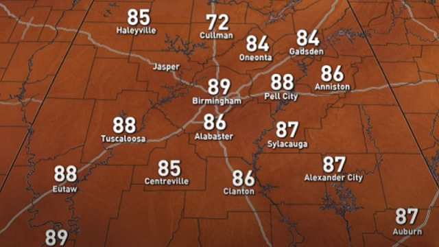
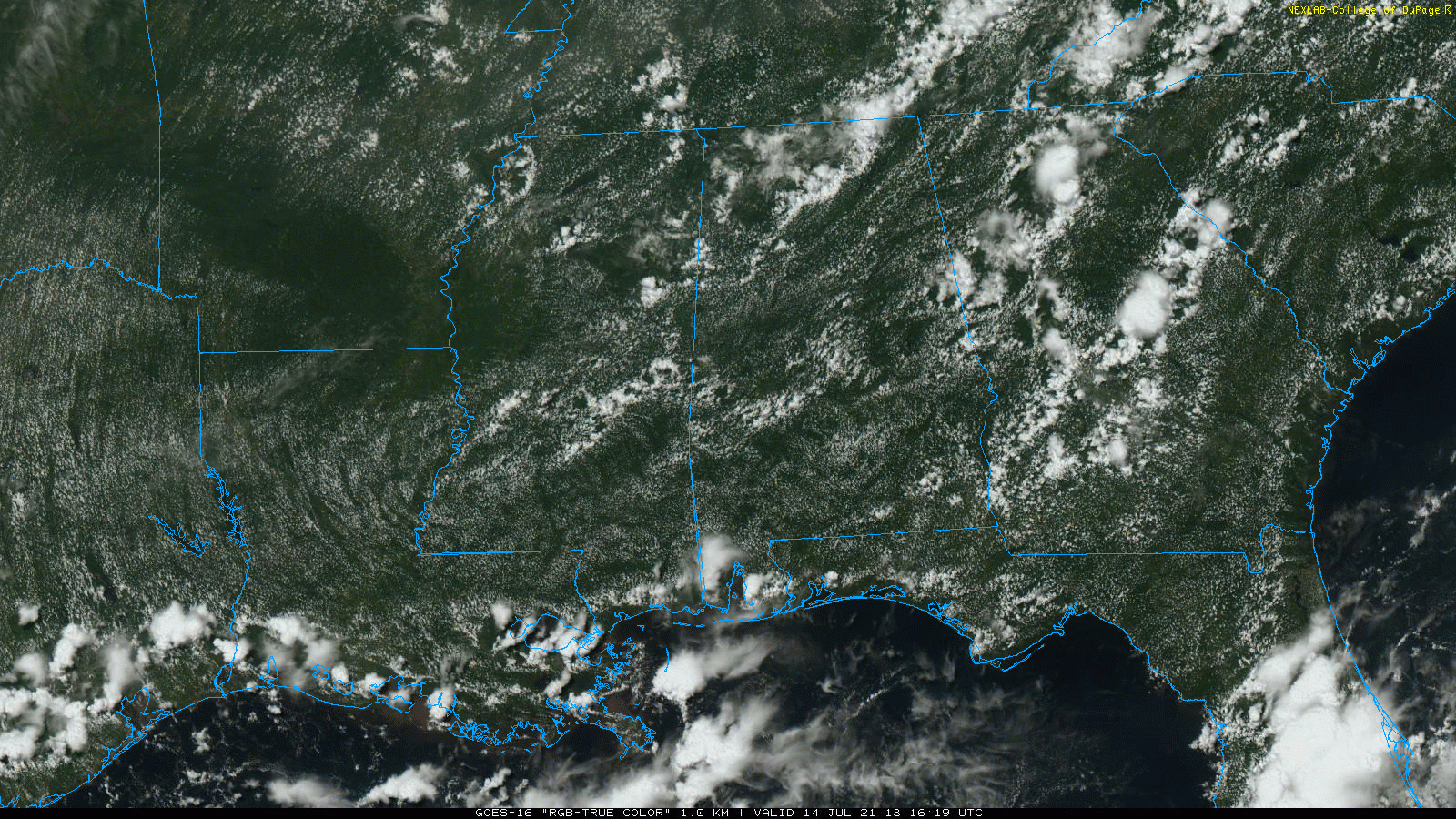
RADAR CHECK: As advertised, showers and storms are fewer in number across Alabama today. The sky is partly sunny statewide with temperatures generally between 86 and 90 degrees. Widely scattered showers and storms will end soon after sunset, and the sky will be mostly fair late tonight.
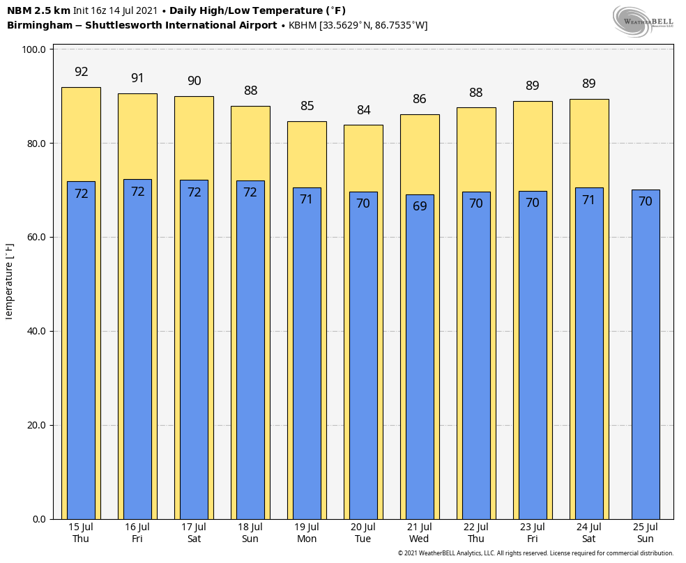
The weather won’t change much Thursday — partly sunny with just a few widely scattered showers and storms during the afternoon and evening. The high will be between 87 and 91 degrees.
FRIDAY AND THE WEEKEND: An approaching upper trough will likely bring an increase in the number of showers and thunderstorms over these three days — not an all-day kind of rain, but from time to time you will be dealing with a passing shower or thunderstorm. Most of the showers will come from roughly 1 until 11 p.m., and the chance of any one location seeing rain each day is 55-65%. Afternoon highs will be in the mid to upper 80s, below average for mid-July in Alabama.
NEXT WEEK: Warm, humid summer weather continues with partly sunny days and the daily round of scattered, mostly afternoon and evening showers and thunderstorms. Highs will be mostly in the upper 80s.
TROPICS: A non-tropical area of low pressure several hundred miles south-southwest of Cape Race, Newfoundland, is producing limited shower activity but winds to gale force, mainly north of the surface center. Although environmental conditions are only marginally conducive during the next couple of days, some slight development of this system is possible as it drifts generally southwestward over warmer waters. The low is expected to accelerate northeastward and open up into a trough of low pressure by Friday to the south of Atlantic Canada.
The bottom line is that tropical storm formation is not expected across the Atlantic basin through the weekend.
LIGHTNING FATALITIES: So far, only two people have been killed by lightning in the U.S. in 2021. One death came in Georgia, one in New Jersey. However, on Sunday in the city of Jaipur in Rajasthan, India, 23 died after lightning hit Amer Fort, a popular tourist spot on the outskirts of the city.
ON THIS DATE IN 1995: On the evening of July 14, thunderstorms producing severe weather were occurring over upper Michigan and adjacent portions of Ontario near Sault Saint Marie. By late evening the storms had evolved into a bowing line just northwest of the Mackinac Bridge. At 10:17 p.m. EDT, the thunderstorm gust front hit the bridge, and a gust to 90 mph was measured. Sustained winds of 80 mph continued on the bridge for 10 more minutes. Thus began the intense “Ontario-Adirondacks Derecho” that would cause hundreds of millions of dollars’ worth of damage, several deaths and many injuries as it raced southeast from the northern Great Lakes to the Atlantic coast.
BEACH FORECAST: Click here to see the AlabamaWx Beach Forecast Center page.
WEATHER BRAINS: You can listen to our weekly 90-minute show any time on your favorite podcast app. This is the show all about weather featuring many familiar voices, including the meteorologists at ABC 33/40.
CONNECT: You can find me on the major social networks:
For more weather news and information from James Spann and his team, visit AlabamaWx.


