James Spann: Alabama showers remain widely scattered this afternoon
James Spann forecasts widely scattered showers for Alabama Thursday from Alabama NewsCenter on Vimeo.
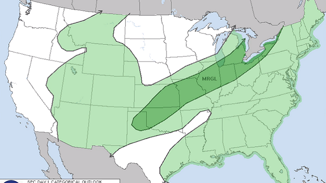
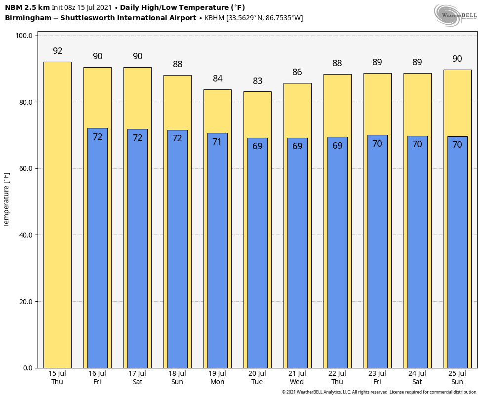
QUIET WEATHER PATTERN CONTINUES: The air aloft over Alabama was warmer on Wednesday, resulting in a more stable air mass and a reduction in the number of scattered showers and thunderstorms. Things won’t be much different Thursday; we are forecasting a partly to mostly sunny sky with just a handful of widely scattered showers or storms this afternoon and into the evening. The chance of any one location seeing rain is 20-30%, and temperatures will peak around 90 degrees this afternoon. The average high for Birmingham on July 15 is 91.
FRIDAY AND THE WEEKEND: An approaching upper trough will bring an increase in the number of showers and storms to the state over these three days. This doesn’t mean a washout or an all-day kind of rain, but look for scattered to numerous showers and thunderstorms, mostly from 1 until 11 p.m. The chance of rain for any one spot will be 50-60%, and afternoon highs will be in the mid to upper 80s with a mix of sun and clouds.
NEXT WEEK: A number of showers and thunderstorms are likely Monday and Tuesday with high precipitable water values and a nearby upper trough. Showers should thin out out a bit over the latter half of the week. Highs will remain in the 80s, below average for mid-July in Alabama.
TROPICS: Shower activity associated with a non-tropical area of low pressure, several hundred miles south-southwest of Cape Race, Newfoundland, has increased a little since Wednesday. However, environmental conditions are only marginally conducive, and little additional development is expected while the low moves little over the next day or so. On Friday, the low is expected to accelerate northeastward and open up into a trough of low pressure to the south of Atlantic Canada.
Tropical storm formation is not expected through the weekend across the Atlantic basin.
ON THIS DATE IN 1980: Birmingham’s official high was 102 degrees. Alabama and much of the southern U.S. was in the midst of one of the greatest heat waves of all time. It still rates as one of the hottest Alabama summers on record. Starting on July 10, 1980, daily maximum temperatures at Birmingham were 101, 102, 104, 106, 103, 102, 105 and 105. The string of triple-digit heat was finally broken July 18, when powerful storms formed at mid-afternoon, cooling down the temperature just shy of the 100-degree mark.
Around the nation, the heat wave claimed anywhere between 1,250 and 10,000 lives. Also because of the massive drought, agricultural damage estimates totaled more than $50 billion when adjusted for inflation. In Dallas/Fort Worth, Texas, high temperatures exceeded 100 for 69 days between June 23 and Sept. 6. Dallas/Fort Worth reached an all-time high on June 26-27, soaring to 113 on both days. In the summer of 1980 in Dallas/Fort Worth, 29 days either tied or broke records for those respective dates. Wichita Falls, Texas, would hit 119, the second-highest temperature ever recorded in Texas.
BEACH FORECAST: Click here to see the AlabamaWx Beach Forecast Center page.
WEATHER BRAINS: You can listen to our weekly 90-minute show any time on your favorite podcast app. This is the show all about weather featuring many familiar voices, including the meteorologists at ABC 33/40.
CONNECT: You can find me on the major social networks:
For more weather news and information from James Spann and his team, visit AlabamaWx.


