James Spann: Scattered storms stay in the Alabama forecast; Fred is struggling
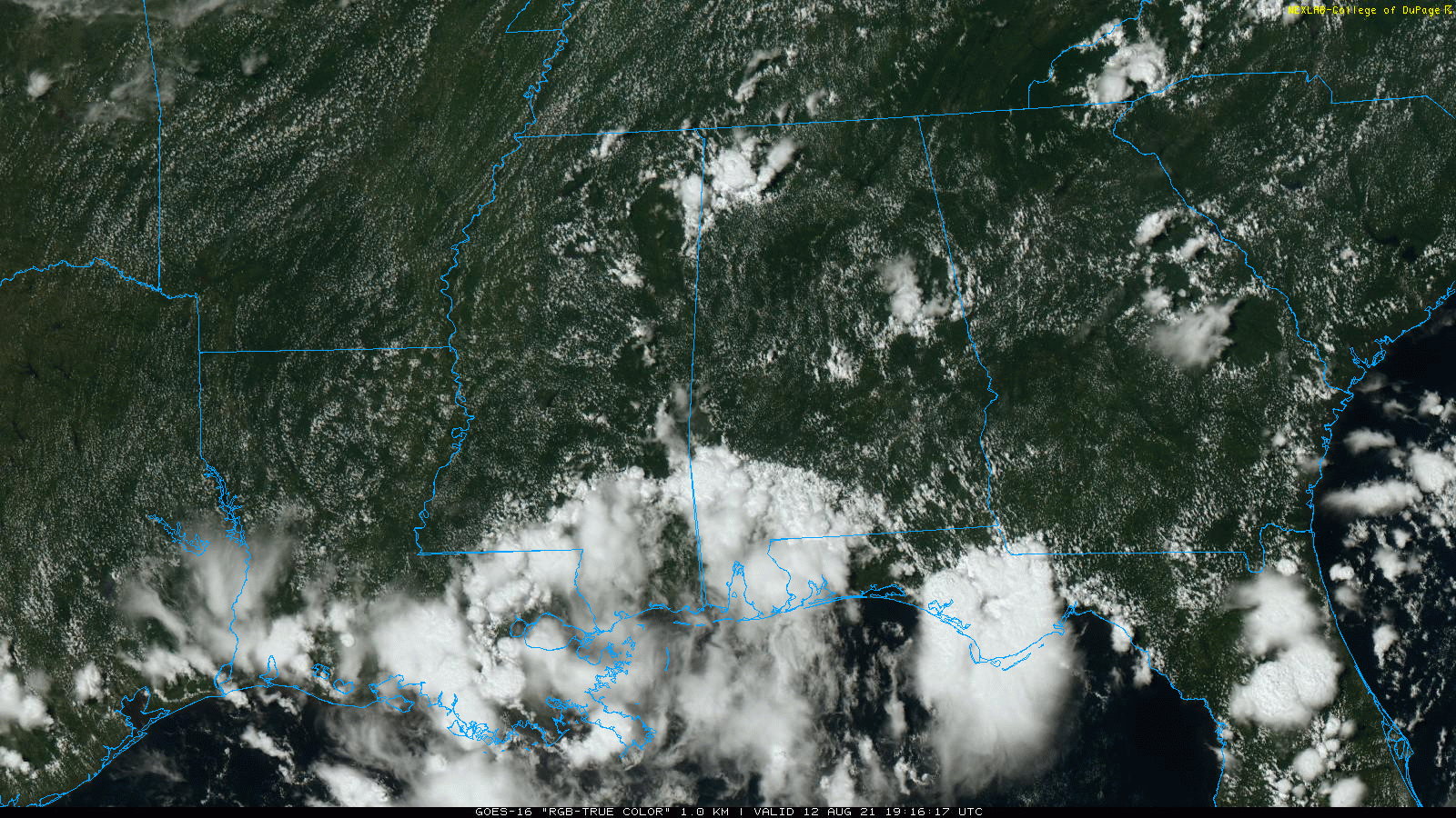
RADAR CHECK: Showers and storms are most numerous over northwest, southwest and east-central Alabama this afternoon. Some spots are getting heavy rain, gusty winds and lots of lightning. Away from the storms, the sky is partly sunny with temperatures mostly between 88 and 92 degrees. Showers and storms will fade away late tonight.
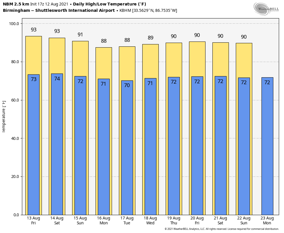
FRIDAY THROUGH THE WEEKEND: We aren’t expecting much change; look for a mix of sun and clouds each day with scattered showers and thunderstorms, most active from about noon to 10 p.m. Odds of any one spot getting wet each day is 40-50%. Highs will be in the low 90s Friday and between 87 and 90 degrees over the weekend.
NEXT WEEK: Rain coverage will likely increase over the first half of the week as deeper tropical moisture moves in from the south; the heaviest rain from the tropical system will likely be east of Alabama, however. Highs next week will be mostly in the mid to upper 80s, below average for mid-August in Alabama.
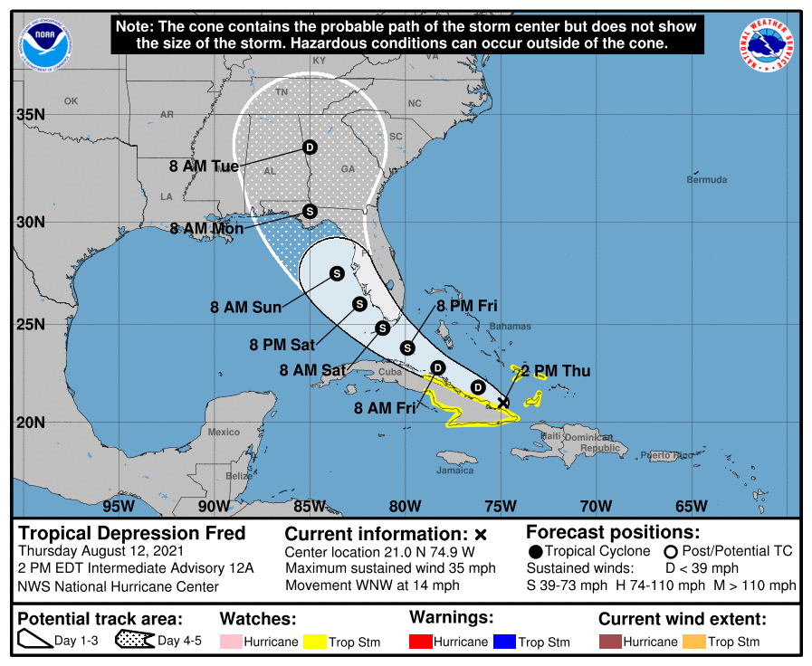
FRED REMAINS DISORGANIZED: Tropical Depression Fred remains very disorganized this afternoon near the eastern tip of Cuba. The system will move along the northern coast of Cuba tonight and Friday, and into the eastern Gulf of Mexico over the weekend. The latest National Hurricane Center track has Fred moving into the eastern part of the Florida Panhandle late Sunday night or early Monday as a tropical storm.
Some notes on Fred this afternoon:
- Some models suggest Fred won’t regain tropical storm status due to land interaction, shear and drier air being pulled into the system. Others bring it back to tropical storm strength, in line with the NHC forecast. Most likely, the main impact with Fred will come from heavy rain and rip currents.
- The main impact, in terms of storm surge, rain and wind, will be along and east of the circulation center (if it can regain tropical storm strength). The Alabama Gulf Coast and the western tip of the Florida Panhandle (Gulf Shores, Orange Beach, Pensacola and Navarre Beach) will be on the better, drier, west side of the system. But the rip current danger will be high all along the Gulf Coast by Sunday and early next week. And there will be some rain on the west side of the tropical system as well.
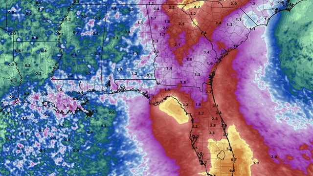
- The heaviest rain directly associated with Fred, once inland, will likely be east of Alabama, across the Florida peninsula, Georgia and the Carolinas.
- I can’t give specific advice for those planning a beach trip this weekend and early next week since different people go to the beach for different reasons. Odds of this turning into a hurricane, for now, look very low.
- Remember, all of this could change. When it comes to tropical systems, if you are working with old information, you are working with bad information.
INVEST 95L: Satellite-derived wind data from this morning indicated that a small area of low pressure has developed along a tropical wave about 1,200 miles east of the Lesser Antilles. However, the low does not quite have a closed circulation, and the associated shower and thunderstorm activity remains disorganized. Environmental conditions are expected to become more conducive for additional development, and a tropical depression is likely to form by the weekend while moving generally westward at about 20 mph across the tropical Atlantic. This system is expected to reach portions of the Leeward Islands late Saturday or early Sunday.
The NHC is showing a 70% chance of this becoming a tropical depression or storm over the next five days. This one will be called Grace.
It’s way too early to know whether Grace will move into the Gulf of Mexico or affect the U.S.
ON THIS DATE IN 2005: A tornado struck Wright, Wyoming, a coal-mining community, killing two, destroying 91 homes and damaging about 30 more around the town.
BEACH FORECAST: Click here to see the AlabamaWx Beach Forecast Center page.
WEATHER BRAINS: You can listen to our weekly 90-minute show any time on your favorite podcast app. This is the show all about weather featuring many familiar voices, including the meteorologists at ABC 33/40.
CONNECT: You can find me on the major social networks:
For more weather news and information from James Spann and his team, visit AlabamaWx.


