James Spann: Sun, scattered storms for Alabama through the weekend; still watching Fred
James Spann forecasts more standard summer weather for Alabama from Alabama NewsCenter on Vimeo.
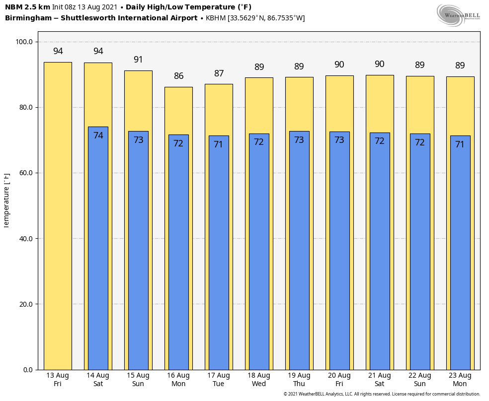
ROUTINE SUMMER WEATHER CONTINUES: Alabama’s weather won’t change much through Sunday. We expect a mix of sun and clouds each day with the usual round of daily scattered showers and thunderstorms, most active between noon and 10 p.m. The chance of any specific spot getting wet each day is 40-50%; the high will be in the low 90s Friday, close to 90 Saturday and in the upper 80s Sunday. Pretty much what you expect in mid-August around here.
NEXT WEEK: Fred, which should be a broad tropical low, will bring deeper tropical moisture into the state next week. While the heaviest rain will most likely be east of Alabama, we do expect scattered to numerous showers and thunderstorms daily with highs mostly in the mid to upper 80s, about 5 degrees below average for this time of the year.
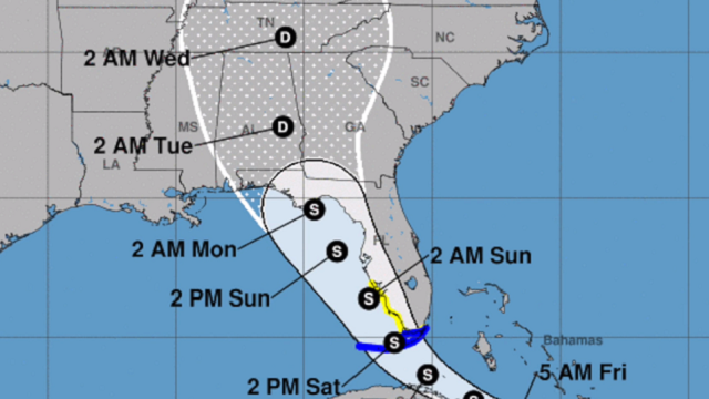
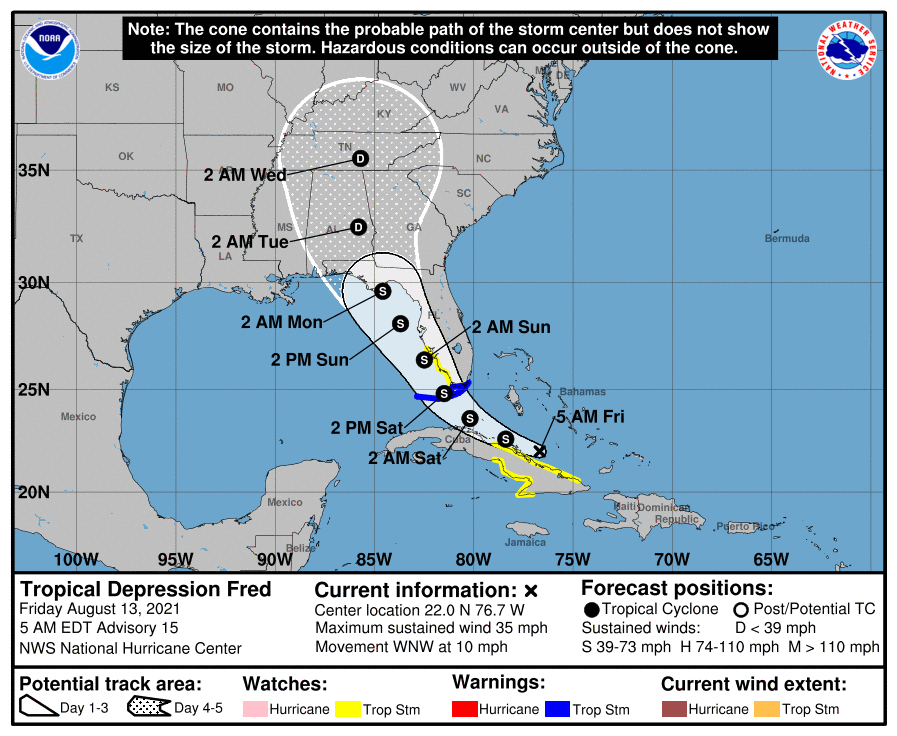
FRED: Tropical Depression Fred remains very disorganized this morning on the northern coast of Cuba. The system will pass over the Florida Keys Saturday as a minimal tropical storm and then through the far eastern Gulf of Mexico Sunday. It moves into the eastern Florida Panhandle Sunday night, most likely well under hurricane strength.
Some notes on Fred this morning:
- Confidence is high Fred won’t become a hurricane in the Gulf due to interaction with the Florida peninsula and shear. The main impact will be rip currents and lots of rain.
- As you look on the National Hurricane Center forecast map, remember this most likely will be a broad tropical low and not a dot on a map. The heaviest rain from Fred will be along and east of the circulation center.
- Inland, the heaviest rain as a direct result of Fred will be over the Florida peninsula, Georgia and the Carolinas. But the system will pull deeper tropical moisture into Alabama next week, and we will see an increase in the number of showers and storms.
- There will be a high danger of rip currents along the entire central Gulf Coast (Gulf Shores to Panama City Beach) Sunday and Monday. Expect double red flags in many areas.
- A few isolated tornadoes will be possible across the Florida peninsula Sunday on the east side of Fred.
- This forecast can still change; keep an eye on updates. When it comes to tropical systems, if you are working with old information, you are working with bad information.
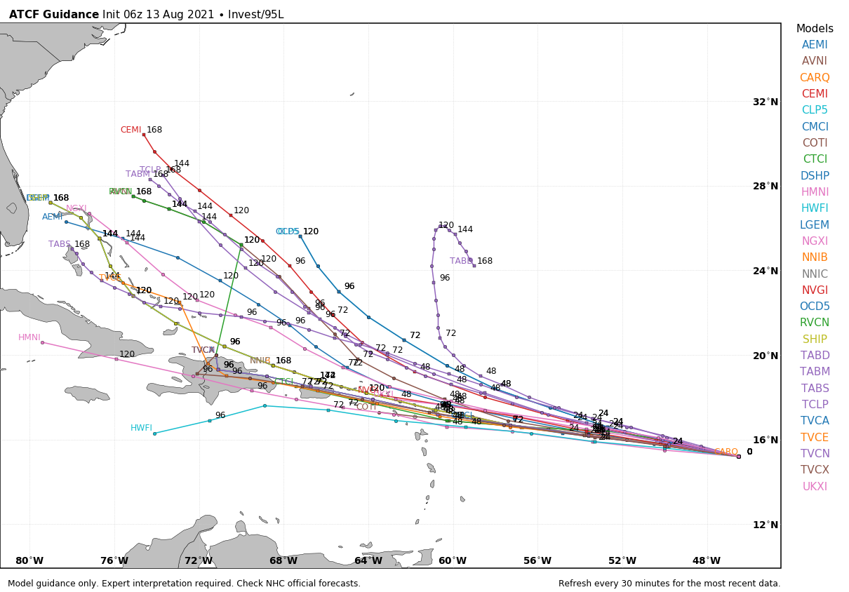
INVEST 95L: A small low-pressure system about 1,000 miles east of the Lesser Antilles is producing disorganized shower and thunderstorm activity, primarily west of the center. Environmental conditions are expected to gradually become more conducive for additional development, and a tropical depression is likely to form within the next couple of days. The system is forecast to move generally westward at about 20 mph across the tropical Atlantic, reaching portions of the Leeward Islands Saturday night and Virgin Islands on Sunday.
There is a 70% chance this becomes a tropical depression or storm within 48 hours, and the name will be Grace. It’s too early to know whether this will affect the Gulf of Mexico or the U.S. Most models bring this up to hurricane strength in a few days.
ON THIS DATE IN 2004: Hurricane Charley made landfall on the southwest coast of Florida near Cayo Costa, just west of Fort Myers, around 3:45 p.m. Eastern Time with maximum sustained surface winds near 150 mph. Charley was initially expected to hit farther north in Tampa, and caught many Floridians off guard with a sudden change in the storm’s track as it approached the state. Along its path, Charley caused 10 deaths and $16.9 billion in damage to insured residential property, making it the second-costliest hurricane in United States history at the time. Charley was a compact, fast-moving storm, which limited the scope and severity of the damage.
BEACH FORECAST: Click here to see the AlabamaWx Beach Forecast Center page.
WEATHER BRAINS: You can listen to our weekly 90-minute show any time on your favorite podcast app. This is the show all about weather featuring many familiar voices, including the meteorologists at ABC 33/40.
CONNECT: You can find me on the major social networks:
For more weather news and information from James Spann and his team, visit AlabamaWx.


