James Spann: Strong storms over northwest Alabama this evening
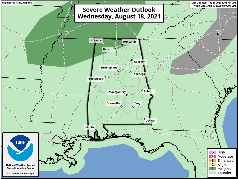
RADAR CHECK: Most of Alabama is dry this afternoon, but strong storms are entering the northwest corner of the state ahead of an upper trough. A few storms over northwest Alabama this evening could produce strong, gusty winds. The Storm Prediction Center maintains a marginal risk for areas north of a line from Hamilton to Huntsville. Away from the storms, the sky is partly to mostly sunny with temperatures mostly in the low 90s, right at seasonal averages for mid-August.
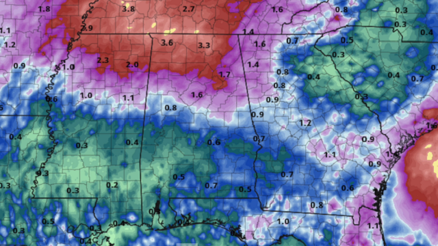
THURSDAY THROUGH SATURDAY: An upper trough in the vicinity will bring scattered to numerous showers and thunderstorms on these three days, mostly from noon to midnight. The chance of any one spot getting wet each day is 55-65%, and highs will drop into the mid to upper 80s with a limited amount of sun.
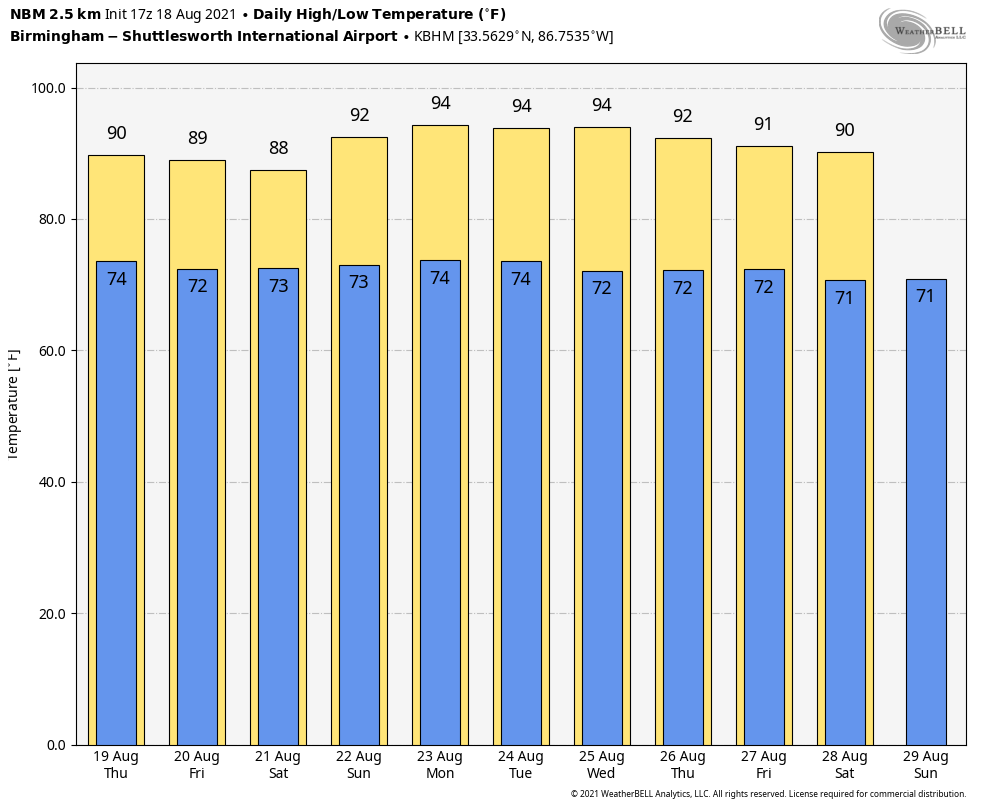
SUNDAY AND NEXT WEEK: An upper ridge will begin to build into the region Sunday; the sky will be partly to mostly sunny with only isolated afternoon showers. Sunday’s high will be in the low 90s. Then, the weather will be hot and mostly dry Monday and Tuesday, with just a small risk of any one spot getting an afternoon storm and highs between 91 and 95 degrees. The ridge weakens over the latter half of the week, and there should be a slow increase in the number of scattered afternoon and evening showers and storms Wednesday through Friday.
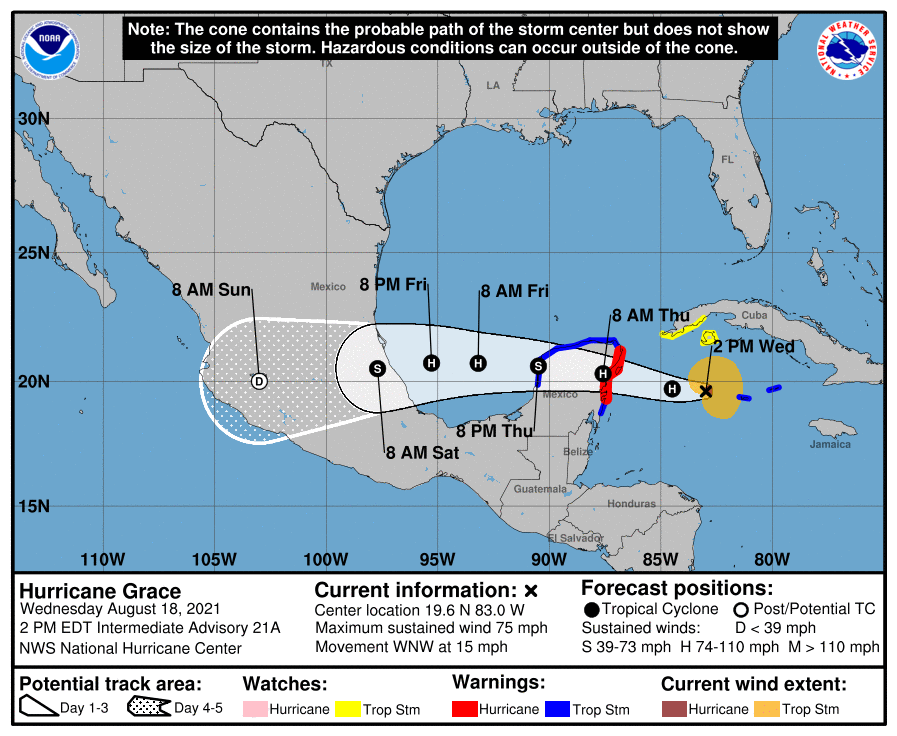
TROPICS: Grace, in the western Caribbean, is now a hurricane with sustained winds of 75 mph. It will weaken as it moves across the Yucatan Peninsula Thursday, but is expected to regain hurricane strength by the second landfall on the coast of Mexico well south of Brownsville, Texas, late Friday night. Grace will remain far south of the U.S., but it will bring a higher rip current danger to the central Gulf Coast Thursday night and Friday.
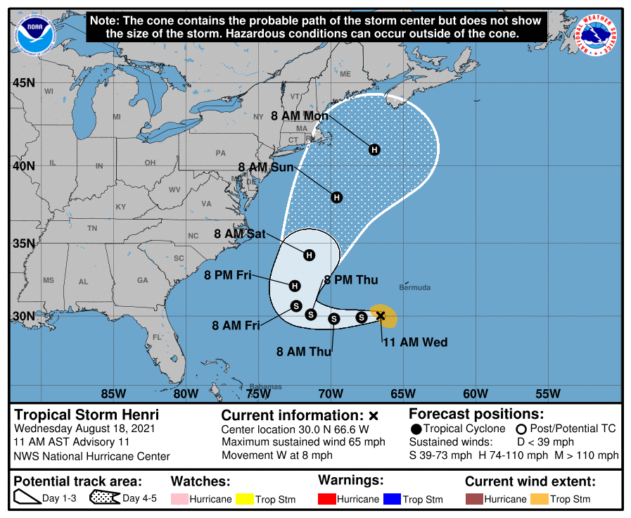
Tropical Storm Henri is expected to reach hurricane strength Thursday; it will loop around Bermuda and ultimately move out into the North Atlantic while staying east of the U.S. It will bring a high danger of rip currents to the U.S. East Coast this weekend.
 The rest of the Atlantic basin is very quiet.
ON THIS DATE IN 1983: Hurricane Alicia made landfall at Category 3 strength on the southwestern end of Galveston Island, Texas. Alicia’s eye passed just west of downtown Houston, producing widespread damage. Thousands of homes were destroyed. In downtown Houston, nearly all skyscrapers lost approximately half of lower-level windows, littering the urban streets with debris. Widespread power outages and flooding affected much of southeast Texas, with observed rainfall totals peaking at 9.95 inches. In addition to the strong winds, rough surf and heavy rain, Alicia generated 22 tornadoes around the Houston–Galveston area; most were rated F0, but the strongest, an F2, tore through Corsicana farther north.
BEACH FORECAST: Click here to see the AlabamaWx Beach Forecast Center page.
WEATHER BRAINS: You can listen to our weekly 90-minute show any time on your favorite podcast app. This is the show all about weather featuring many familiar voices, including the meteorologists at ABC 33/40.
CONNECT: You can find me on the major social networks:
For more weather news and information from James Spann and his team, visit AlabamaWx.


