James Spann: Occasional showers, storms for Alabama through the weekend
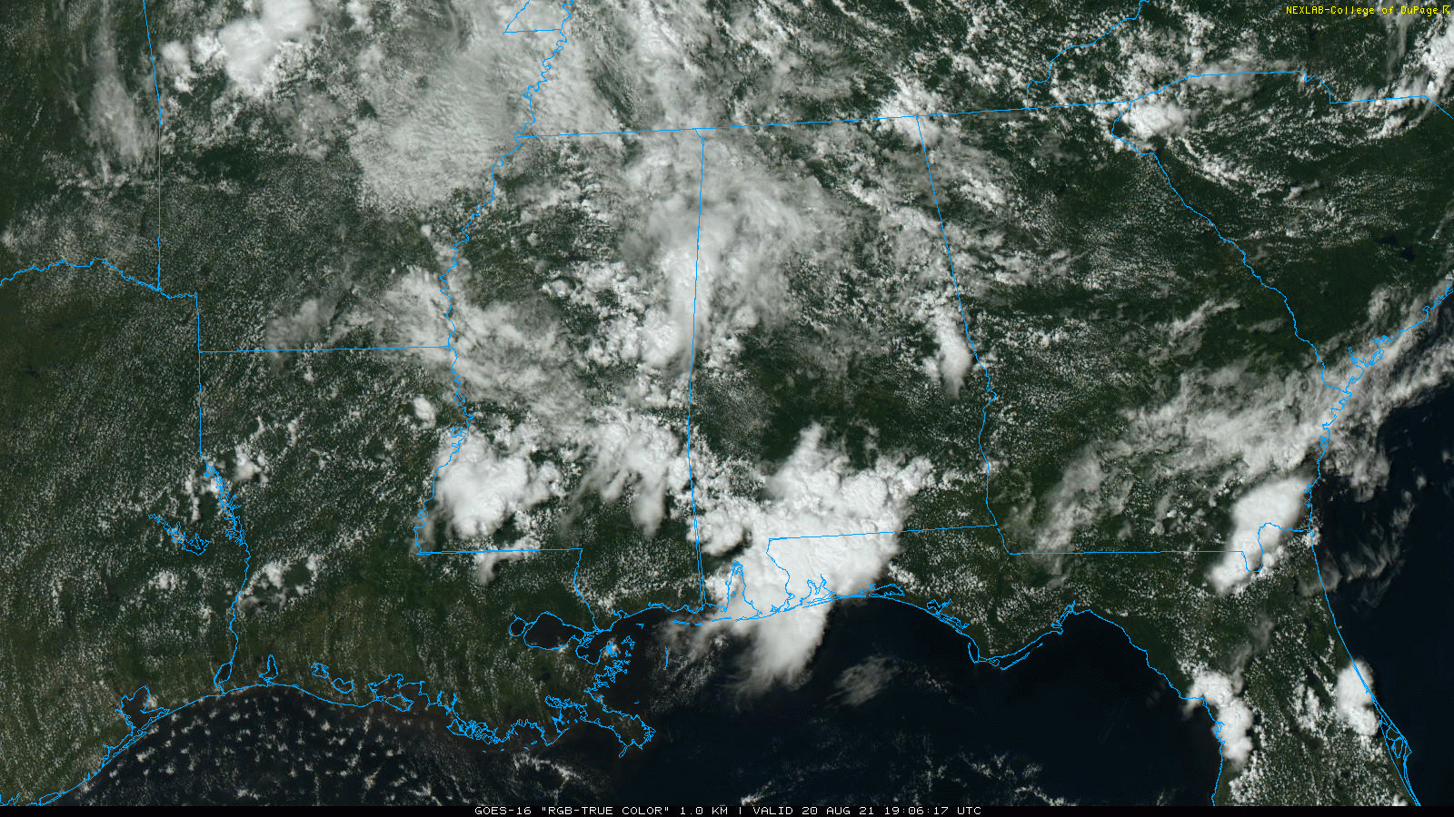
RADAR CHECK: The heaviest rain across Alabama this afternoon is over the southern quarter of the state; otherwise we have scattered showers and thunderstorms in various pockets, moving southeast. Temperatures are mostly in the 80s, but where rain is falling we are seeing many places in the 70s; the average high for Birmingham on Aug. 20 is 91.
Showers and storms will remain possible across Alabama tonight, but they will fade during the late night as the air becomes more stable.
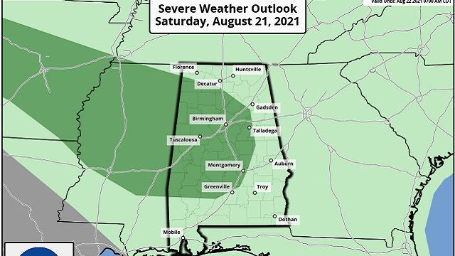
THE ALABAMA WEEKEND: The sky will be occasionally cloudy Saturday with scattered to numerous showers and thunderstorms. Some high-resolution models suggest a mesoscale convective system will roll through the state, especially the western counties, with potential for strong winds. The Storm Prediction Center has introduced a marginal risk (level 1 of 5) of severe weather for parts of central and west Alabama due to the potential.

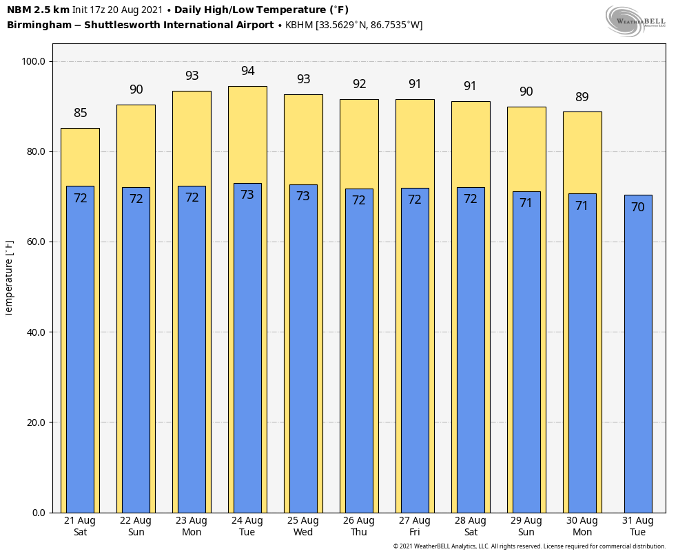
The sky will feature more clouds than sun Saturday with a high in the mid 80s. On Sunday, look for a partly sunny sky with the usual summer round of scattered, mostly afternoon and evening showers and thunderstorms. Sunday’s high will be between 87 and 90 degrees. Odds of any one spot getting wet are 65-75% Saturday and 35-45% Sunday.
NEXT WEEK: An upper ridge will build over the Deep South Monday and Tuesday; the sky will be mostly sunny both days with only isolated showers. Heat levels rise with highs in the low to mid 90s. Wednesday through Friday we expect pretty routine August weather with partly sunny days, and showers and storms in scattered spots during the afternoon and evening hours. Highs over the latter half of the week will be close to 90 degrees.
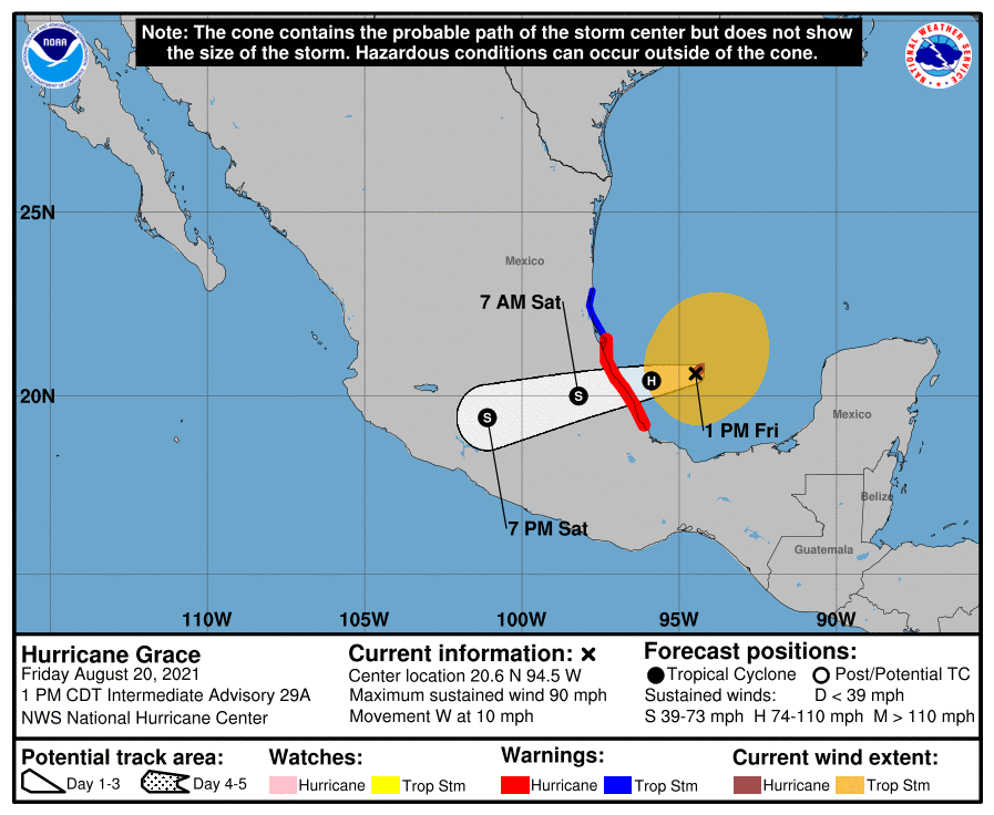
GRACE: Grace is a hurricane again in the Bay of Campeche, and landfall will come this evening on the coast of Mexico well south of Brownsville, Texas, at Category 2 strength.
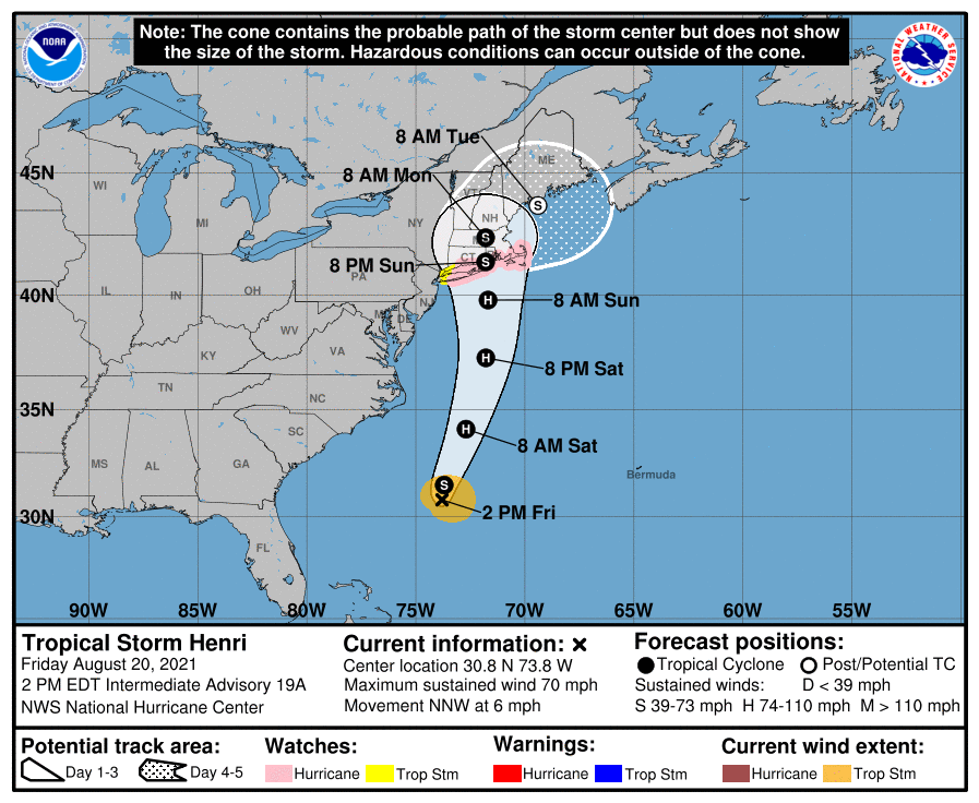
HENRI: In the Atlantic, Tropical Storm Henri now packs winds of 70 mph and is about 320 miles south/southeast of Cape Hatteras. The latest National Hurricane Center forecast has the system moving into the southern New England coast Sunday as an upper-end tropical storm or a Category 1 hurricane. A Hurricane Watch is in effect for:
- The south shore of Long Island from Fire Island Inlet to Montauk.
- The north shore of Long Island from Port Jefferson Harbor to Montauk.
- New Haven, Connecticut, to Sagamore Beach, Massachusetts.
- Nantucket, Martha’s Vineyard and Block Island.
Dangerous storm surge inundation and hurricane conditions are possible beginning Sunday in portions of Long Island, Connecticut, Rhode Island and southeastern Massachusetts, where a Storm Surge Watch and Hurricane Watch are in effect.
Also, a tropical wave over the eastern Atlantic, several hundred miles southwest of the Cabo Verde Islands, is producing a broad area of disorganized showers and thunderstorms. This wave is expected to interact with another wave emerging off the African coast over the next day or two. Afterward, environmental conditions appear marginally favorable for some slow development by the beginning of next week as this system moves gradually northwest at 5 to 10 mph. For now the chance of development is only 20% over the next five days.
ON THIS DATE IN 1928: A tornado estimated at F4 intensity initially touched down in Winnebago County, Iowa, moved to Freeborn County, Minnesota, and hit the south side of Austin, Minnesota. Five of the six deaths were in Austin, with 60 injuries.
BEACH FORECAST: Click here to see the AlabamaWx Beach Forecast Center page.
WEATHER BRAINS: You can listen to our weekly 90-minute show any time on your favorite podcast app. This is the show all about weather featuring many familiar voices, including the meteorologists at ABC 33/40.
CONNECT: You can find me on the major social networks:
For more weather news and information from James Spann and his team, visit AlabamaWx.


