James Spann: Summer mix of sun, heat, scattered storms ahead for Alabama
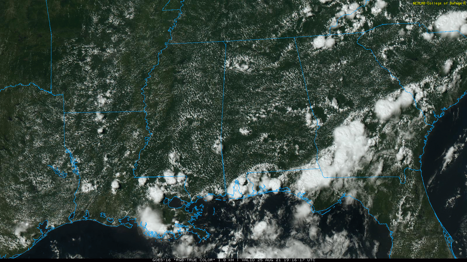
RADAR CHECK: We have several small, isolated showers and thunderstorms across Alabama this afternoon, moving west. But, for most places, it is a partly to mostly sunny, hot afternoon with temperatures between 90 and 95 degrees. Isolated showers end this evening and the sky will be mostly fair through the night.
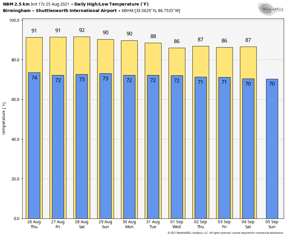
THURSDAY THROUGH THE WEEKEND: The upper ridge across the Deep South will be a little weaker, opening the door for an increase in the coverage of scattered showers and storms each day. Odds of any one place seeing rain will be 40-50%, with most of the showers coming from noon to midnight. Otherwise, expect partly sunny days with highs between 88 and 91, very standard weather for late August in Alabama.
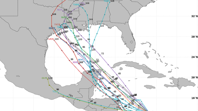
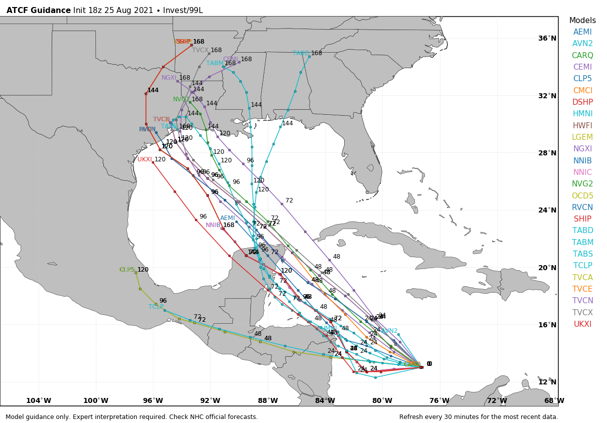
NEXT WEEK: The weather here will all depend on how Invest 99L behaves. Most global guidance brings the system into Louisiana Monday night or Tuesday, putting Alabama on the wet, east side of the circulation. This could bring a good coverage of rain into the state during midweek, but there is considerable uncertainty this far out. Highs through the week will be mostly in the mid to upper 80s.
TROPICS: The National Hurricane Center is monitoring two tropical waves in the Atlantic; the one southeast of Bermuda has a high chance of becoming a tropical depression or storm over the next few days, but it will turn eastward and is no threat to the U.S.
The one to watch is the system in the southern Caribbean, not far from the coast of Columbia (Invest 99L). Most guidance suggests this becomes a tropical depression or storm by Saturday, and global models bring it into the western Gulf of Mexico. Highest landfall probabilities now are centered over the western half of the Louisiana coast, but it is far too early to determine the track and intensity. Everyone on the Texas and Louisiana coasts will need to monitor forecasts and updates in coming days.
ON THIS DATE IN 2017: Hurricane Harvey first made landfall on San Jose Island and then near the Rockport and Fulton, Texas, area around 10 p.m. CDT; it was the first Category 4 hurricane to make landfall along the Texas coast since Carla in 1961. It was the first major hurricane to make landfall in the United States since Wilma in 2005, ending a record 12-year span in which no hurricanes made landfall at the intensity of a major hurricane throughout the country. In a four-day period, many areas received more than 40 inches of rain as the system slowly meandered over eastern Texas and adjacent waters, causing unprecedented flooding. Throughout Texas, approximately 336,000 people were left without electricity and tens of thousands required rescue. Throughout the state, 103 people died in storm-related incidents: 68 from its direct effects, including flooding, and 35 from indirect effects in the hurricane’s aftermath.
BEACH FORECAST: Click here to see the AlabamaWx Beach Forecast Center page.
WEATHER BRAINS: You can listen to our weekly 90-minute show any time on your favorite podcast app. This is the show all about weather featuring many familiar voices, including the meteorologists at ABC 33/40.
CONNECT: You can find me on the major social networks:
For more weather news and information from James Spann and his team, visit AlabamaWx.


