Weather update: Risk grows for northern Alabama; Tornado Watch issued until 10 p.m.
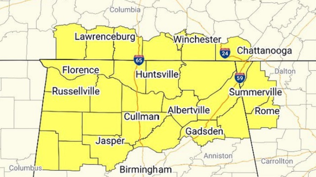

The Storm Prediction Center has issued a Tornado Watch until 10 p.m. for Blount, Cherokee, Colbert, Cullman, DeKalb, Etowah, Fayette, Franklin, Jackson, Lamar, Lauderdale, Lawrence, Limestone, Madison, Marion, Marshall, Morgan, Walker and Winston counties.
Primary threats include:
• A few tornadoes likely, with a couple of intense tornadoes possible.
• Scattered damaging winds likely, with isolated significant gusts to 75 mph possible.
• Scattered large hail events to 1.5 inches in diameter possible.
Thunderstorms over northern Mississippi will build eastward this evening across northern Alabama.
A Tornado Watch means conditions are favorable for tornadoes and severe thunderstorms in and close to the watch area. People in these areas should be on the lookout for threatening weather conditions and listen for later statements and possible warnings.
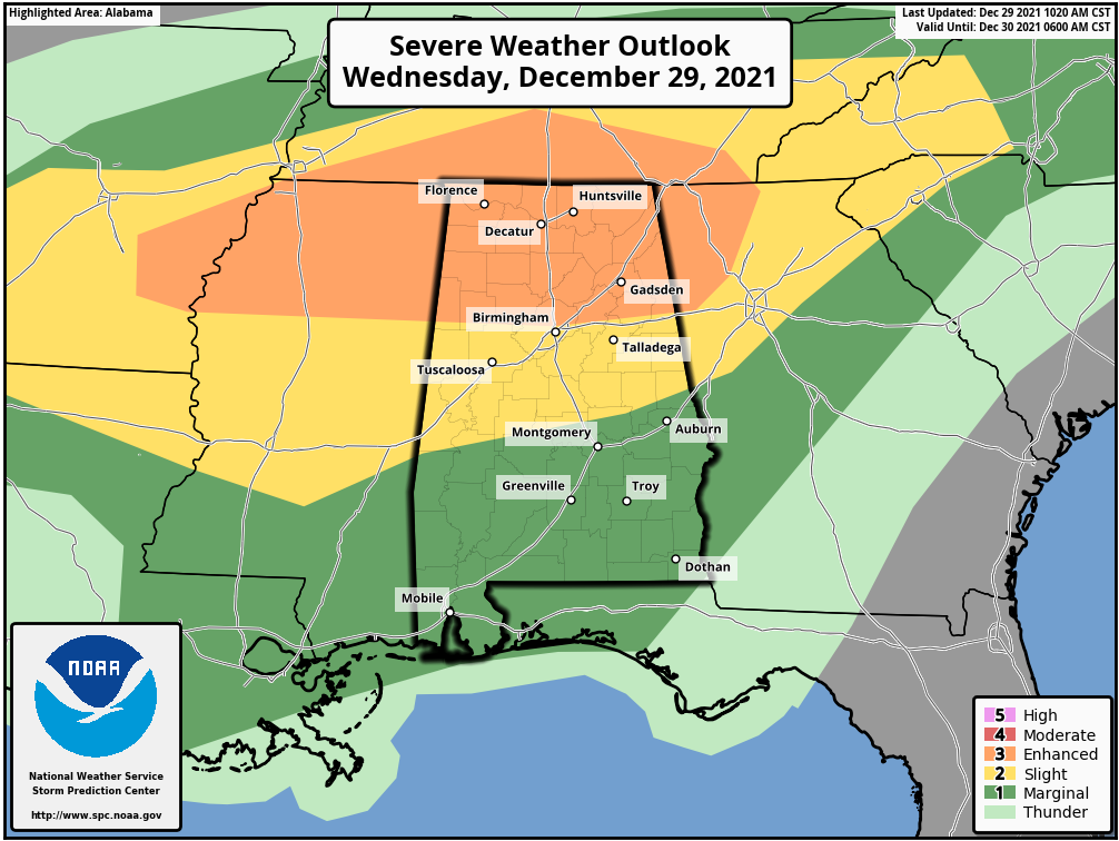
The SPC earlier today expanded the area classified as being at a Level 3 enhanced risk for severe weather to include all of north Alabama and parts of north central Alabama. Another substantial portion of central Alabama is at a Level 2 slight risk, represented by yellow on the map, with the southern part of the state at a Level 1 marginal risk, represented by green.
For more weather news and information from James Spann, Scott Martin and other members of the James Spann team, visit AlabamaWx.


