Scott Martin: Alabama heat rolls on for the first day of summer
HOT: Highs from the major reporting stations on Monday:
- Anniston – 92 degrees
- Birmingham – 93
- Huntsville – 93
- Montgomery – 97
- Muscle Shoals – 95
- Shelby County Airport – 92
- Troy – 95
- Tuscaloosa – 96
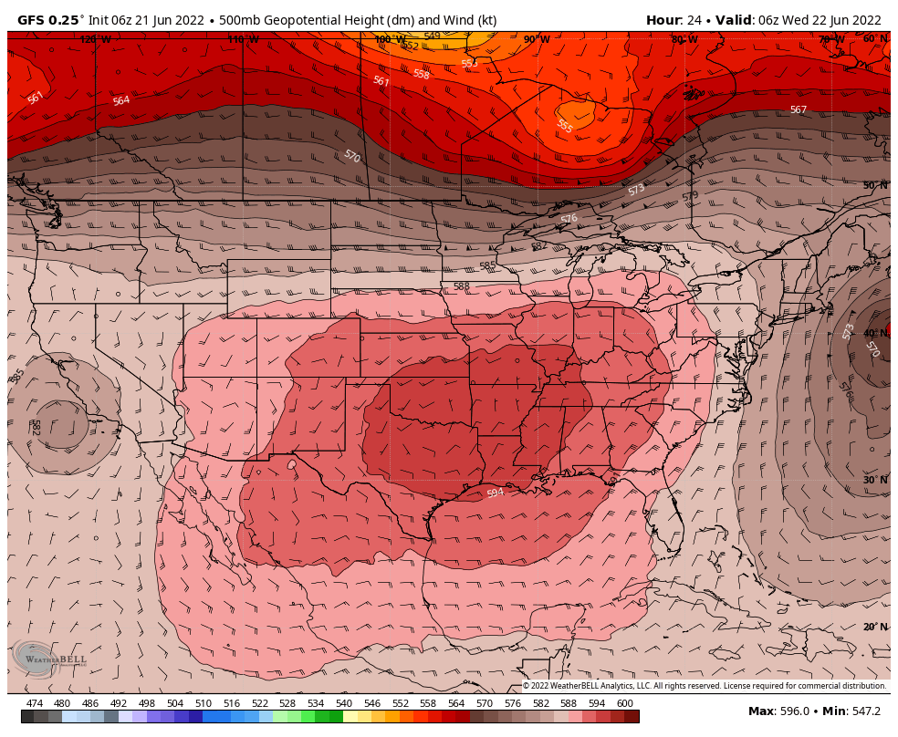
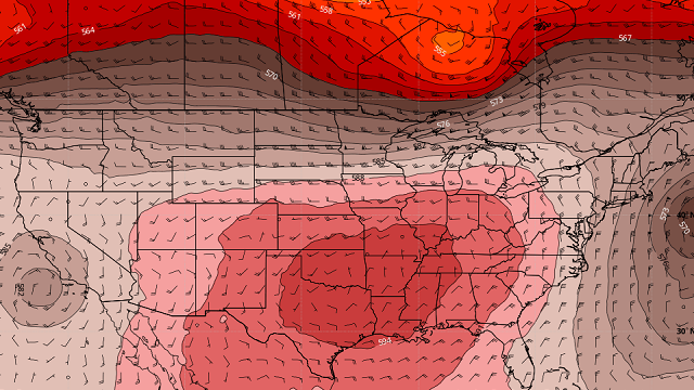
THE WORK WEEK: Today will be hot across Alabama as the heat dome of high pressure sits over a good portion of the southeastern and south-central U.S., and it will not be leaving anytime soon. Skies will be sunny with highs reaching the mid to upper 90s.
Wednesday will be just a little hotter for some locations. There will be plenty of sun with highs in the upper 90s to the lower 100s.
No relief from the heat on Thursday. Look for sunny skies with highs in the upper 90s to the lower 100s.
Friday will be very similar, with sunny skies and highs in the mid 90s to the lower 100s.
THE ALABAMA WEEKEND: The high weakens a little over the Southeast on Saturday, which will allow for those afternoon highs to cool off just a little. Skies will remain sunny, with highs in the mid to upper 90s.
Moisture levels will increase on Sunday, and with a weak front approaching from the northwest, we could see a few isolated showers or storms. Highs will be in the mid to upper 90s underneath mostly sunny skies.
Next Monday, that front pushes into the northern half of the state, continuing the small chance of a few isolated showers and storms. Highs will range from the lower 90s to the upper 90s.
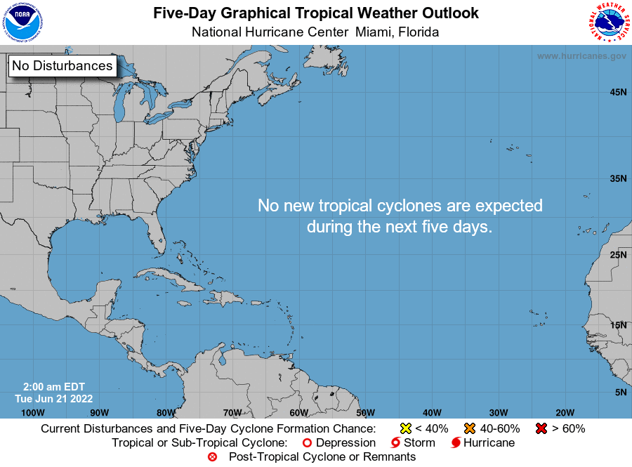
TROPICS: Tropical cyclone formation is not expected during the next five days in the North Atlantic, the Caribbean Sea or the Gulf of Mexico.
For more weather news and information from James Spann, Scott Martin and other members of the James Spann team, visit AlabamaWx.


