Scott Martin: Cooler temperatures, rain chances in Alabama’s future
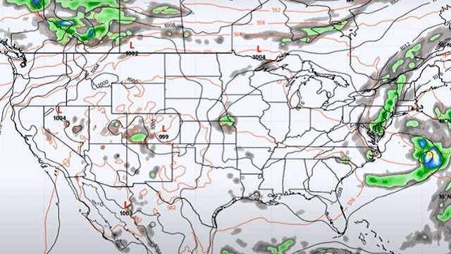
TODAY AND FRIDAY: A few locations will get a little relief from the oppressive heat today as we’ll have a weak surface boundary move through the state. A few isolated showers and storms will be possible for the southern half, while the northern half will remain dry. Highs will be in the mid 90s to the lower 100s under mostly sunny skies.
With slightly drier air in place, heat index values will stay below 100 on Friday with sunny skies. An isolated shower or two may be possible south of I-85, but that will depend on whether any outflow from storms off to the east makes it into the area. Highs will be in the lower 90s to the lower 100s.
THE ALABAMA WEEKEND: A trough will move in our direction from the east on Saturday, bringing a slight increase in our shower and thunderstorm chances during the afternoon, mainly for the eastern half of the state. Skies will be mostly sunny, with highs ranging from the upper 80s in the east to the upper 90s in the west.
An approaching front will stop the progress of the westward-moving trough on Sunday. That will keep the chance of isolated to scattered afternoon showers and storms in the forecast, mainly for the western half of Alabama. Highs will be in the lower to mid 90s for most locations.
FIRST HALF OF NEXT WEEK: The front slows down and will struggle to make it into northern Alabama on Monday. For those who want some rain, this will most likely be the day with the highest chances. We’ll have a 50/50 shot for scattered showers and storms, and highs will be in the upper 80s to the mid 90s.
The front makes it halfway through the state on Tuesday, keeping isolated to scattered showers possible mostly during the afternoon to early evening. Highs will be in the upper 80s to the mid 90s.
On Wednesday the front makes it to the Gulf Coast, but we’ll keep a chance of isolated to scattered showers and storms in the forecast for central Alabama. Highs will be in the upper 80s to the mid 90s.
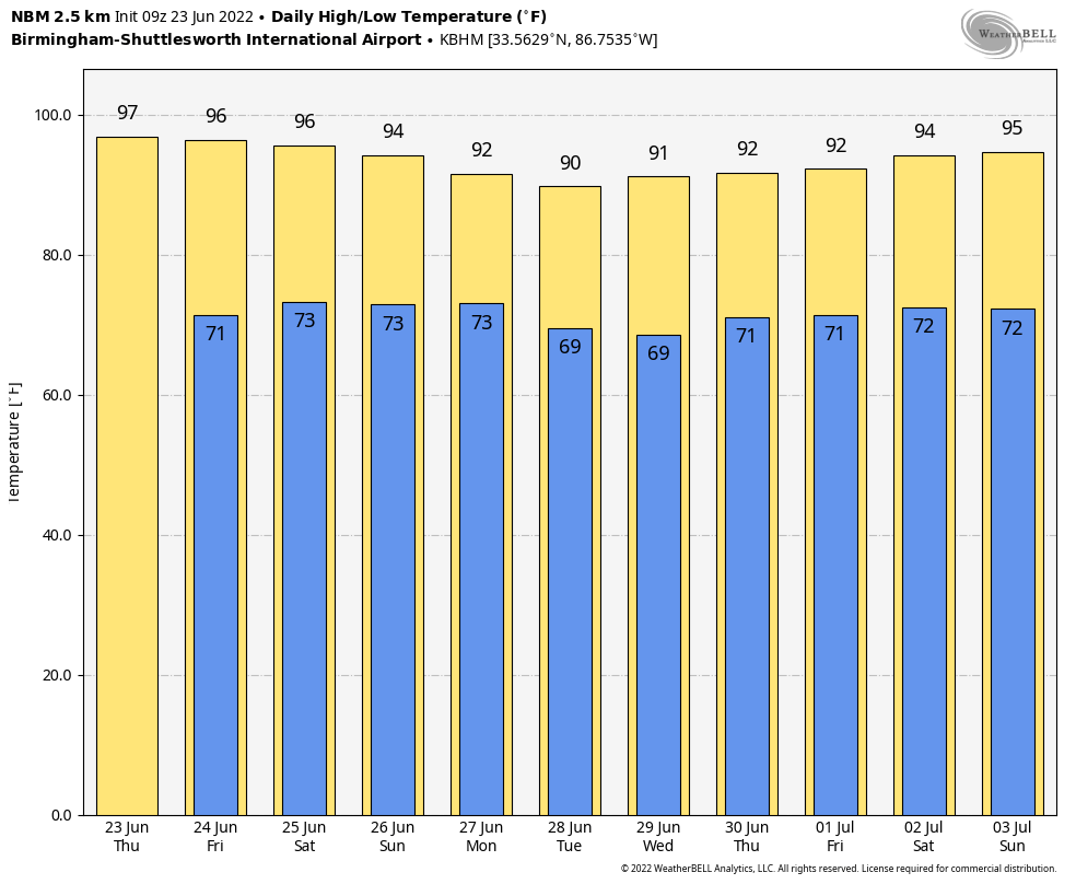
NO HEAT ADVISORIES FOR A WHILE: It looks like we may be done with the 100s for a while, as the National Blend of Models shows our highs getting only to the mid 90s by July 3.
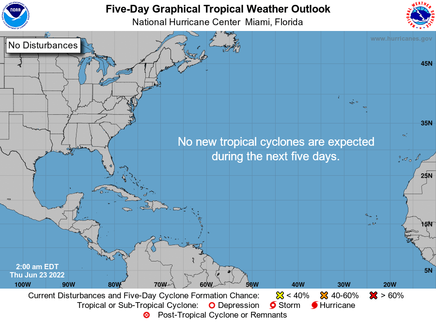
TROPICS: Tropical cyclone formation is not expected during the next five days in the North Atlantic, the Caribbean Sea or the Gulf of Mexico.
For more weather news and information from James Spann, Scott Martin and other members of the James Spann team, visit AlabamaWx.


