James Spann: Heat levels down, rain chances up in Alabama this week
James Spann forecasts a break from extreme heat for Alabama from Alabama NewsCenter on Vimeo.
NOT AS HOT: The core of the upper high that has been responsible for above-average temperatures across the Deep South over the past week is shifting west, meaning lower heat levels this week, and a better coverage of afternoon and evening showers and thunderstorms. Humidity will be high each day, but afternoon highs this week will be mostly between 85 and 89 degrees, a good 10 degrees lower than those we experienced last week.
We have a few isolated showers on radar early this morning, but most of the showers and storms this week will come during the afternoons and evenings, between 2 and 10 p.m. Summer soakers are random; there’s no way of knowing exactly when and where they pop up in advance. If you have something planned outdoors you simply have to watch radar trends. It won’t rain everywhere every day, but mostly places stand a good chance of seeing several downpours over the next five to seven days.
The chance of any one spot getting wet each day is 40-60% if you like the numbers game. Higher probabilities will be over the northern half of the state, but scattered storms will form over south Alabama as well each day.
Summer storms can pack a punch; the main issue is lightning. Remember, “when thunder roars get indoors.” When you hear thunder, go inside (or into a vehicle) even if it is not raining.
FOURTH OF JULY WEEKEND: The weather won’t change much over the holiday weekend. You will see some sun at times Saturday, Sunday and Monday, but from time to time a passing shower or storm is likely, especially during the afternoons and evenings. Highs will remain mostly in the mid to upper 80s, below average for early July in Alabama.
REST OF NEXT WEEK: The upper ridge will try and rebuild, so afternoon highs will likely rise into the low 90s by the middle and end of next week. Days will be partly sunny, and afternoon and evening storms become more widely scattered.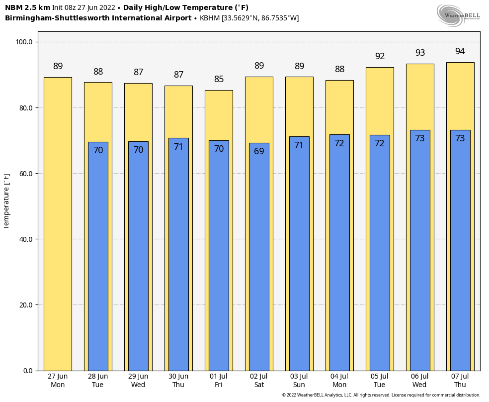 TROPICS: Disorganized showers and thunderstorms over the north-central and northeastern Gulf of Mexico are associated with a trough of low pressure. Development of this system is expected to be slow while it moves west-southwestward at about 10 mph toward the northwestern Gulf of Mexico and approaches the coasts of southern Texas and northeastern Mexico during the next few days. The chance of development over the next five days is only 20%. This feature will not affect the central Gulf Coast directly (Gulf Shores to Panama City Beach).
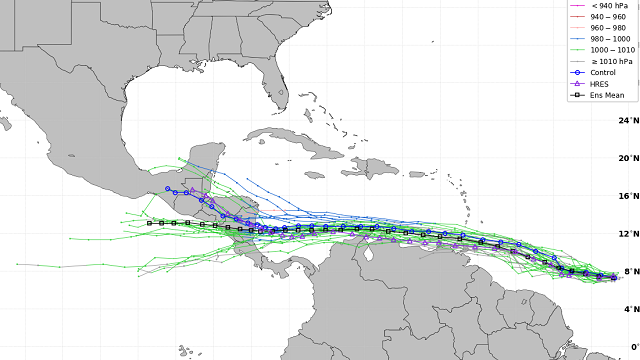
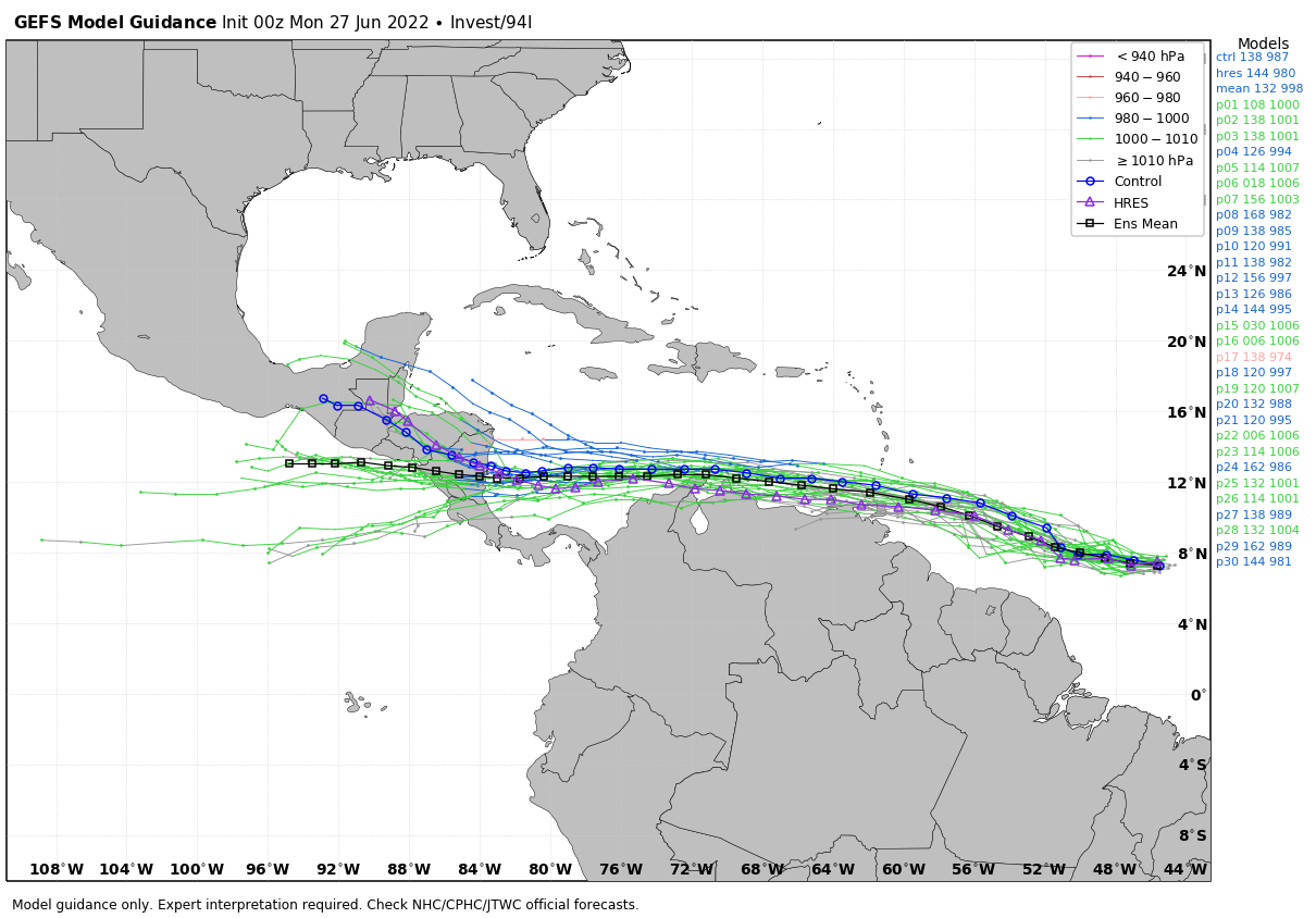
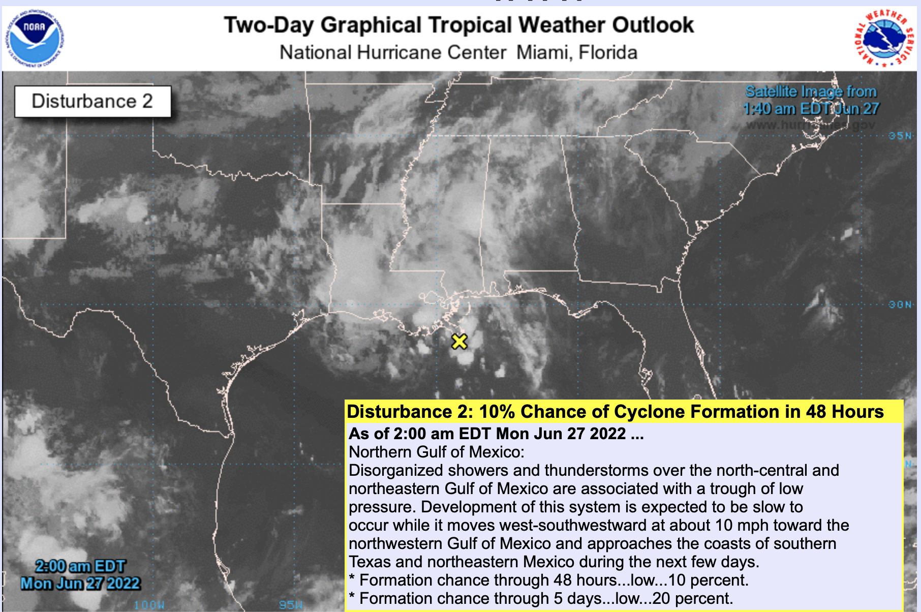 Also, shower and thunderstorm activity has increased in association with a tropical wave about 950 miles east-southeast of the southern Windward Islands. Environmental conditions appear conducive for further development, and a tropical depression is likely to form during the next couple of days before the system reaches the Windward Islands Tuesday night or possibly while moving westward across the southern Caribbean Sea Wednesday through Friday. A NOAA Hurricane Hunter aircraft is scheduled to investigate the system this afternoon. This system is expected to remain far south of the U.S., moving into Central America in five to seven days.
 ON THIS DATE IN 1915: The temperature at Fort Yukon, Alaska, soared to 100 degrees to establish a state record.
ON THIS DATE IN 1995: The Madison County Flood on June 27, 1995, was the worst flash flooding Virginia had seen since the remnants of Camille dropped up to 30 inches of rain one night in Nelson County in August 1969. The Nelson County flood ranked as one of the nation’s worst flash floods of the century and resulted in the deaths of 117 people. The Madison County flood killed one person.
BEACH FORECAST: Click here to see the AlabamaWx Beach Forecast Center page.
For more weather news and information from James Spann and his team, visit AlabamaWx.


