James Spann: Humid summer days for Alabama with scattered afternoon, evening storms
James Spann has the midweek forecast for Alabama from Alabama NewsCenter on Vimeo.
CLASSIC SUMMER PATTERN: If you are new to Alabama, this kind of weather is just what we expect in summer — partly sunny, very humid days with random, scattered showers and storms during the afternoon and evening. This is our forecast for the rest of the week; highs will be between 86 and 90 degrees for most places, right at seasonal averages. Concerning the afternoon storms, there is no way of knowing in advance exactly when and where they pop up; you just have to watch radar trends if you have an outdoor event planned. The chance of any one spot getting rain is 45-55%, and most of the summer soakers will be active between 2 and 10 p.m.
FOURTH OF JULY WEEKEND: The weather won’t change much over the holiday weekend. The sun will be out at times, and random storms will pop up during the peak of the daytime heating process each day. It should be the usual situation; some places won’t see any rain on any given day, while others will see a passing summer soaker with heavy rain. Highs will remain between 86 and 90 degrees.
REST OF NEXT WEEK: Highs rise into the low 90s for most of the week, with no major change in the overall situation. Days will be partly sunny with scattered, mostly afternoon and evening showers and thunderstorms, your classic July forecast.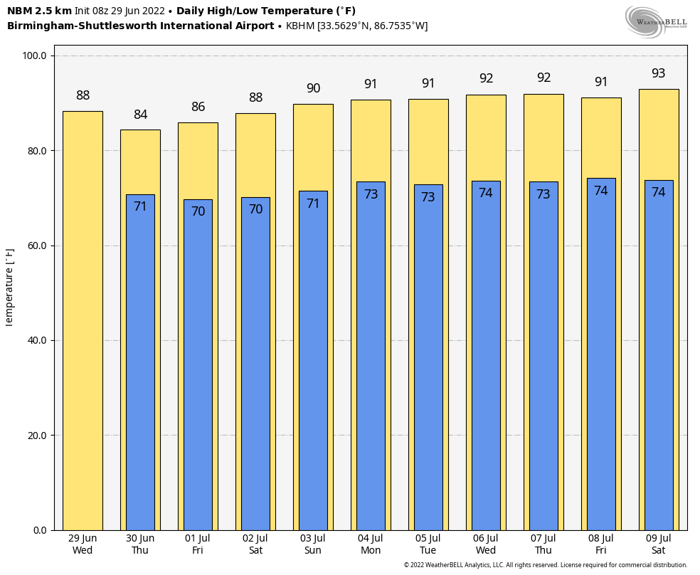 TROPICS: An area of low pressure centered over the northwestern Gulf of Mexico continues to produce disorganized showers and thunderstorms. This system is forecast to move slowly westward or west-southwestward and approach the coast of Texas during the next 48 hours. Slow development of the low is possible, and it could become a short-lived tropical depression near the coast before it moves inland tonight or Thursday. Regardless of development, heavy rain will be possible along portions of the Texas coast later this week.
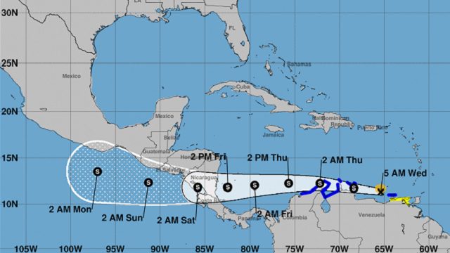
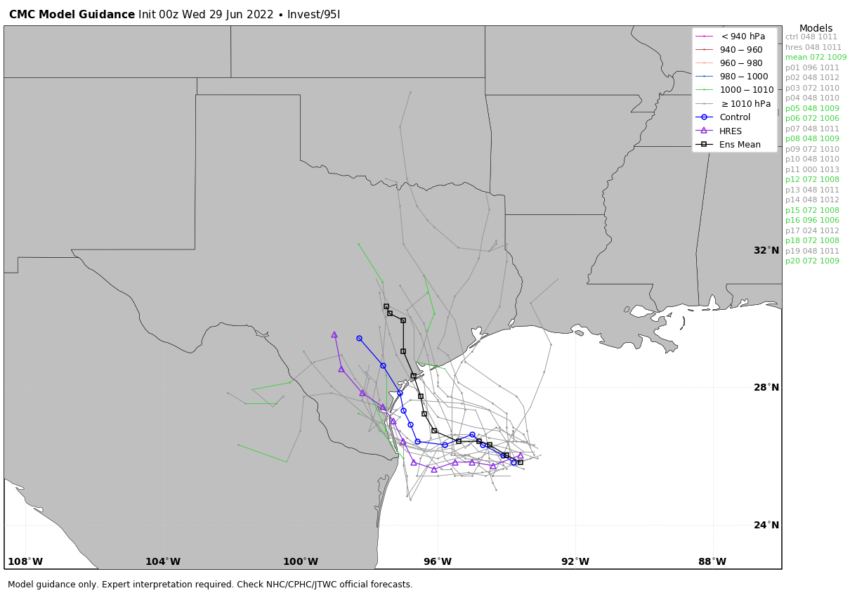 Potential Tropical Cyclone 2 is moving rapidly through the Caribbean; it will skirt the coast of South America and should move into Central America (most likely the coast of Nicaragua) Friday night as a tropical storm. This system will remain far south of the U.S.
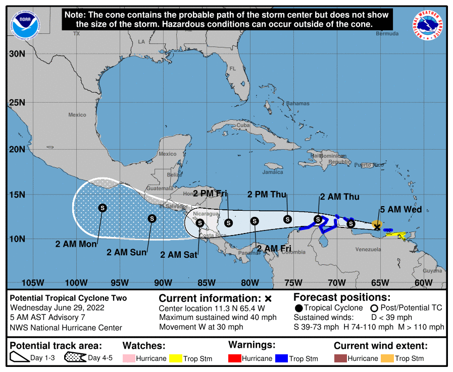 ON THIS DATE IN 1998: “The Corn Belt Derecho of 1998” hit Nebraska, Iowa, Illinois, Indiana and Kentucky. A derecho that originated in far southeast South Dakota moved across Illinois during the afternoon and evening and continued as far east as Ohio the next morning. Every county in central Illinois sustained some damage as these severe thunderstorms passed. Winds gusted in the 60 to 80 mph range, with some localized microbursts producing winds more than 100 mph. Significant damage occurred in the microburst areas, including the towns of Morton, McLean, LeRoy and Tolono. In Tolono, 22 cars of a southbound 101-car Illinois Central freight train were blown off the tracks. It was unknown how many vehicles were picked up by the wind, but 16 cars were turned over and another six derailed but remained upright.
ON THIS DATE IN 2012: The Mid-Atlantic and Midwest derecho was one of the deadliest and most destructive fast-moving severe thunderstorm complexes in North American history. The progressive derecho tracked across a large section of the midwestern United States and across the central Appalachians into the mid-Atlantic states on the afternoon and evening of June 29 and into the early morning of June 30. It resulted in 22 deaths, millions of power outages across the entire affected region and a damage total of $2.9 billion.
BEACH FORECAST: Click here to see the AlabamaWx Beach Forecast Center page.
For more weather news and information from James Spann and his team, visit AlabamaWx.


