James Spann: Classic summer pattern continues in Alabama through the week

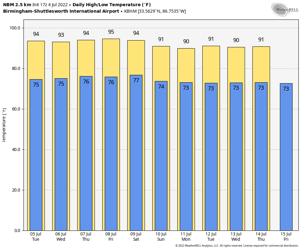
RADAR CHECK: Again we have random, scattered showers and thunderstorms across Alabama on a hot, humid Independence Day. The more concentrated showers are over the southwest counties of the state at midafternoon. Away from the summer rain, temperatures are mostly in the low 90s. The average high for July 4 in Birmingham is 90. Scattered showers and storms end after sunset.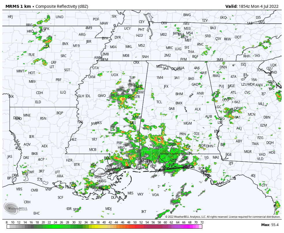 Alabama’s weather won’t change much through the rest of the week. Look for partly sunny, hot, humid days with the chance of a passing shower or storm in random spots. Most of the showers will come between 2 and 10 p.m., and the odds of any one place seeing rain daily is 30-40%. Afternoon highs will be mostly in the mid 90s.
THE WEEKEND AND NEXT WEEK: We’re seeing some evidence the ridge could be a little weaker and the air a little more unstable, meaning some increase in the number of afternoon and evening showers and storms Saturday, Sunday and into next week, but the overall pattern won’t change much. Good ol’ summertime in Alabama. Highs will be mostly in the low 90s.
TROPICS: All is quiet across the Atlantic basin, and tropical storm formation is not expected for at least the next five days.
ON THIS DATE IN 1911: Record temperatures were set in the northeastern United States as a deadly heat wave hit the area that would go on to kill 380 people. In Nashua, New Hampshire, the mercury peaked at 106 degrees. Other high-temperature records were set all over New England during an 11-day period.
BEACH FORECAST: Click here to see the AlabamaWx Beach Forecast Center page.
For more weather news and information from James Spann and his team, visit AlabamaWx.


