James Spann: Showers, storms build northward in Alabama Wednesday
RADAR CHECK: Again today most of the showers and thunderstorms are over the southern half of Alabama, mainly south of a line from Lafayette to Montgomery to Mobile. Stronger storms there are producing heavy rain and lots of lightning, but the northern counties of the state remain in a drier air mass. Temperatures are mostly between 87 and 92 degrees at mid-afternoon.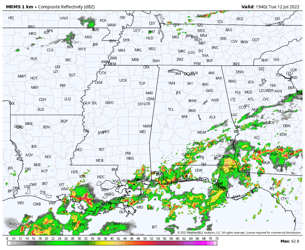 A surface front will approach from the north tonight, and a few storms could drop into the Tennessee Valley after sunset; the Storm Prediction Center has a low-end marginal risk (level 1 out of 5) defined for the far northern part of the state tonight for potential for strong, gusty winds with heavier storms that form ahead of the front.
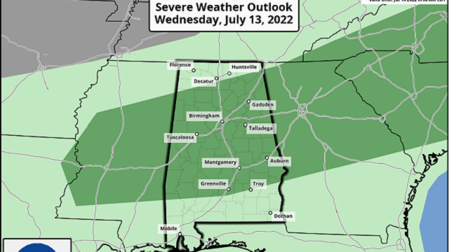
REST OF THE WEEK: Moisture will move northward Wednesday, and with the surface front drifting southward over the Tennessee Valley we expect scattered to numerous showers and thunderstorms by afternoon. Much of north and central Alabama is in a marginal risk (level 1) due to the potential of strong, gusty winds.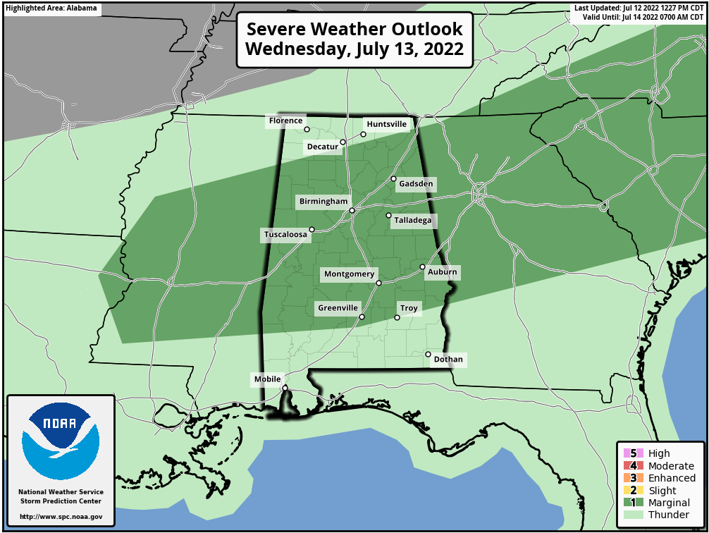 The coverage of scattered showers and storms will remain fairly high Thursday as the front continues to drop slowly southward. On Friday, drier air will likely move into north and central Alabama, with most of the showers forming close to the Gulf Coast. The high will be in the upper 80s Wednesday and Thursday, followed by low 90s Friday.
THE ALABAMA WEEKEND: For now it looks like a very routine summer weekend for Alabama — partly sunny, humid days with random showers and storms in scattered spots during the afternoon and evening, mostly between 2 and 10 p.m. Expect highs between 88 and 91 degrees, and odds of any one spot getting wet both days are 30-40%.
NEXT WEEK: We will roll with a persistence forecast. The core of the heat ridge will remain west of Alabama; highs around here will be mostly in the low 90s through the week, right at seasonal averages. Each day we will mention scattered, mostly afternoon and evening showers and thunderstorms with a partly sunny sky.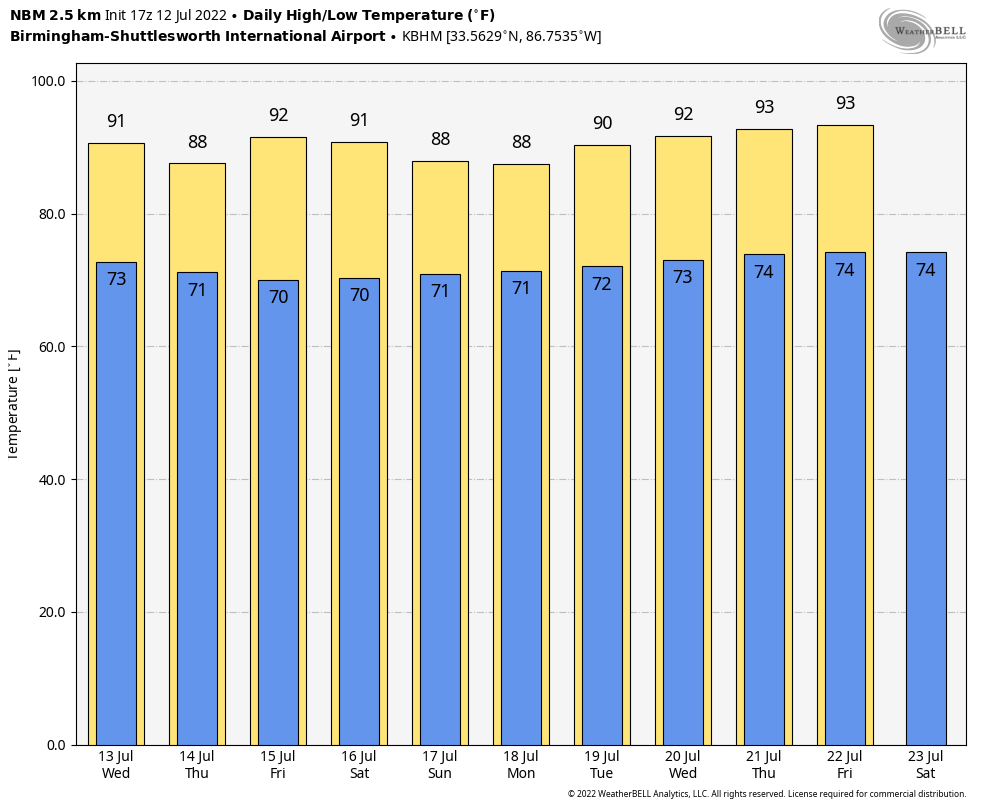
TROPICS: A couple of weak low-pressure systems embedded along a surface trough are producing disorganized showers and thunderstorms over the northern Gulf of Mexico, with some of that activity now spreading inland over the Florida Panhandle. The surface trough is expected to meander near the northern Gulf Coast through the end of the week, but gradual development will be possible only if it remains over water during that time. Regardless of development, heavy rains will pose a risk of flash flooding along portions of the northern Gulf coast from Louisiana to the Florida Panhandle over the next several days.
The National Hurricane Center has dropped the chance of development over the next five days to 20%. If you are headed to the central Gulf Coast over the next few days, the sun will be out at times and days won’t be a total washout. But shower and thunderstorm coverage will be higher than usual through the end of the week.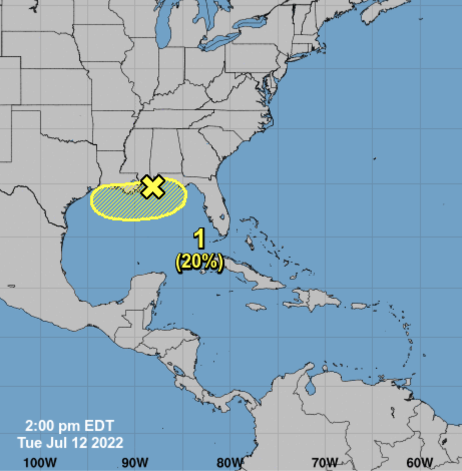 The rest of the Atlantic basin remains very quiet.
ON THIS DATE IN 1995: An intense heat wave affected much of the Midwest for a four-day period beginning on this day. The worst effects of the heat were in the Chicago metropolitan area, where 583 people died from the heat. Temperatures across the region reached as high as 104 degrees.
BEACH FORECAST: Click here to see the AlabamaWx Beach Forecast Center page.
For more weather news and information from James Spann and his team, visit AlabamaWx.


