James Spann: More hot, muggy summer weather ahead for Alabama
James Spann has a muggy midweek forecast for Alabama from Alabama NewsCenter on Vimeo.
ISOLATED SHOWERS LATER TODAY: Hot, humid summer weather continues across Alabama today and Thursday with partly sunny days, fair nights and a few pop-up afternoon and evening showers and storms. Odds of any one spot seeing rain both days are 15-25%, and highs will be between 90 and 95 degrees, which is what you expect in late July.
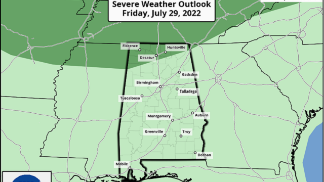
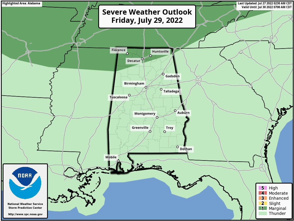
FRIDAY AND THE WEEKEND: Scattered showers and storms should become more numerous over the northern half of the state Friday afternoon as a weak surface front moves down toward the Alabama/Tennessee border. It won’t rain everywhere, but a number of summer soakers are likely from about 2 until 10 p.m. The high Friday will be between 88 and 92 degrees. The Storm Prediction Center has the far northern part of the state in a marginal risk (level 1 out of 5) of severe thunderstorms Friday due to the potential for strong winds. South Alabama will be hotter and drier, with only isolated showers.
For the weekend, the higher coverage of scattered showers and storms will remain over the northern half of the state. Otherwise, look for partly sunny days with highs close to 90 degrees. The chance of any one location getting wet is 55-65% over the northern counties Friday, dropping to 30-40% Saturday and Sunday.
NEXT WEEK: Looks like routine summer weather through the week as August begins — hot, humid days with scattered, mostly afternoon and evening showers and storms. Highs will be in the low to mid 90s. TROPICS: Conditions remain very calm across the Atlantic basin, and tropical storm formation is not expected through the next five days.
RAIN UPDATE: Here are rain totals since Jan. 1, and the departure from average:
- Birmingham — 45.88 inches (10.87 inches above average)
- Mobile — 37.15 (2.56 inches below average)
- Tuscaloosa — 35.97 (3.92 above average)
- Huntsville — 35.2 (2.23 above average)
- Anniston — 34.2 (1.8 above average)
- Montgomery — 33.41 (2.42 above average)
- Dothan — 33.05 (1 inch above average)
- Muscle Shoals — 32.94 (0.22 below average)
ON THIS DATE IN 1819: A hurricane affected the coast from Louisiana to Alabama. New Orleans was on the fringe of the storm and suffered no severe damage. Ships at the Balize experienced a strong gale for 24 hours that grounded three ships. Lakes Pontchartrain and Borgne rose 5 to 6 feet during the storm, with farms along the lakes flooded by the storm tide. Forty-one lives were lost on the U.S. man-of-war schooner Firebrand, a 150-ton gunship, while it lay off the west end of Cat Island.
ON THIS DATE IN 1943: A “surprise” Category 2 hurricane moved ashore near Galveston, Texas. Because of World War II, all news underwent censorship, including any weather reports, making this the surprise storm. The hurricane killed 19 people and caused millions of dollars in damages. Lt. Col. Joe Duckworth and Lt. Ralph O’Hair flew an AT-6 Texan into the eye of the hurricane, the first flight into the eye of a storm.
BEACH FORECAST: Click here to see the AlabamaWx Beach Forecast Center page.
For more weather news and information from James Spann and his team, visit AlabamaWx.


