James Spann: Alabama stays dry through next week; next chance of rain 10-15 days away
James Spann forecasts more dry October weather for Alabama from Alabama NewsCenter on Vimeo.
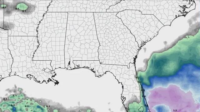
DRY: Alabama’s weather just won’t change too much through the weekend, with sunny days and fair nights. Afternoon temperatures will reach the low 80s through Friday, but a cooler air mass arrives over the weekend, with highs dropping into the mid 70s Saturday and Sunday. Sunday morning will be very cool, with a low well down in the 40s for most places; some of the colder spots could reach the upper 30s over north Alabama.
NEXT WEEK: Dry conditions continue with highs between 77 and 83 degrees most afternoons. Long-range guidance suggests our next chance of rain around here will be sometime in the Oct. 15-20 time frame.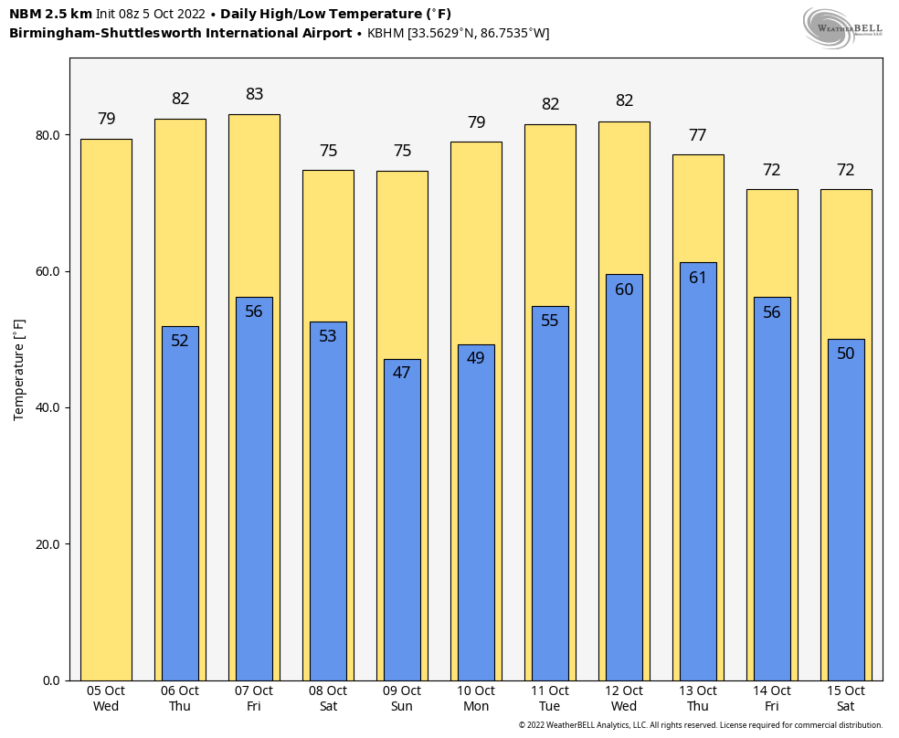 Some notes on the dry conditions (based on data at Birmingham):
- Today will be the 10th consecutive day with no measurable rain.
- Our last measurable rain was on Sept. 25, but the amount was only 0.03 inch.
- We have gone without measurable rain on 24 of the last 25 days.
- The last day with more than one-tenth of an inch of rain was Sept. 4, when the total was 1.55 inches.
FOOTBALL WEATHER: Expect another delightful evening for high school football games across the state Friday night; the sky will be clear with temperatures falling through the 60s.
Auburn travels to Athens Saturday to take on the Georgia Bulldogs (2:30 p.m. CT kickoff). The sky will be sunny and the temperature about 77 degrees at kickoff, falling into the low 70s by the final whistle.
UAB has a home game in downtown Birmingham Saturday at Protective Stadium against Middle Tennessee (also a 2:30 p.m. kickoff). It will be a sunny afternoon with temperatures falling from around 75 degrees at kickoff to near 70 by the final whistle.
Saturday night, Alabama hosts Texas A&M (kickoff at 7) at Bryant-Denny Stadium in Tuscaloosa. The sky will be clear with temperatures falling from 67 degrees at kickoff into the 50s by the fourth quarter. It will be a perfect night for football.
TROPICS: Tropical Depression 12 formed Tuesday in the eastern Atlantic; it’s a junk system that will likely dissipate later today far from land before reaching tropical storm strength.
Invest 91L is a tropical wave just east of the Windward Islands. It continues to produce a large area of showers and thunderstorms. Satellite-derived wind data and radar images from Barbados indicate that this system does not yet have a well-defined circulation center. However, upper-level winds are forecast to become more conducive for development, and a tropical depression is likely to form over the next several days if the system remains over open waters while moving generally westward at about 15 mph through the Windward Islands and into the Caribbean Sea. An Air Force reconnaissance mission is scheduled to investigate the system this morning, if necessary.
Most likely this system is headed for Central America in five days or so; long-range global model guidance suggests the remnants then will likely emerge into the eastern Pacific Ocean. It’s still too early to know the final destination or intensity.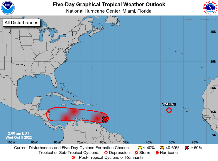 ON THIS DATE IN 1972: Tropical Storm Joanne, earlier a hurricane, moved across the Baja California peninsula and came ashore in western Mexico south of Ajo. The storm brought heavy rain and flooding to much of Arizona. This storm is the first documented tropical storm to reach Arizona with its cyclonic circulation intact. More than 5 inches of rain was reported on the Mogollon rim southeast of Flagstaff.
BEACH FORECAST: Click here to see the AlabamaWx Beach Forecast Center page.
For more weather news and information from James Spann and his team, visit AlabamaWx.


