James Spann: Alabama still dry today; rain at times over the weekend
James Spann forecasts another beautiful day for Alabama before rain returns from Alabama NewsCenter on Vimeo.
ONE MORE SUNNY DAY: We are forecasting a high in the mid 70s across Alabama today with a good supply of sunshine. Clouds will increase late tonight ahead of a disturbance that will bring some rain to the state over the weekend.
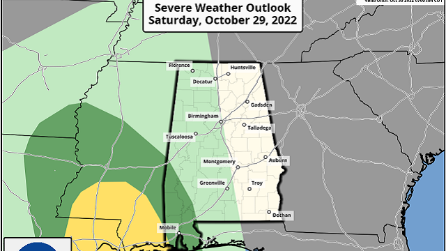
SATURDAY/SUNDAY: Saturday will feature a mostly cloudy sky, but much of the state will remain dry during the day. Some rain will likely begin over the western counties during the afternoon, however, and a strong storm can’t be ruled out over the southwest corner of the state. The Storm Prediction Center maintains a low-end marginal risk (level 1 out of 5) of severe thunderstorms Saturday afternoon and evening in a zone from near Butler down to the Alabama Gulf Coast.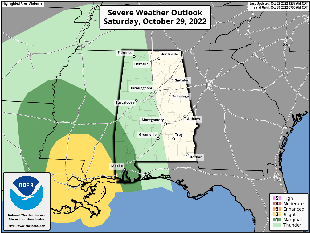 The main risk from heavier storms over southwest Alabama will come from strong, gusty winds. But for the rest of Alabama there is very little surface-based instability, and there will be little thunder. Periods of rain are likely statewide Saturday night into Sunday morning; then a dry slot works into the state Sunday afternoon, which should shut down the rain. Amounts of around 1 inch are likely over the western half of the state, with amounts of one-half to 1 inch for the eastern counties.
The high will be between 71 and 74 degrees Saturday, followed by upper 60s Sunday.
NEXT WEEK: Clouds will linger at times Monday, and some patchy, light rain can’t be ruled out, but there’s a decent chance most of the state will be dry for the trick-or-treaters during the evening. Tuesday will be dry, but a fast-moving disturbance will bring a few showers on Wednesday. Rain-free weather looks likely Thursday and Friday; highs will be in the 70s through the week.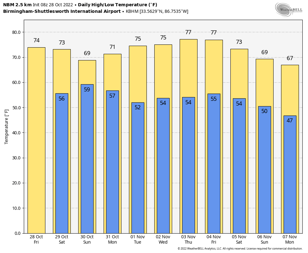 There’s no sign of any freezing temperatures across Alabama and the Deep South through mid-November at this point.
FOOTBALL WEATHER: For tonight’s high school games across Alabama, the sky will be mostly fair with temperatures falling from the low 70s at kickoff into the 60s by the second half.
Saturday Auburn hosts Arkansas (11 a.m. kickoff) at Jordan-Hare Stadium; the sky will become mostly cloudy during the game, but we expect the weather to stay dry. Temperatures will rise from near 68 at kickoff into the low 70s during the second half.
The Magic City Classic (Alabama A&M vs. Alabama State) is Saturday at Birmingham’s Legion Field (2:30 p.m. kickoff). The sky will be mostly cloudy with temperatures hovering around 70 degrees during the first half, falling into the upper 60s by the final whistle. Some light rain can’t be ruled out toward the end of the game.
UAB is at Florida Atlantic in Boca Raton Saturday night (6 p.m. kickoff). The sky will be clear with temperatures falling from near 80 degrees at kickoff into the mid 70s by the final whistle.
TROPICS: A trough of low pressure over the southwestern Atlantic Ocean continues to produce a broad area of disorganized showers and thunderstorms. A surface low-pressure system is forecast to emerge along the northern portion of the trough axis, and some subsequent development could occur through Saturday. By late Saturday, upper-level winds are forecast to become less conducive for development, and the low is expected to begin interacting with an approaching frontal system. This feature will remain well east of the U.S.
An area of low pressure is expected to form over the eastern Caribbean Sea this weekend, possibly related to the southern portion of an existing trough of low pressure over the area. Environmental conditions are forecast to be conducive for gradual development, and a tropical depression could form early next week while the disturbance moves generally westward or west-northwestward over the central Caribbean Sea. It’s still too early to know whether this will affect any land areas.
ON THIS DATE IN 2020: Hurricane Zeta made landfall at Cocodrie, Louisiana, as a Category 3 storm with sustained winds of 115 mph. Zeta produced widespread wind gusts over 40-50 mph across much of Alabama, with some locations experiencing gusts of 50-70 mph. These strong winds caused widespread tree and power-line damage across southwest, south-central and east-central parts of the state. Alabama Power reported at least 494,000 outages across the state at one point.
BEACH FORECAST: Click here to see the AlabamaWx Beach Forecast Center page.
For more weather news and information from James Spann and his team, visit AlabamaWx.


