James Spann: Severe storms possible in Alabama Tuesday night, early Wednesday
James Spann forecasts potential severe weather for Alabama Tuesday night from Alabama NewsCenter on Vimeo.
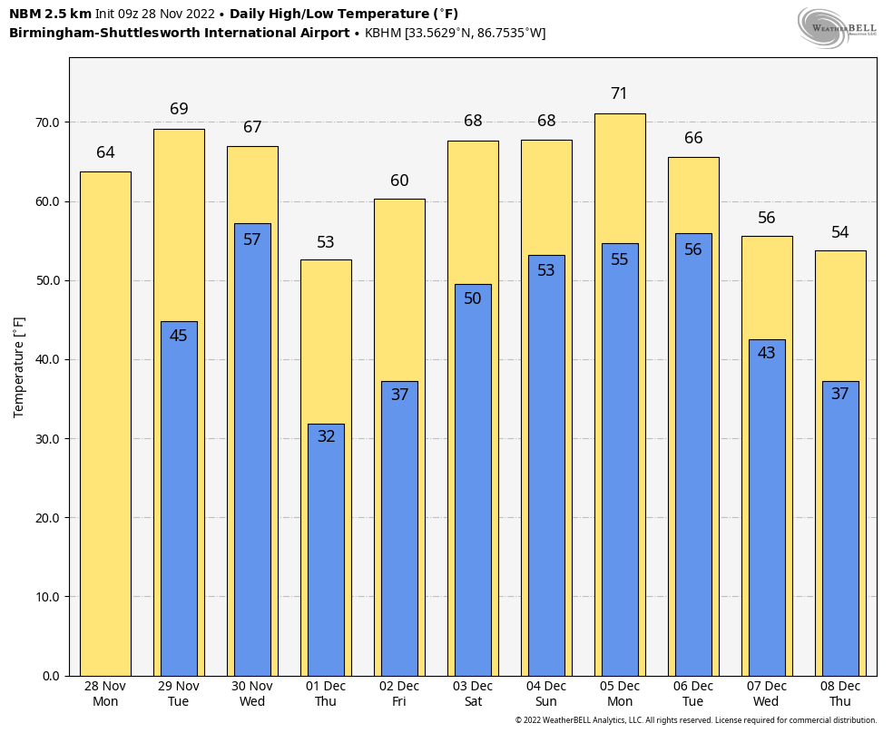
DRY TODAY: With a good supply of sunshine, we project a high in the mid 60s this afternoon across the northern half of Alabama; some south Alabama communities will see low 70s. Clouds increase Tuesday ahead of a storm system, and a few showers could break out by late afternoon as moisture levels rise quickly. The high will be between 67 and 71 degrees.
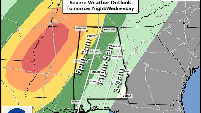
SEVERE STORMS TUESDAY NIGHT: We have potential for strong to severe thunderstorms over Alabama Tuesday night into early Wednesday morning. The Storm Prediction Center has defined an enhanced risk (level 3 of 5) for the northwest corner of the state around the Shoals; there is a slight risk (level 2) as far east as Decatur, Jasper and Livingston, and a marginal risk (level 1) over to Fort Payne, Calera, Jackson and Mobile.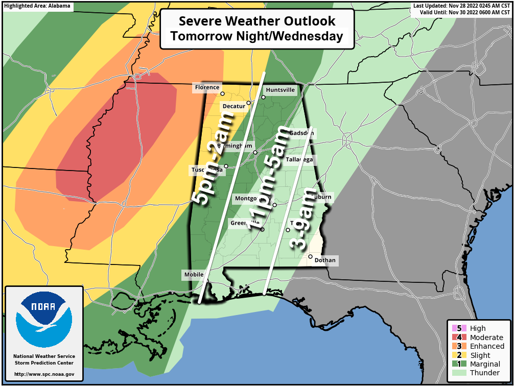
A marginal risk continues after 6 a.m. Wednesday for southeast Alabama.
TIMING: A few severe storms are possible across far west Alabama as early as 5-8 p.m. Tuesday, but the core threat for the western counties of the state will come from 8 p.m. until 2 a.m. The severe weather threat will shift into east and southeast Alabama before dawn Wednesday.
THREATS: Storms over west Alabama Tuesday night will be capable of producing large hail, damaging wind and a few tornadoes. The threat for east Alabama is primarily from strong thunderstorm winds.
WIND: Away from thunderstorms, pressure gradient winds will average 15-25 mph Tuesday night, with potential for gusts to 40 mph in spots.
RAIN: Amounts of 1-2 inches are likely; flooding is not expected.
BE PREPARED: For most of Alabama, the core threat will come during the late night and early morning, meaning you have to have a reliable way of getting warnings if they are needed. The best way is a NOAA Weather Radio; every home and business needs one. Be sure Wireless Emergency Alerts are enabled on your phone and have the free ABC 33/40 weather app installed. Know the safe place in your home and have helmets for everyone there. If you live in a mobile home, know the location of the nearest shelter, or a business open 24/7 that can provide shelter, and also know the quickest way to get there. Have transportation available.
There is some uncertainty in how this event unfolds. The best-chance situation is that a large area of rain develops Tuesday night before the arrival of the best dynamic support. This could keep instability low and really reduce the risk of severe storms. But there is no guarantee that happens, and we all have to be ready.
REST OF THE WEEK: The sky will clear Wednesday, and colder air arrives, with a high in the 50s over the northern half of the state. Most places across north and central Alabama will drop into the 27- to 32-degree range early Thursday morning, with mid 30s for south Alabama. Thursday and Friday will feature a sunny sky; the high will be in the 50s Thursday, followed by 60s Friday.
THE ALABAMA WEEKEND: Moisture levels will rise, and we need to mention the chance of showers over the northern half of the state both Saturday and Sunday. For now, it doesn’t look like a big rain event, and the weekend certainly won’t be a washout. Highs over the weekend will be between 67 and 73 degrees with more clouds than sun.
NEXT WEEK: Global models suggest a chance of showers in the Tuesday-Wednesday time frame, followed by cooler, drier air over the latter half of the week. Highs will be in the upper 60s and low 70s Monday and Tuesday, then in the 50s and 60s Wednesday through Friday.
 ON THIS DATE IN 1921: New England was in the midst of a four-day ice storm, its worst on record. Ice was more than 3 inches thick in many places following the storm, and property damage was in the millions of dollars. Northern New England received heavy snow, with more than 2 feet reported in some areas. Overnight freezing rains continued through the day at Worcester, Massachusetts, while the wind increased to a gale. Streets become impassable even on foot, and whole towns were plunged into darkness without communication. The storm caused $20 million damage to power lines, telephone lines and trees.
BEACH FORECAST: Click here to see the AlabamaWx Beach Forecast Center page.
For more weather news and information from James Spann and his team, visit AlabamaWx.


