James Spann: Clouds linger over Alabama tonight; a few flurries possible
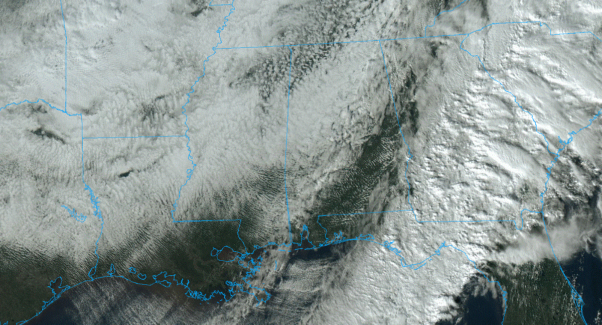
COLD WINTER DAY: Clouds cover much of Alabama this afternoon, although we are seeing some sun over parts of east and south Alabama. Temperatures have been slowly falling since this morning; we have 40s over the northern counties of the state, with 50s to the south. We will maintain the chance of a few sprinkles or snow flurries tonight over north and central Alabama, but if we see a snowflake or two there won’t be any impact.
The day Thursday will feature a mix of sun and clouds with highs in the 40s over north Alabama, with 50s to the south.
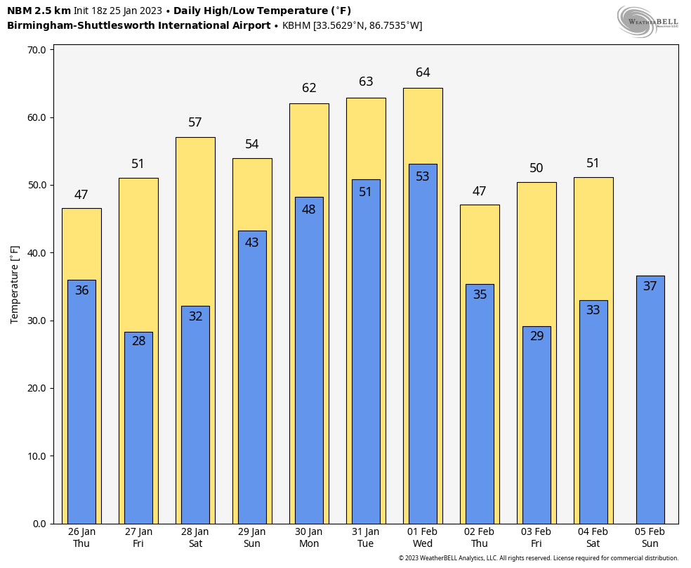
FRIDAY AND THE WEEKEND: Friday will be sunny. After a subfreezing start, highs will be in the 50s and 60s. Dry weather continues Saturday with seasonal temperatures, but a disturbance will bring periods of rain Sunday. There could be some thunder, but there is no risk of severe thunderstorms.
NEXT WEEK: For now it looks like we get in the rain Monday, but occasional rain is likely statewide Tuesday and Wednesday. Colder, drier air rolls into the state Thursday and Friday.
 TWO YEARS AGO TODAY: An EF-3 tornado moved through Fultondale, just north of downtown Birmingham, killing one person (14-year-old Elliott Hernandez) and injuring about 30 more.
The parent storm was first tracked from near Interstate 55 in central Mississippi. As the storm moved across Mississippi and into west Alabama, it exhibited episodes of rotation, but none strong enough to produce a tornado.
As the storm entered Jefferson County, its structure underwent organization. A rotational signature quickly matured, and a tornado warning was issued at 10:34 p.m. About 10 minutes later, the tornado started to produce damage.
The tornado began along Chapel Hills Parkway, where minor shingle damage occurred. It tracked northeastward across Ellard Road and directly over the Walker Chapel Road overpass on Interstate 65. At this interstate exit the tornado began to intensify rapidly, snapping numerous power poles and causing substantial damage to a hotel.
It continued northeastward, crossing U.S. 31, causing mostly tree damage along the highway. As the tornado moved into residential areas along Fulton Drive and Lykes Boulevard, substantial damage occurred, with several homes being destroyed and at least one being swept off the foundation.
As the tornado continued toward the northeast, it paralleled Carson Road and caused substantial damage to homes along Meida Circle, Darlene Drive and New Castle Road. Buildings in an industrial area along Carson Road were damaged, including a fleet of vehicles at Hurst Towing. The damage along New Castle Road was widespread, with a few trees debarked or snapped halfway down the trunk and debris from homes thrown considerable distances.
The tornado was down for 10.4 miles, and the maximum path width was 900 yards.
NEXT WEEK: For now it looks like we get in the rain Monday, but occasional rain is likely statewide Tuesday and Wednesday. Colder, drier air rolls into the state Thursday and Friday.
BEACH FORECAST: Click here to see the AlabamaWx Beach Forecast Center page.
For more weather news and information from James Spann and his team, visit AlabamaWx.


