James Spann: Dry day ahead for Alabama; unsettled weather Wednesday-Friday
James Spann forecasts a beautiful Tuesday for Alabama, then unsettled weather from Alabama News Center on Vimeo.
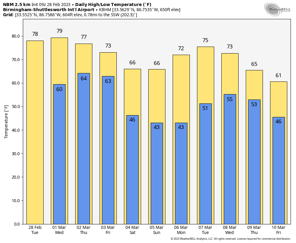
BEAUTIFUL DAY AHEAD: Today is the last day of meteorological winter, and the day will feature a good supply of sunshine for Alabama with a high in the 70s for the northern counties; low 80s are likely again for the southern quarter of the state.
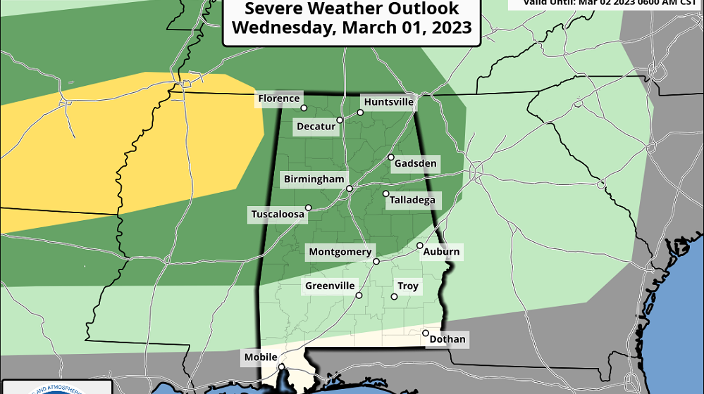
WEDNESDAY: Moist air returns, and scattered showers and storms will form during the afternoon and evening. Where thunderstorms form, they will be strong, with potential for hail and strong, gusty winds. The Storm Prediction Center (SPC) has the northern two-thirds of Alabama in a marginal risk (level 1 out of 5) of severe thunderstorms.
Otherwise, expect a mix of sun and clouds with a high around 80 degrees.
THURSDAY: The day will feature more clouds than sun, and a few showers and thunderstorms are possible. A strong storm can’t be ruled out during the afternoon and evening as the air will be unstable, but the main dynamic support from the next system will remain to the west, and for now the risk of organized severe storms Thursday looks low (but not zero).
FRIDAY: We expect a fast-moving line of severe storms to move through the state Friday morning in the general window from 4 until 11 a.m. The SPC has most of the state (except the southwest corner) in a severe weather risk.
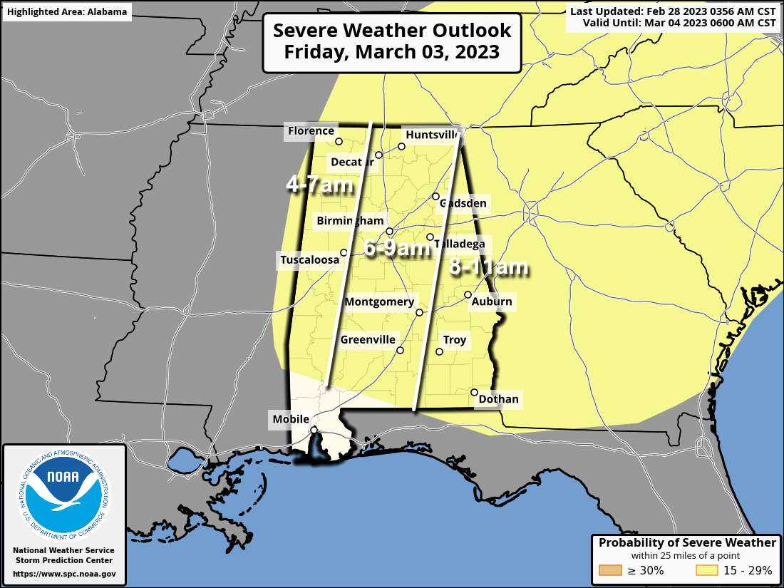
The greatest concern with this line will be from damaging winds, but an isolated tornado is certainly possible as well. It will be a very rough start to the day, and everyone will need to be sure they can hear warnings. Be sure and pay attention to severe thunderstorm warnings Friday morning.
In addition to damaging thunderstorm winds, pressure gradient winds (not related to thunderstorms) could gust to 40-45 mph at times. This means power outages are likely Friday morning. The storms will race into Georgia by late morning, and the sky will begin to clear Friday afternoon. The high Friday will be between 67 and 73 degrees.
THE ALABAMA WEEKEND: The weekend will be dry with sunny days and clear nights. Highs will be mostly in the 60s, lows between 37 and 44 degrees for most communities.
NEXT WEEK: For now, much of the week looks dry with highs in the 60s.
ON THIS DATE IN 1952: A powerful Nor’easter hit Cape Cod with winds of 70-80 mph and snowfall amounts of 12-20 inches. These conditions created 12-foot drifts.
ON THIS DATE IN 2011: Four tornadoes touched down across central Alabama, affecting parts of Lowndes, Autauga, Elmore, Chambers and Talladega counties. There were no injuries.
BEACH FORECAST: Click here to see the AlabamaWx Beach Forecast Center page.
For more weather news and information from James Spann and his team, visit AlabamaWx.


