James Spann: Showers for Alabama Wednesday, a few strong storms Thursday
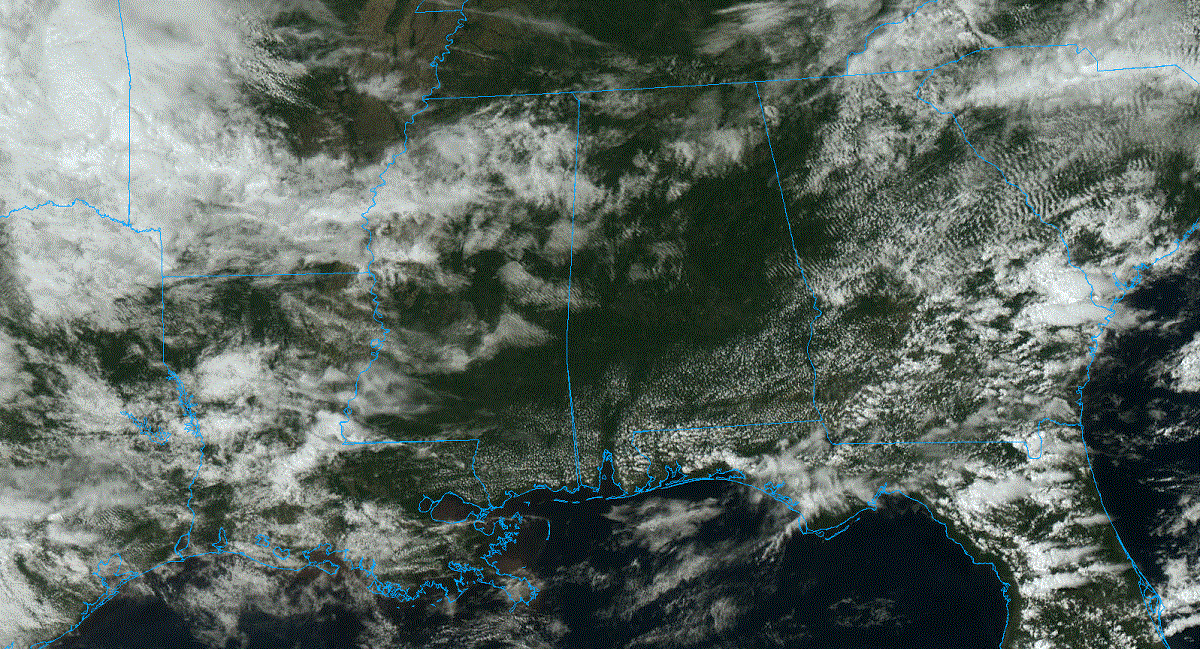
DRY APRIL DAY: The sky is partly to mostly sunny across Alabama this afternoon with temperatures mostly in the 70s; Mobile had reached 81 degrees at 2 p.m. Clouds will increase tonight.
We will bring in the chance of showers Wednesday as moisture levels rise. It won’t rain all day, and nothing too heavy. Otherwise, Wednesday will be mostly cloudy with a high in the 70s.
THURSDAY: A wave aloft will bring showers and thunderstorms to the state Thursday. The Storm Prediction Center has introduced a low-end, marginal risk of severe thunderstorms for the southern three-quarters of the state, areas south of a line from Hamilton to Cullman to Gadsden.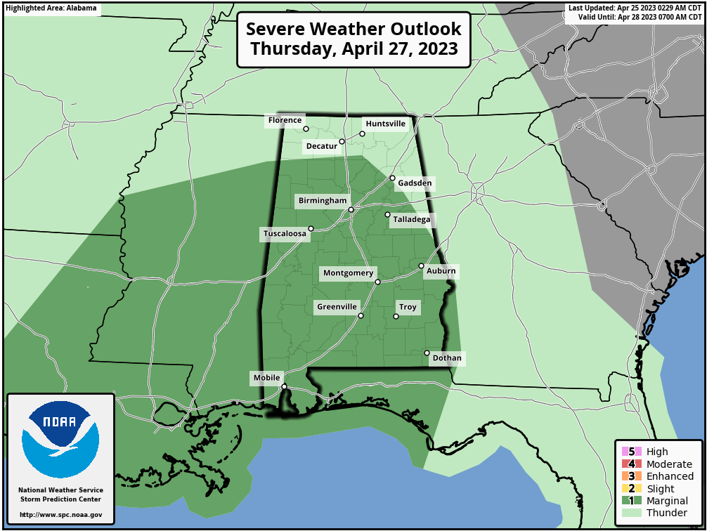 A few of the stronger storms could produce small hail and gusty winds, but a tornado threat is not expected with the best dynamic support displaced to the north, away from the better instability. New high-resolution model data suggests the main chance of rain will come from about 8 a.m. until 3 p.m.; highs will hold in the 70s.
FRIDAY AND THE WEEKEND: Friday will feature more clouds than sun, and we can’t rule out a few lingering showers during the morning as a fairly moist air mass will remain in place across Alabama. But a decent part of the day will be dry.
New model data suggests the weekend will begin with a dry Saturday; the sky will be partly to mostly sunny with a high in the mid 70s. Clouds will increase late in the day, and some rain is possible at times Saturday night and Sunday. Models are trending drier, suggesting mostly light rain amounts and no risk of strong storms.
NEXT WEEK: While much of the week looks dry for now, we will mention a chance of showers Tuesday night into Wednesday morning as a wave passes through the region. Highs will be generally in the 70s.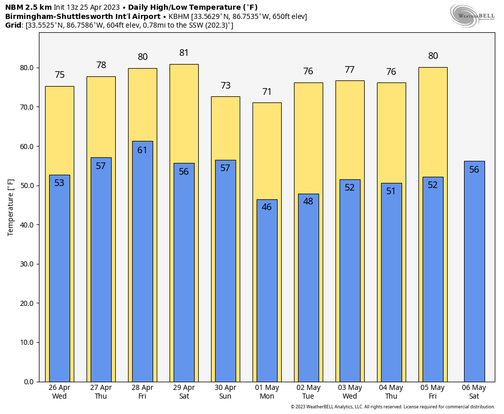 We see no high-impact severe weather threat for Alabama for the next seven to 10 days, despite being in the core of the spring segment of the tornado season.
ON THIS DATE IN 1880: A violent tornado, at times up to 400 yards wide, swept away at least 20 homes in Macon, Mississippi. Pieces of houses were found 15 miles away. Twenty-two people died and 72 were injured. Loaded freight cars were thrown 100 yards into homes. Clothes were carried for eight miles.
ON THIS DATE IN 1990: Thunderstorms produced severe weather from Texas to Nebraska. The storms spawned 15 tornadoes, including a powerful F4 tornado near Weatherford, Texas. Between 3 p.m. and 8 p.m., a storm complex tracking northeastward across central Kansas spawned four tornadoes along a 119-mile path from Ness to Smith Center, with the last tornado on the ground for 55 miles.
For more weather news and information from James Spann and his team, visit AlabamaWx.


