James Spann: Another day of showers, strong storms for Alabama
James Spann forecasts more rain and storms for Alabama from Alabama News Center on Vimeo.
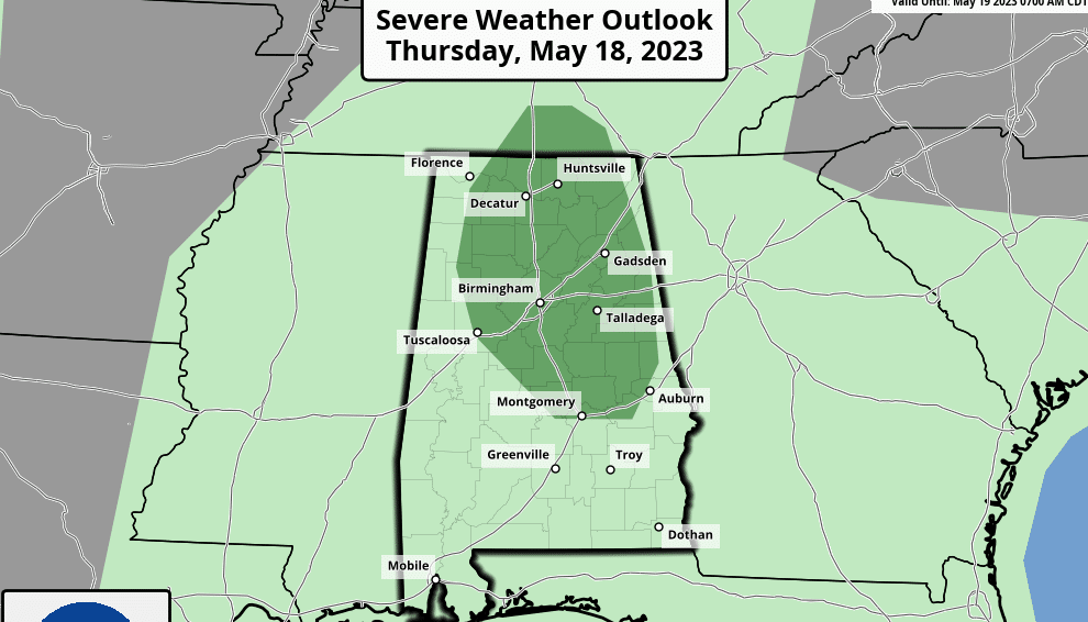
NEW DAY, OLD FORECAST: Alabama’s weather won’t change much today. Scattered showers and storms will form later today and early tonight in the humid air across the state. The Storm Prediction Center (SPC) has a marginal risk (level 1 of 5) in place for many of the northern and central counties.
Like recent days, heavier storms this afternoon and early tonight will produce small hail, strong, gusty winds, heavy rain and lots of lightning. Storms will diminish after sunset. Otherwise, today will be occasionally cloudy with a high between 77 and 82 degrees. The average high for Birmingham on May 18 is 83.
Scattered showers and storms will form again Friday, but they are expected to be fewer in number. With a partly sunny sky the high will remain in the upper 70s and low 80s. The chance of any one spot getting wet is 40-50%.
THE ALABAMA WEEKEND: A cold front will bring scattered to numerous showers and thunderstorms to the state Saturday. It won’t rain all day, but a few passing showers or storms are likely for any given spot. The SPC has much of the state in a marginal risk (level 1) of severe thunderstorms for the potential for small hail and strong, gusty winds.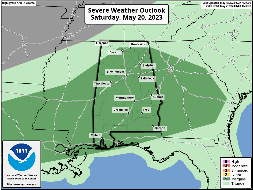 The sky will be mostly cloudy Saturday with a high around 80 degrees. Then, drier air moves into the northern two-thirds of the state Sunday; the day will be mostly sunny there with lower humidity. A few showers will remain possible, mainly over the southeast corner of Alabama. Sunday’s high will be in the low 80s.
NEXT WEEK: The week generally looks quiet and drier for the Deep South. Still, a few scattered showers or storms are possible Monday, followed by only isolated showers for the rest of the week. Highs will be mostly in the 80s, with lows in the 60s.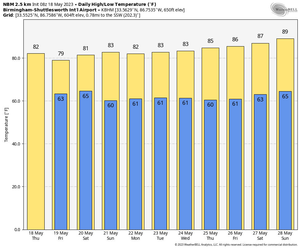 ON THIS DATE IN 1883: The massive tornado outbreak on record in Illinois affected the northern and central parts of the state. At least 14 strong to violent tornadoes touched down, killing 52 people.
ON THIS DATE IN 1980: Mount Saint Helens erupted, spewing ash and smoke 63,000 feet into the air. Heavy ash covered the ground to the immediate northwest, and small particles were carried to the Atlantic coast.
ON THIS DATE IN 1995: In the warm, humid late afternoon, a tornado touched down just northwest of Athens. It tracked from that point through eastern Limestone County, through Harvest, Meridianville and New Market in northern Madison County and ended near Princeton in northwest Jackson County. The strongest portion of the tornado’s path was near Harvest in northwest Madison County around the Anderson Hills subdivision and the Huntsville Dragway, which is the reason it is usually referred to as the “Anderson Hills Tornado.” One person was killed and 55 others injured; the tornado was rated F4 on the Fujita Scale.
For more weather news and information from James Spann and his team, visit AlabamaWx.


