James Spann: Mix of sun, strong storms for Alabama
James Spann forecasts highs around 90, scattered afternoon storms for Alabama this week from Alabama News Center on Vimeo.
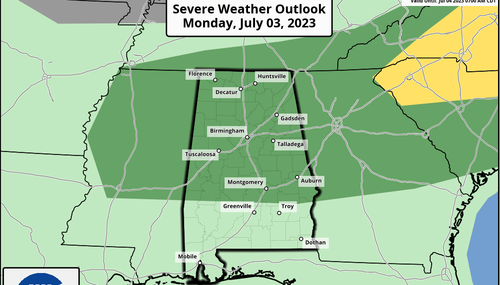
SUMMER MIX: Alabama’s weather won’t change much through the week as we are forecasting the usual mix of sun and scattered showers and thunderstorms daily. We note a few storms on radar early this morning over north Alabama, but most of the activity will come during the afternoon and evening. The Storm Prediction Center has the northern two-thirds of the state in a marginal risk (level 1 out of 5) of severe thunderstorms.
Like Sunday, heavier thunderstorms will be capable of producing hail and strong, potentially damaging winds. The chance of any one spot getting wet today is 30-40%, and the high will be in the low 90s. The average high for Birmingham on July 3 is 90.
Expect the same conditions through the week, with morning sun and afternoon storms. The storms will be random and scattered, so it won’t rain everywhere, but where the storms form, they could produce strong winds and hail. Most (but not all) of the showers and storms will come from 2 until 9 p.m., and the odds of any one given location seeing rain daily are 40-60%. Highs will remain at or just over 90 degrees.
THE ALABAMA WEEKEND: Look for partly sunny days with scattered, mostly afternoon and evening showers and thunderstorms Saturday and Sunday with highs in the low 90s — exactly what you expect in Alabama in summer.
NEXT WEEK: We will stick with a persistence forecast — the risk of random, scattered afternoon and evening storms daily; otherwise, partly sunny days and mostly fair nights with highs in the low 90s.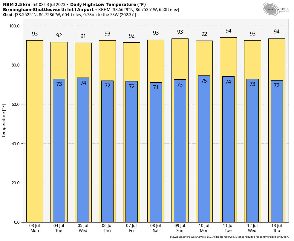 TROPICS: The Atlantic basin is very quiet, and tropical storm formation is not expected this week.
ON THIS DATE IN 1975: Up to 3 inches of rain caused flash flooding throughout Las Vegas. The main damage occurred to vehicles at Caesars Palace, with approximately 700 damaged or destroyed and several cars found miles away. North Las Vegas was hardest hit, with $3.5 million in damage. Two people drowned in the flood waters.
ON THIS DATE IN 2014: Hurricane Arthur made landfall at 3:15 UTC over North Carolina’s Shackleford Banks, positioned between Cape Lookout and Beaufort at Category 2 strength with winds of 100 mph. It was the earliest known hurricane to make landfall in North Carolina during the calendar year.
For more weather news and information from James Spann and his team, visit AlabamaWx.


