James Spann: Scattered storms return to Alabama statewide later this week
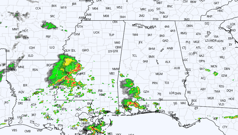
RADAR CHECK: Showers and storms are confined to the southwest counties of Alabama this afternoon. Otherwise, the sky is partly to mostly sunny with temperatures near 90 degrees. Storms over south Alabama will fade this evening, and tonight will feature a mostly fair sky with a low in the low 70s for most places.
Heat levels continue to rise Wednesday, with most communities reaching the mid 90s; the sky will be partly to mostly sunny with a few isolated storms possible over the western and southern counties, but much of east Alabama will stay dry.
THURSDAY THROUGH THE WEEKEND: We expect very routine summer weather — partly sunny, hot, humid days with random, scattered, mostly afternoon and evening showers and thunderstorms daily. Most of the storms will come in the 2-9 p.m. window, and the chance of any one spot getting wet daily is 40-50%. Afternoon highs will be in the low to mid 90s.
NEXT WEEK: We will stick with a persistence forecast as the classic summer pattern continues. A nasty heat ridge will be focused well to the west of Alabama; here, highs will be between 90 and 95 degrees most days with the usual risk of a pop-up thunderstorm during the afternoon and evening in random places.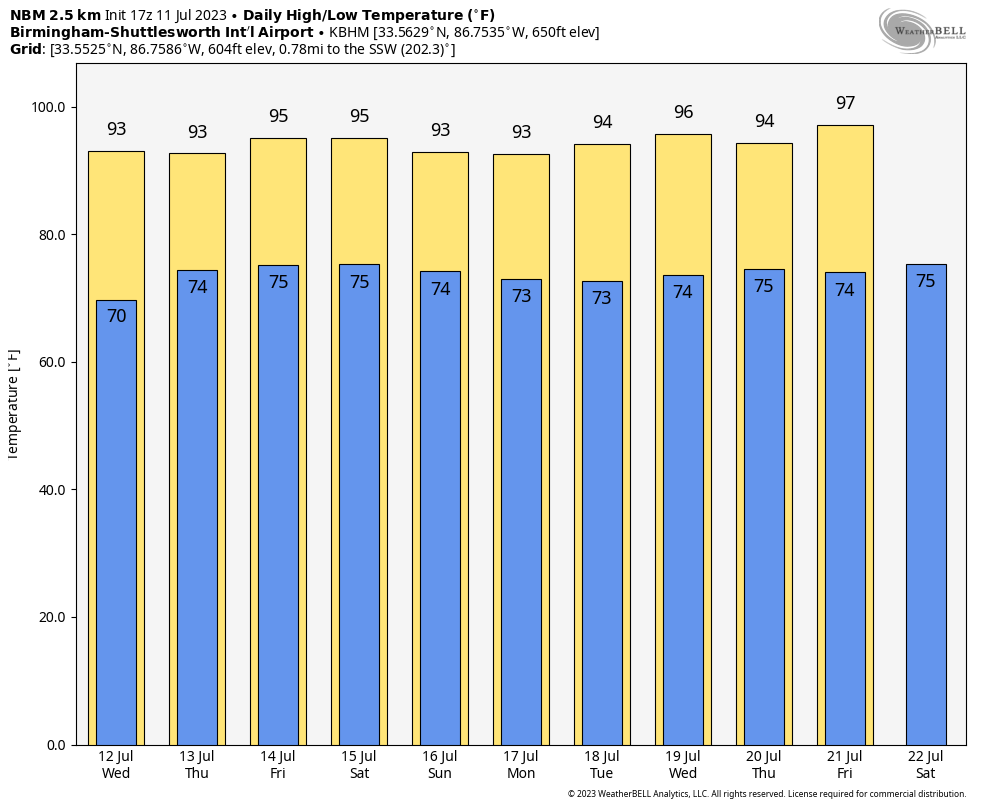 TROPICS: An area of low pressure is producing disorganized showers and thunderstorms several hundred miles east-northeast of Bermuda. Environmental conditions are forecast to be marginally conducive for some development of this system, and a subtropical or tropical depression could form during the next few days while the system moves generally eastward. By the weekend, the low should turn northward, bringing it over cooler waters and likely limiting additional development. This feature is far from land, and the National Hurricane Center gives it a 50% chance of development over the next seven days.
The rest of the Atlantic basin remains very quiet; no tropical systems are expected be anywhere near the U.S. or the Gulf of Mexico through the weekend.
ON THIS DATE IN 1936: From July 5 to July 17, temperatures exceeding 111 degrees in Manitoba and Ontario claimed 1,180 lives (mostly the elderly and infants) during the most prolonged, deadliest heat wave on record. Four hundred of these deaths were caused when people drowned seeking refuge from the heat. In fact, the heat was so intense that steel rail lines and bridge girders twisted, sidewalks buckled, crops wilted and fruit baked on trees.
ON THIS DATE IN 1990: The costliest hailstorm in U.S. history occurred along the Front Range of the Colorado Rockies (Denver). Softball-sized hail destroyed roofs and cars, causing more than $600 million in total damage.
For more weather news and information from James Spann and his team, visit AlabamaWx.


