James Spann: Heavy rain, strong thunderstorms possible for Alabama today
James Spann forecasts an active weather day for Alabama from Alabama News Center on Vimeo.
RADAR CHECK: A nearly stationary band of rain and storms has developed early this morning from the Tennessee Valley down into parts of east Alabama. These storms are very efficient rain producers, and flash flood warnings have been issued for parts of Lauderdale, Limestone, Morgan, Cullman, Blount and St. Clair counties. Some spots have received nearly 2 inches of rain since midnight.
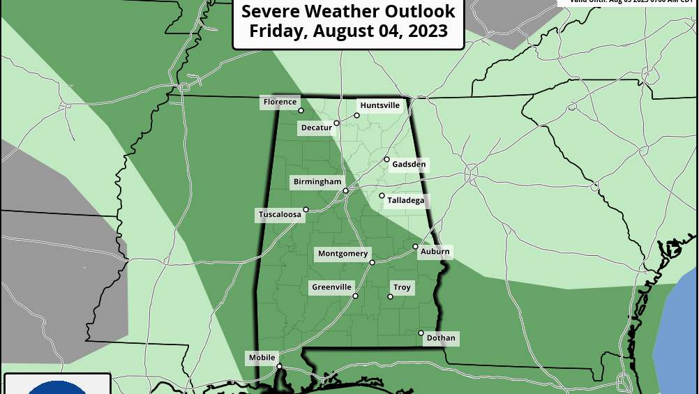
A flash flood watch remains in effect for much of north and east Alabama today, where rain will be heavier and more widespread. The Storm Prediction Center has defined a marginal risk (level 1 out of 5) of severe thunderstorms for roughly the southern three-fourths of the state.
The main concern with the heavier thunderstorms involves strong straight-line winds. On the positive side, highs will be only in the 80s today across much of north and east Alabama, thanks to rain and storms; temperatures reach the 90s south and west of Birmingham, where showers and storms will be fewer in number.
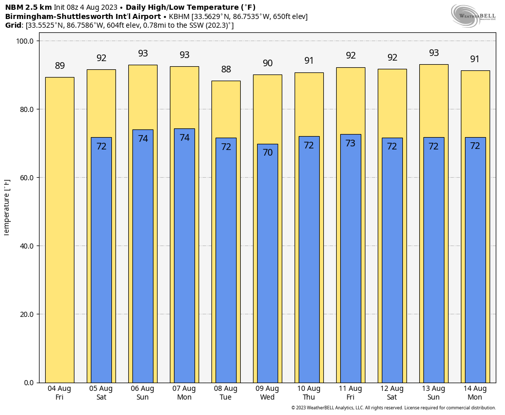
THE ALABAMA WEEKEND: We are looking at fairly routine summer weather Saturday and Sunday, with mixed sun and clouds and a few scattered, mostly afternoon and evening showers and thunderstorms. The chance of any one spot getting wet both days is 20-30%, and highs will be in the low 90s.
NEXT WEEK: The heat ridge will remain west of Alabama, and our weather won’t change much. Expect partly sunny days, scattered, mostly afternoon and evening showers and storms, and highs between 88 and 93 degrees through the week.
TROPICS: Tropical storm formation is not expected at least for the next seven days across the Atlantic basin as the remarkably quiet pattern continues.
ON THIS DATE IN 2008: Severe storms moved across northern Illinois and Indiana with tornadoes and strong winds. With tornado sirens blaring, the game at Wrigley Field between Cubs and Astros was stopped as fans were told to evacuate to the lower concourse. Passengers at O’Hare International Airport were evacuated to lower levels of buildings as well.
ON THIS DATE IN 2009: The strongest tornado to hit Quebec since the same date in 1994 ripped through Mont-Laurier. The F2 tornado tore through the small western Quebec town, severely damaging about 40 homes.
For more weather news and information from James Spann and his team, visit AlabamaWx.