James Spann: Alabama temperatures trend downward beginning Wednesday
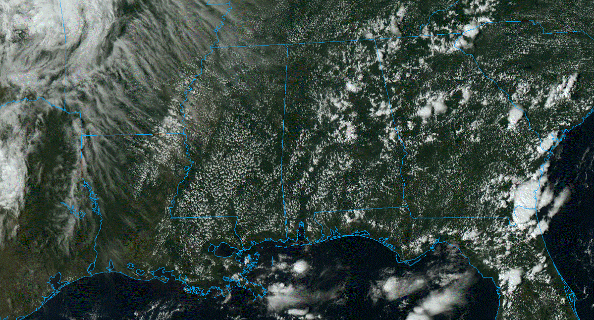
RADAR CHECK: We have a few isolated showers on radar this afternoon over the eastern half of the state; otherwise, the sky is partly to mostly sunny with temperatures between 87 and 93 degrees. Showers will end this evening, and tonight will be mostly fair with a low in the upper 60s and low 70s.
The weather won’t change much Tuesday, but showers could be a little more numerous during the afternoon with the approach of a surface front. Cooler air slips into the state over the latter half of the week, with highs dropping into the 81- to 85-degree range over the northern counties and upper 80s for south Alabama. The front will become nearly stationary, meaning we will maintain the chance of a few scattered showers daily, but nothing especially heavy or widespread.
THE ALABAMA WEEKEND: We will maintain the risk of a few showers over the weekend, but it certainly won’t be a washout, and the sun will be out at times. The chance of any one spot seeing rain is 25-35% Saturday and 50-60% Sunday. Highs will remain in the low 80s for north Alabama, with mid to upper 80s to the south.
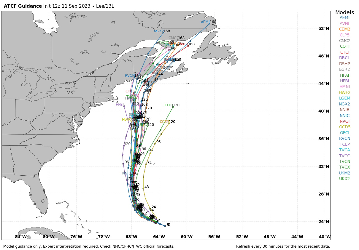
NEXT WEEK: While we will have a few days with scattered showers, we still don’t see any widespread, heavy, high-impact rain event through the week. Highs will be in the 80s, lows in the 60s.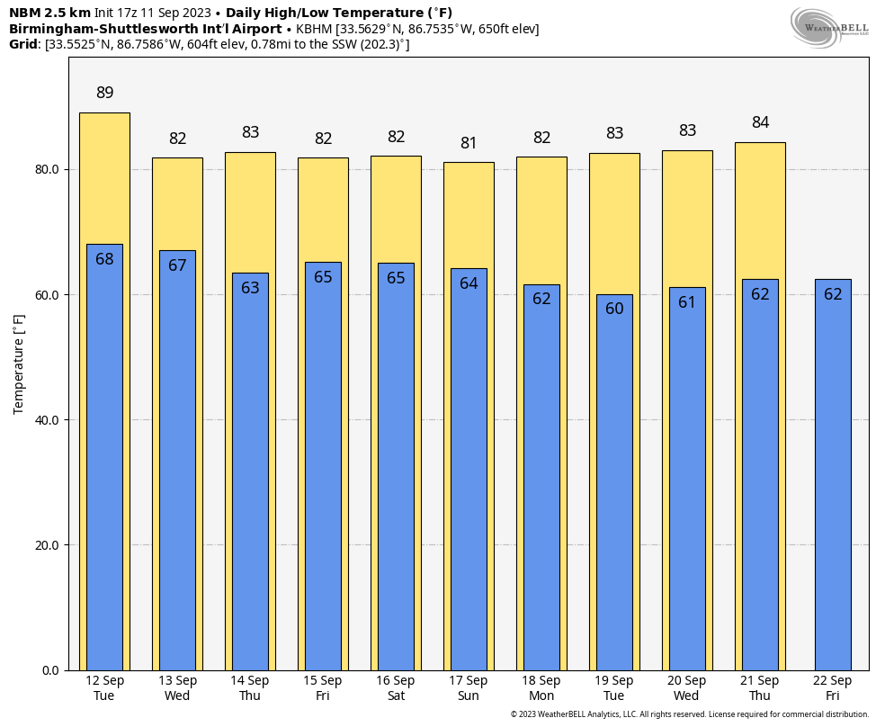 TROPICS: Hurricane Lee remains a Category 3 storm with winds of 120 mph, about 610 miles south of Bermuda. Fluctuations in strength are likely in the short term due to eyewall replacement cycles, but there is an opportunity for some strengthening during that time since the system is expected to remain over very warm waters and in relatively low wind-shear conditions. Beyond a couple of days, however, progressively cooler waters and a notable increase in shear should cause Lee to gradually weaken. Although the weakening is forecast later in the week, Lee is expected to significantly increase in size.
Lee will likely pass just east of Cape Cod and the coast of Maine, but because of the large wind radius there will be some impact there. Lee will likely move into Nova Scotia Sunday.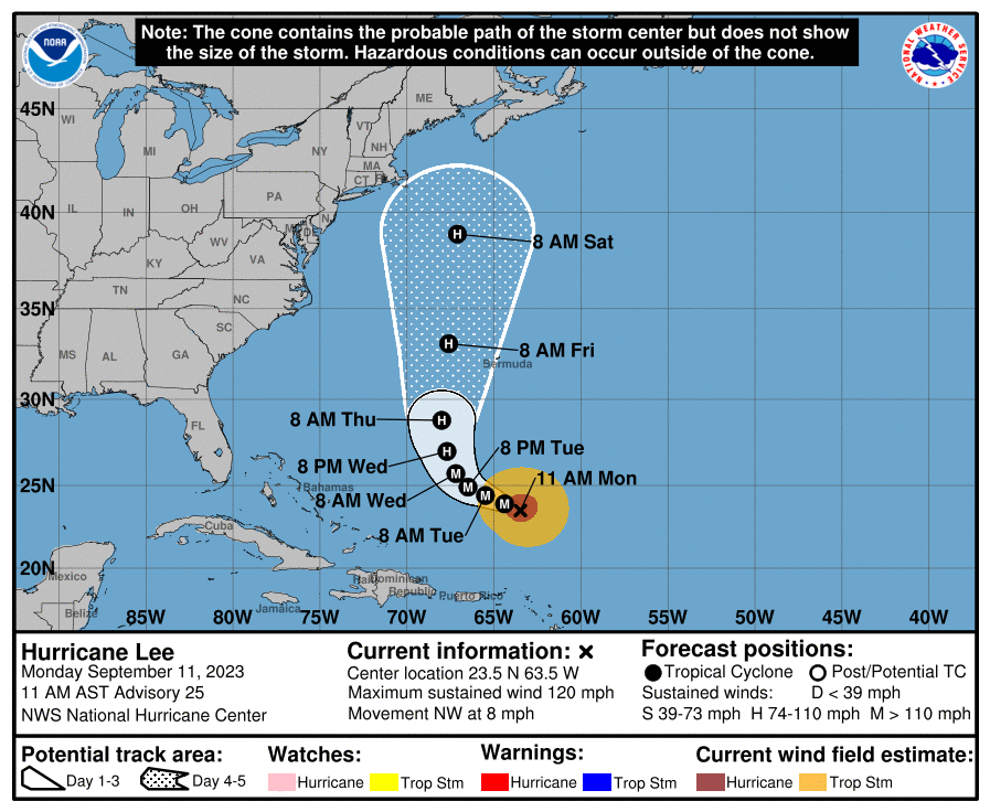
 Tropical Storm Margot is expected to become a hurricane this week in the Central Atlantic, but it will remain far from land.
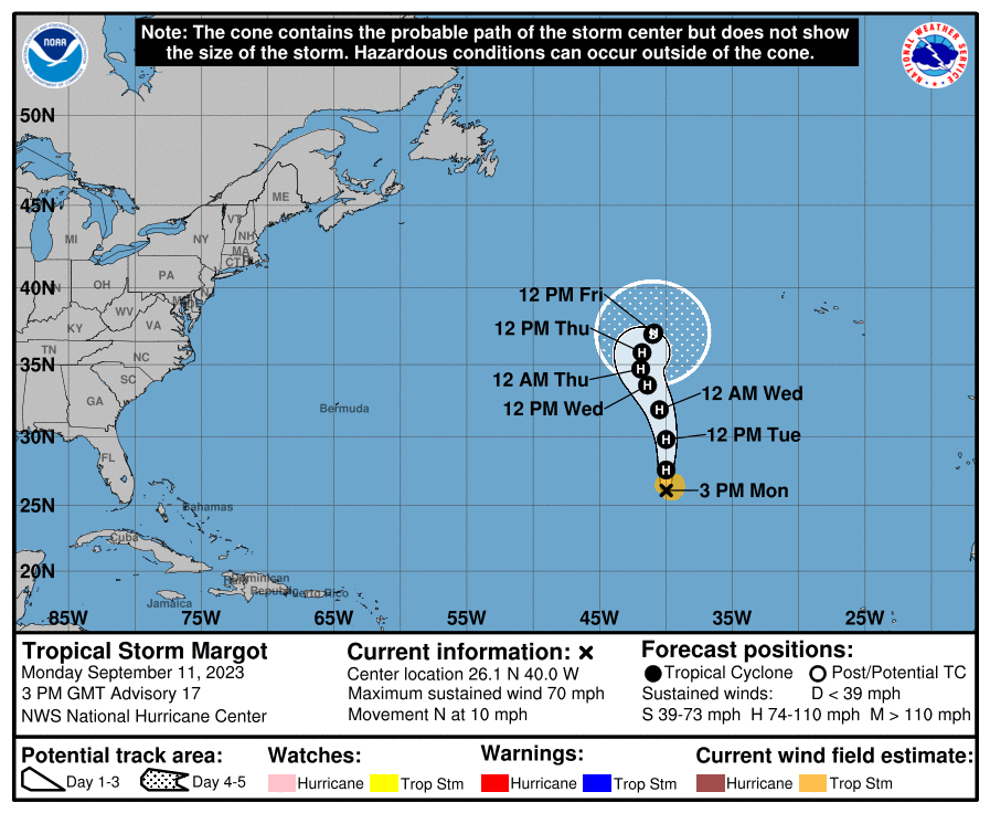 A new wave in the eastern Atlantic has a 60% chance of development during the next seven days. Most likely it turns north before reaching the U.S. No tropical systems will threaten the Gulf of Mexico for at least the next week or so.
ON THIS DATE IN 1961: Hurricane Carla made landfall on the northeast part of Matagorda Island, Texas, as a strong Category 4 storm. Carla was an extremely large hurricane with devastating effects from the winds and storm surge for the middle and upper Texas coast. Hurricane-force gusts were recorded along the coast from Port Mansfield to Galveston. The highest sustained wind speeds reported were 115 mph at Matagorda, 110 mph at Victoria and 88 mph at Galveston. Extreme peak wind gusts were estimated to be near 170 mph at Port Lavaca as the wind equipment blew away after reading 153 mph.
ON THIS DATE IN 2001: Hurricane Erin was off the coast of New Jersey and New York. Two of four hijacked planes took off from Boston’s Logan Airport, and one each took off from Newark-Liberty and Dulles Airports. It’s safe to assume that a significant number of flights to and from the major Northeast hubs would have been canceled if Hurricane Erin had threatened the East Coast.
For more weather news and information from James Spann and his team, visit AlabamaWx.


