Scott Martin: Rain, some thunder likely for much of Alabama today
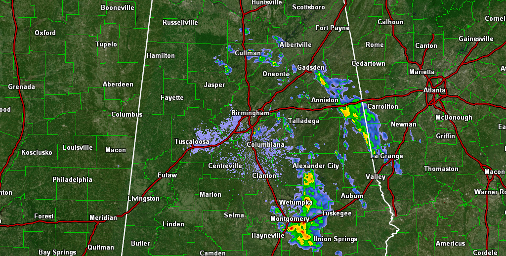
THE WEEKEND: As of 5:37 this morning, we have some scattered showers mostly around Alexander City, Wetumpka and Montgomery. The eastern half of the state will see scattered to numerous showers today with just a little thunder, while the western half’s rain chances will be a little smaller. Highs will range from the upper 70s to the upper 80s from northeast to southwest.
Sunday will be much drier after a cool front pushes through the state overnight. A few lingering showers may be left across the eastern half of Alabama during the morning. Clouds will be on the decrease and highs will be in the 80s.
THE WORK WEEK: Monday will be absolutely wonderful, with sunny skies and highs in the upper 70s to the upper 80s. High pressure over the East Coast will send a northeasterly flow across Alabama on Tuesday, which will keep us clear with highs in the upper 70s to the upper 80s.
On Wednesday, ridging starts to develop over the south-central parts of the country and will weaken the flow across Alabama, which will bring a slight warm-up. Skies will be sunny with highs in the 80s. The ridge gets forced back to the west on Thursday, and the northeasterly flow across Alabama strengthens. We’ll have sunny skies with highs in the upper 70s to the upper 80s both Thursday and Friday.
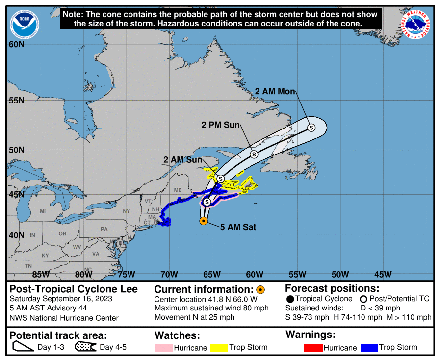
TROPICS: Lee has become post-tropical this morning but is still producing maximum sustained winds at 80 mph as it continues to move north toward Nova Scotia and extreme eastern Canada through the weekend. Lee will eventually be absorbed by another low-pressure system after moving out over the Atlantic.

Tropical Storm Margot continues to meander around over the open waters of the Atlantic with maximum sustained winds at 60 mph. A major U-turn is expected and Margot will eventually be absorbed with the same system that gets Lee. While she is no threat to land for now, the current track has Margot moving over the Azores by midweek as a post-tropical depression.
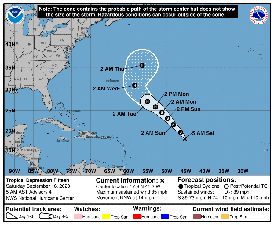
Tropical Depression 15 is over the central tropical Atlantic, moving northwest. Within a few hours, we will see the depression strengthen into Tropical Storm Nigel. Eventually, the system will become a hurricane while moving northwestward, but it will curve away from any land mass and pester the fish and shipping lanes.
For more weather news and information from James Spann, Scott Martin and other members of the James Spann team, visit AlabamaWx.


